Search
News
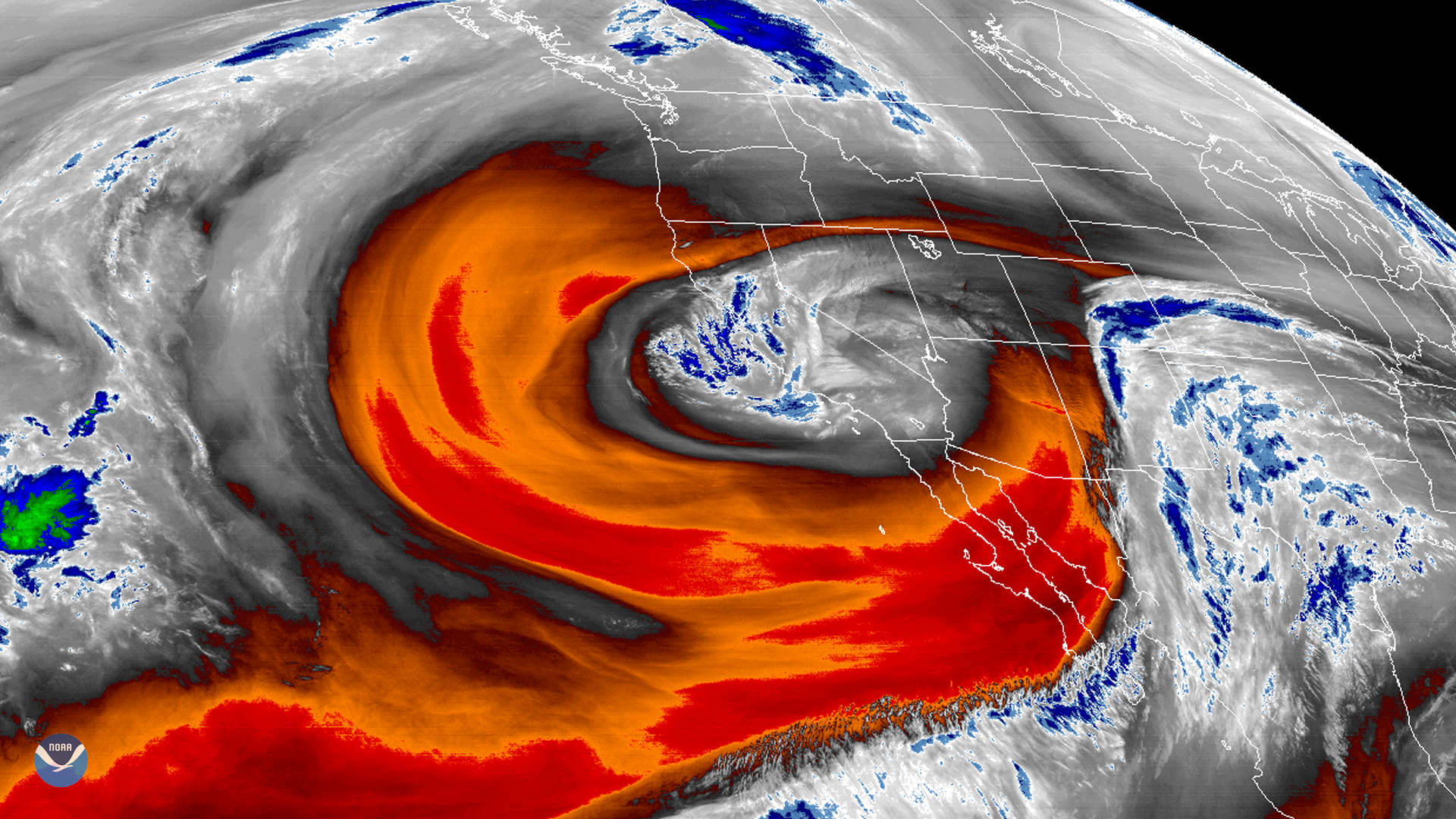
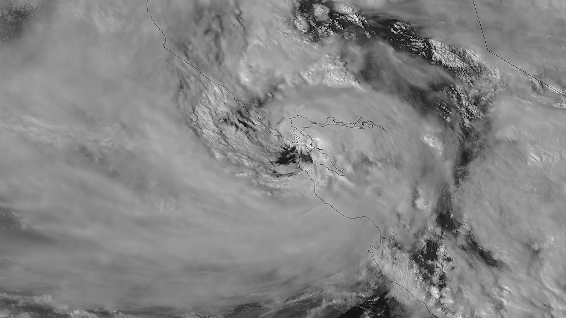
GOES West's water vapor band shows a low-pressure area off California that has become isolated or “cut off” from the…
News
NOAA’s GOES East satellite used its Advanced Baseline Imager to capture this mesmerizing GeoColor image of cloud streets…
Bio

Deputy Director
Systems Architecture and Engineering
Dan St. Jean brings more than 28 years of NOAA experience to our team.
News
NOAA's fleet of Earth-observing satellites provide a steady stream of data on environmental conditions that scientists…
News
Tuesday, February 4, 2020Photo courtesy of the Sterling, Va., NWS Forecast OfficeTen years ago this week, the Eastern U.S.…
News
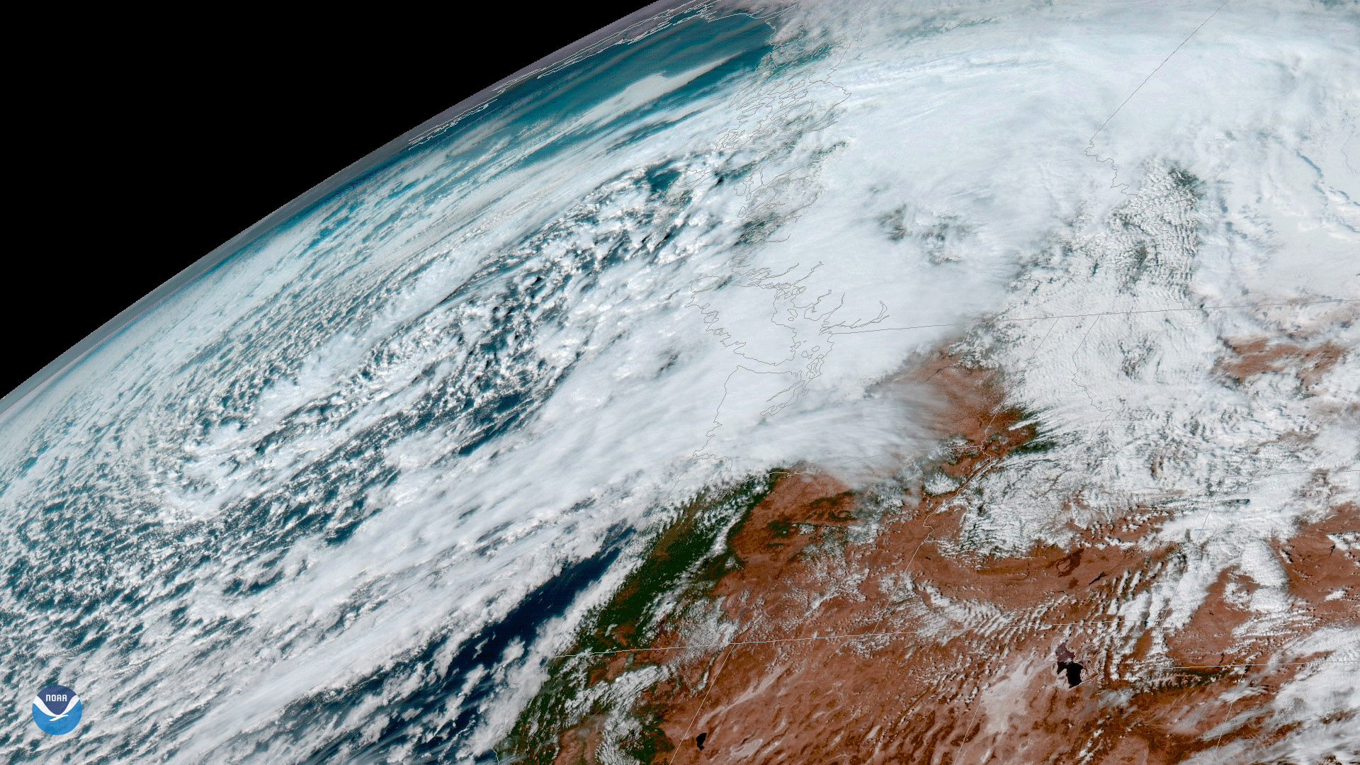
A strong low pressure system approaches the Pacific Northwest in this image from NOAA’s GOES-16 satellite, taken November 14…
News
After tracking round after round of atmospheric rivers dropping heavy rain across the West Coast this year, NOAA satellites…
News
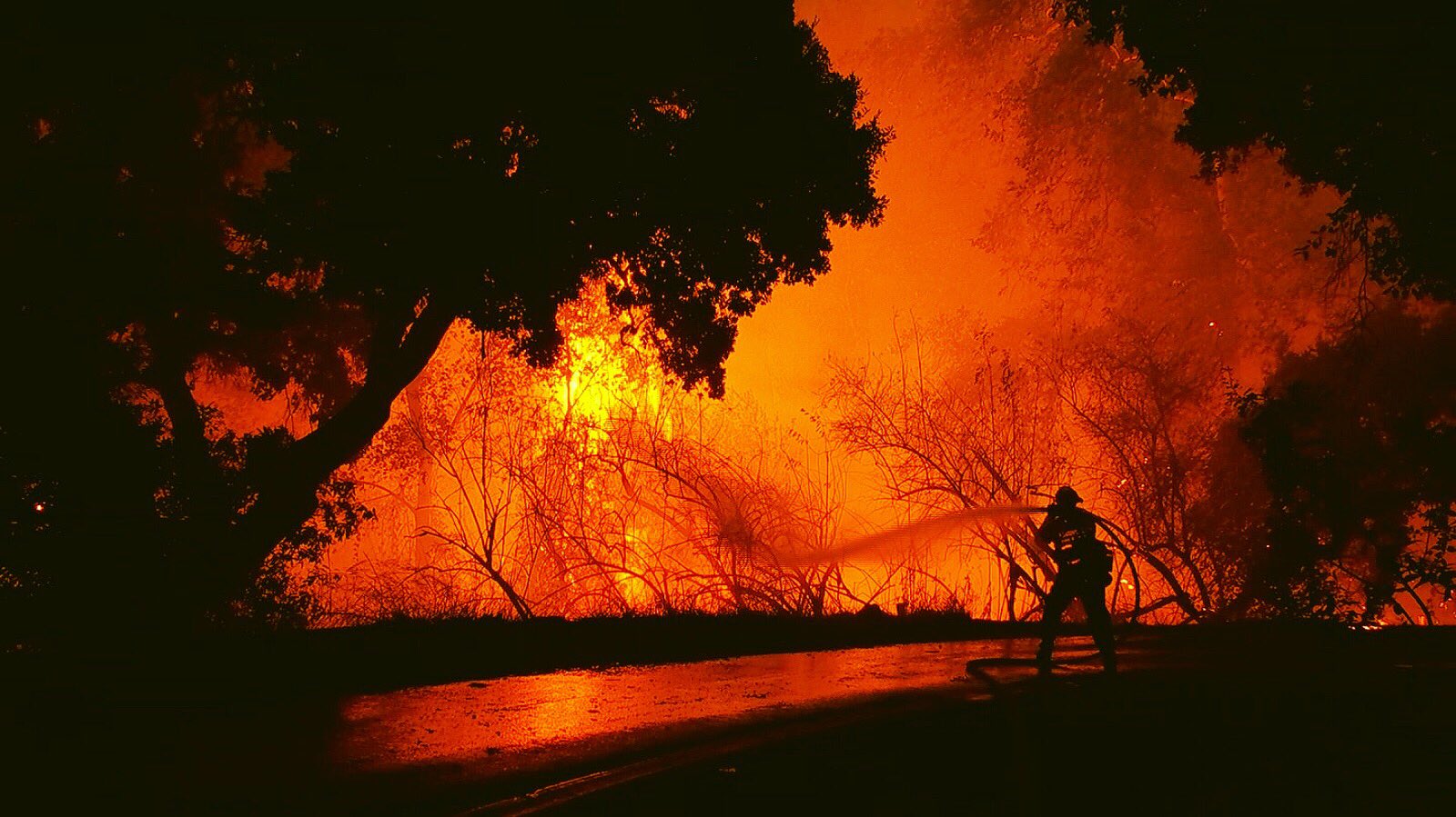
As news of the rising death toll from the California fires continues, NOAA satellites help capture the extent of the…
News
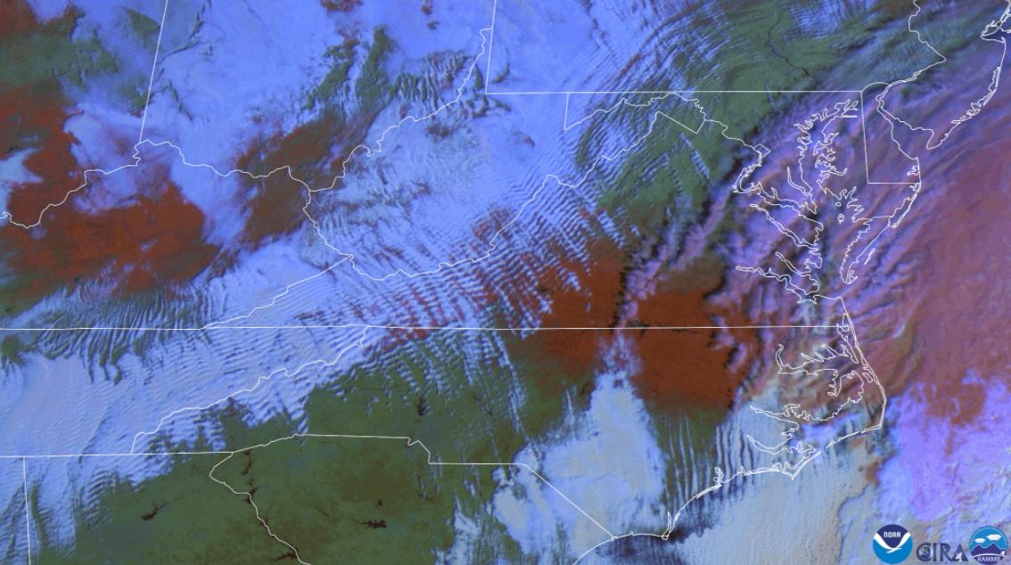
False color satellite imagery shows wave clouds and red snow on the ground.
News
Nothing says spring quite like a little bit of mid-April snow, right? A swath of snow stretches from central Illinois to…
News
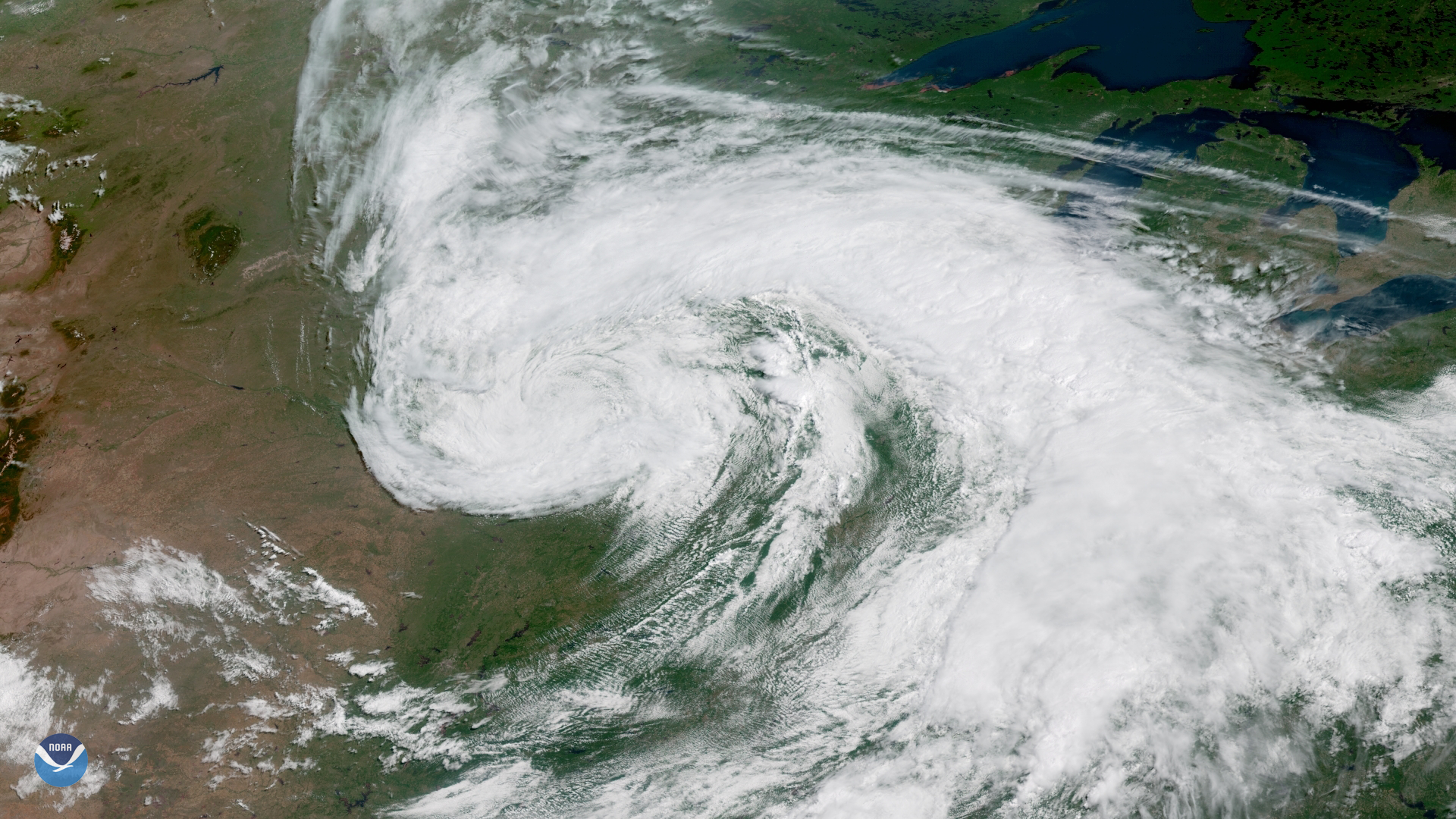
On the first day of astronomical summer , the GOES East satellite captured this image of a large storm system moving across…
News
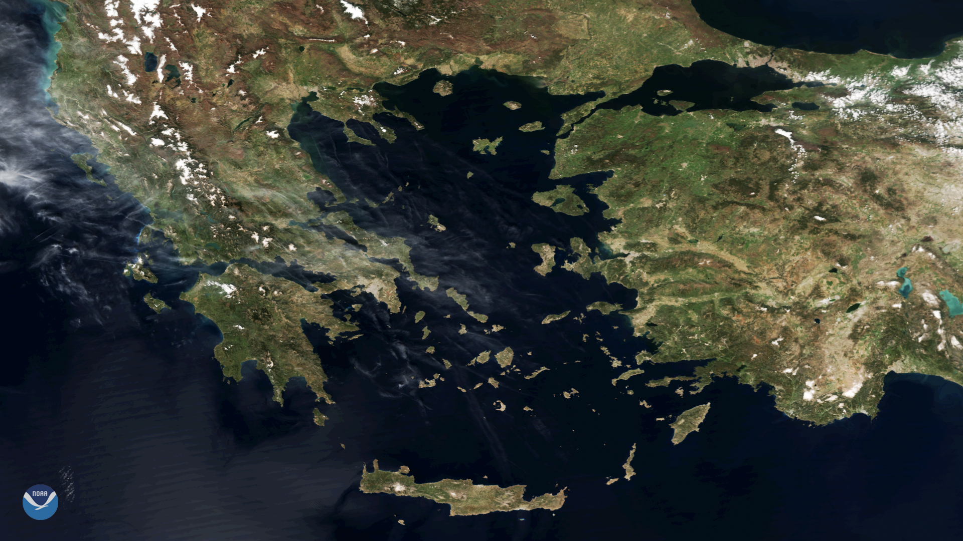
The Suomi NPP satellite captured this textbook imagery of Greece and the numerous islands dotting the Aegean Sea on April 3…
Page
Thursday 12/03/20201:30 PMAndrew AllegraNESDIS/NCEITown Hall: Connect with NOAA National Centers for Environmental…
News
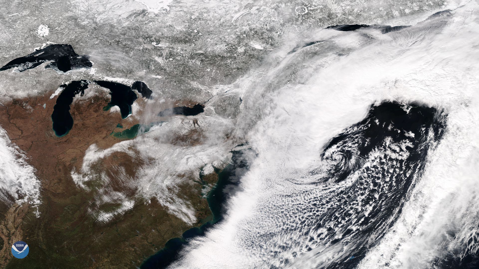
he Suomi NPP satellite's VIIRS instrument captured this week's nor'easter moving away from the U.S. East…
News
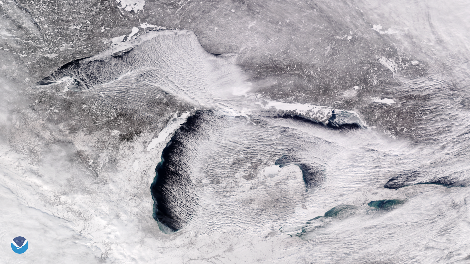
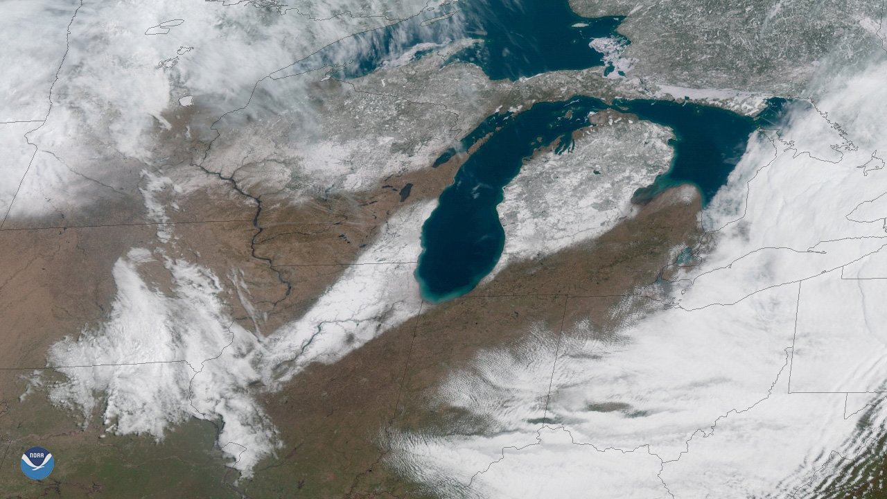
Bitter cold, arctic air is pouring into the Midwest and Great Lakes this week, and is expected to bring a prolonged period…