
Search and Rescue Satellite Aided Tracking (SARSAT)
A Beacon of Hope to Those in Distress
NOAA satellites do more than just monitor the weather. They also detect and relay distress signals from emergency beacons to the appropriate search and rescue authorities. This tells them who is in trouble and, more importantly, where they are located.
The SARSAT program is part of COSPAS–SARSAT, an international satellite-based monitoring initiative to which 45 nations and independent search and rescue organizations belong. Using this system, authorities can locate beacons almost anywhere in the world at any time, and in almost any condition.
COSPAS stands for "COsmicheskaya Sisteyama Poiska Avariynich Sudov," Russian for “Space System for the Search of Vessels in Distress.”
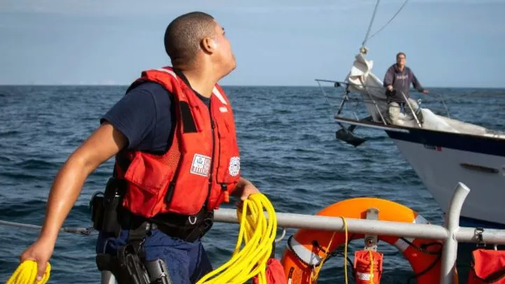
A sailor being rescued at sea.
SARSAT Tracking Application
Each icon on this map represents one rescue event within the U.S. Area of Responsibility (AOR) in the last 14 months, though multiple saves may be involved with each event.
The Search and Rescue Satellite Aided Tracking (SARSAT) system is able to detect three types of beacons: an individual’s Personal Locator Beacons (PLBs), maritime Emergency Position Indicating Radio Beacons (EPIRBs), and aircraft Emergency Locator Transmitters (ELTs).
Who responds to the search and rescue are dictated by the location of the distress. For any beacon activation that occurs in the U.S. AOR, the U.S. is responsible for responding. If it is inland, U.S. Air Force responds, if it is at sea, the U.S. Coast Guard.
If a device registered to another country is activated within the U.S. AOR, the U.S. is still responsible for the rescue but their homeport country will be notified of the event. All areas of the world are covered by COSPAS-SARSAT.
SARSAT Rescues in 2026 as of June 12, 2026
- Rescues at sea: 54 people rescued in 18 incidents
- Aviation rescues: 17 people in 6 incidents
- Terrestrial PLB rescues: 34 people rescued in 15 incidents
- United States: 11,276 people rescued (since 1982)
- Worldwide: Over 64,000+ people rescued (since 1982)
105: Total Number of People Rescued in 2026 in the United States.
300: Total Number of People Rescued in 2025 in the United States.
411: Total Number of People Rescued in 2024 in the United States.
The COSPAS–SARSAT Program
This program consists of:
- Emergency beacons that transmit distress signals
- Satellites that detect the distress signals
- Ground receiving stations that receive and process the satellite signals to generate distress alerts
- Mission control centers that receive the alerts and forward them to rescue coordination centers, operated by the U.S. Coast Guard and the U.S. Air Force.
The U.S. SARSAT system uses NOAA satellites in low-earth and geostationary orbits as well as GPS satellites in medium earth orbit to detect and locate aviators, mariners, and land-based users in distress. The satellites relay distress signals from emergency beacons to a network of ground stations and ultimately to the U.S. Mission Control Center (USMCC) in Suitland, Maryland.
Types of search and rescue beacons.
The Four Agencies Involved in the U.S. SARSAT Program
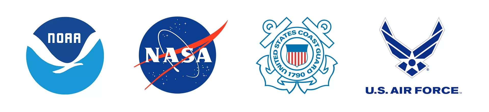
- NOAA: System Operation
- NASA: Research and Development
- U.S. Coast Guard: Maritime Search and Rescue and representative to COSPAS-SARSAT
- U.S. Air Force: Inland Search and Rescue
History
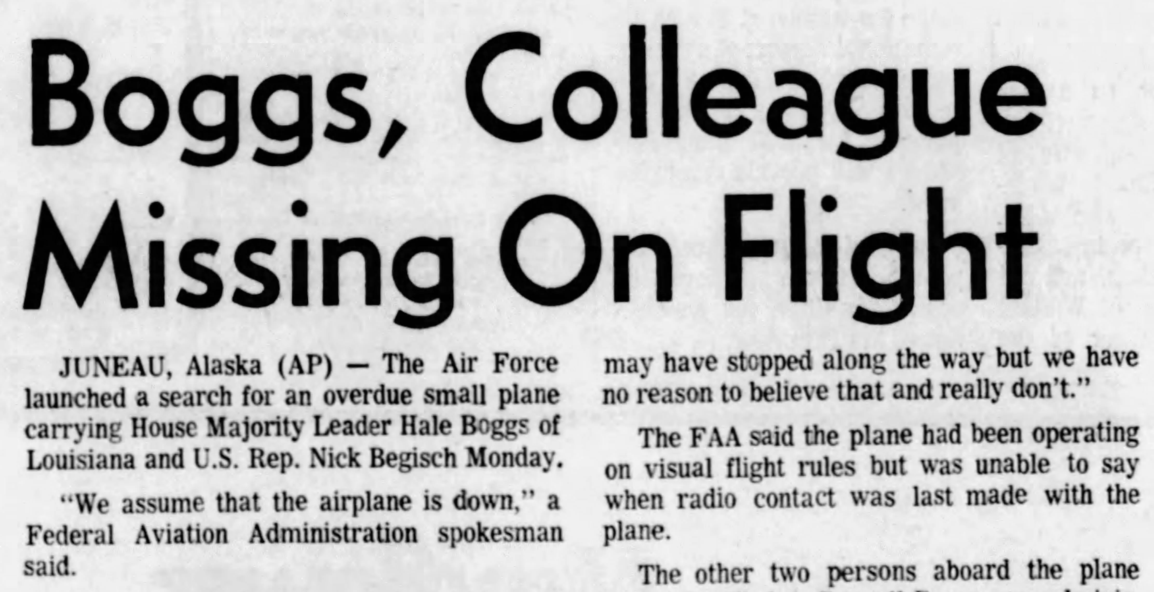
The first beacons used the existing 121.5/243 MHz emergency locator transmitters (ELTs) designed for military aircraft in the 1950s. After a small plane carrying Rep. Hale Boggs (D-La.) along with Rep. Nick Begich (D-Alaska) and others disappeared in Alaska in 1972, Congress mandated ELTs on all U.S. aircraft. Canada soon did the same.
However, early models were not as easy to detect, and there was no way to identify a specific beacon or find its exact location. Thus, engineers began developing new, more robust digital beacons that operated at 406 MHz. Signals from these new beacons could be received from anywhere on the planet, located accurately and almost instantly, and rescue forces would know who and what to look for.
The United States and Canada began looking for other international partners with the ability to launch satellites to achieve a truly global distress alerting satellite system. Russia and France soon signed on to help develop the system for humanitarian purposes.
On June 30, 1982, Russia launched the first experimental COSPAS–SARSAT satellite. Before it was even officially declared operational, the first distress signal was detected—a downed Canadian aircraft. Within the first hundred days of the satellite’s operation, seven people were rescued using the system. Soon after, NASA launched their own SARSAT payload on NOAA-8. The program has continued to grow ever since.
Today, with newer, more advanced beacons and a global network of next generation satellites, COSPAS–SARSAT strives to keep improving its ability to take the “search” out of “search and rescue” and ultimately save lives.
Important Information
All U.S. coded beacons MUST be registered with NOAA. Read our registration brochure to learn more.
- Airworthiness Directives, Ameri-King Corporation ELTs
- Warning regarding unapproved beacon batteries
- Kannad SAFELINK EPIRB recall