
Sea ice is ocean surface water that has frozen. Sea ice grows throughout the fall and winter and melts throughout the spring and summer. In the Arctic Ocean, sea ice extent—the area of ocean with at least 15 percent sea ice concentration—typically reaches its maximum in March and its minimum in September. In polar regions, areas of sea ice—ice atop ocean waters—not only supports entire ecosystems, but also affects Earth’s climate by reflecting sunlight back into space rather than absorbing it.
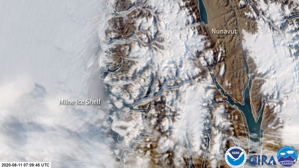
The image above shows the breakup of the Milne Ice Shelf in the Arctic, via the polar-orbiting NOAA-20 satellite.
Additional Examples of Sea Ice
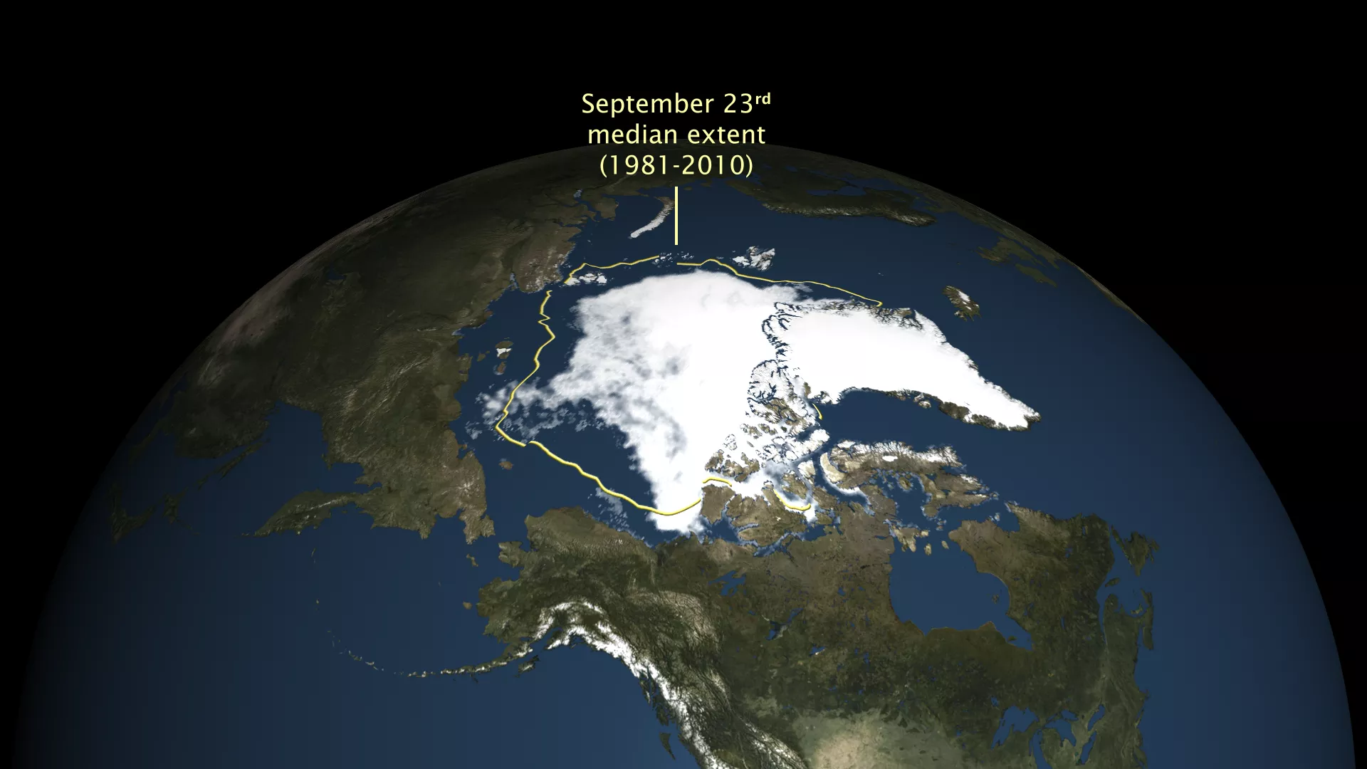
Arctic sea ice has likely reached its annual minimum for 2018, according to the National Snow and Ice Data Center (NSIDC). Sea ice extent shrank to 1.77 million square miles (4.59 square kilometers) on September 19 and again on September 23. Since then, ice extent has grown again, signaling an end to the summer melt season.
Arctic sea ice 2018 Arctic Sea Ice Ties Sixth Lowest Extent Record
In polar regions, areas of sea ice -- ice atop ocean waters -- not only supports entire ecosystems, it affects Earth’s climate by reflecting sunlight back into space rather than absorbing it. Since polar regions are often cloud covered, scientists use microwave sensors onboard satellites (such as JPSS’s ATMS) to “see through” the clouds and make measurements of sea ice.
Concentrated sea ice Sea Ice Concentration