
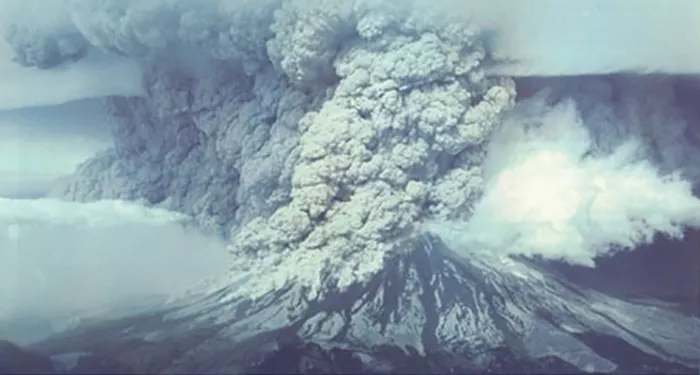
There are more than 1,500 potentially active volcanoes around the world, most of which are unmonitored, and roughly 500 are active at any given time. Although scientists keep an eye on many of these using traditional ground-based observation methods, satellites have become crucial in helping understand where, when, and why volcanoes erupt.
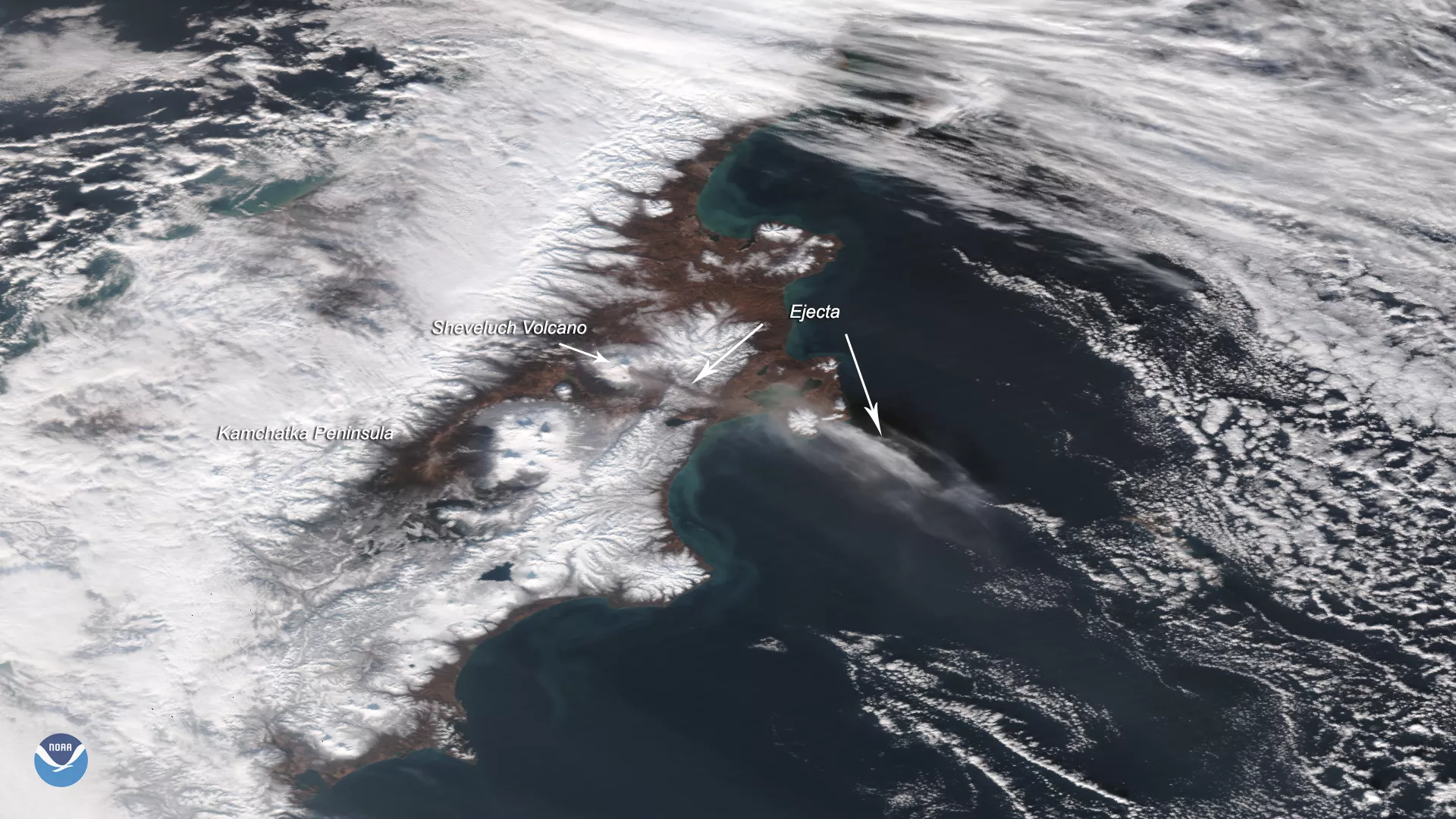
The Advanced Baseline Imager (ABI) onboard NOAA’s GOES-R series of geostationary satellites, which keep watch over the same areas of Earth over time, utilize 16 bands and can monitor small eruptions in great detail.
Additionally, NOAA satellites not only monitor volcanic ash, but gases released in volcanic plumes—particularly toxic sulfur dioxide (SO₂)—which can be visualized through the satellite instrument’s infrared channels both during the day and at night. The polar-orbiting Joint Polar Satellite System (JPSS) satellites, along with the GOES ABI sensor, enable more precise observations of SO₂ atop volcanic clouds.
NOAA also operates two Volcanic Ash Advisory Centers (VAACs) which are among nine centers worldwide, covering advisories for the U.S., Latin America, and the West Pacific.
More Articles on Ash
-
Feature Story
As wildfires become more frequent and severe, accurate forecasting is essential for saving lives,… -
Satellite Snapshots
The 2023/2024 winter season was the warmest on record for Canada and continuing drought conditions… -
Announcement
NASA Selects BAE Systems to Develop Air Quality Instrument for NOAA