
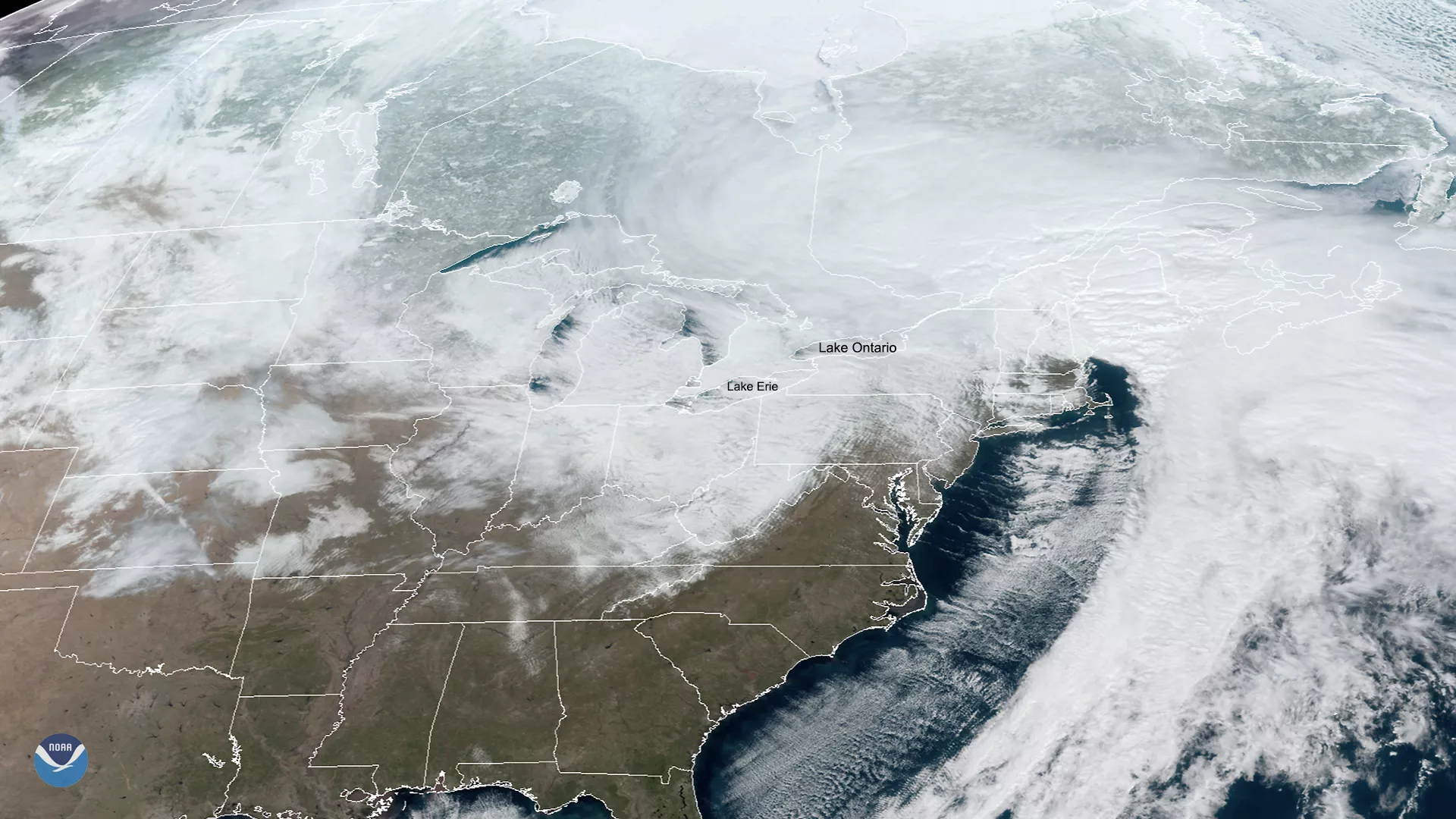
The Lake Effect phenomenon is well-known and studied in meteorological circles. Northern or westerly winds blow over the lakes’ surface, picking up heat and water vapor that produce warm columns of air known as “thermals.” Those columns then cool down and condense into cumulus clouds, aligning in the direction of the prevailing wind over the lakes’ surface. When there is a large enough temperature contrast, the cloud structures can dump heavy lake effect snow on the downwind shores of the lakes.
At times, there is a large temperature contrast between the surface air and lake water, and cloud formations can deliver heavy lake effect snows on the downwind shores of the lakes such as in the imagery above from Suomi-NPP.
Examples of Lake Effect Snow
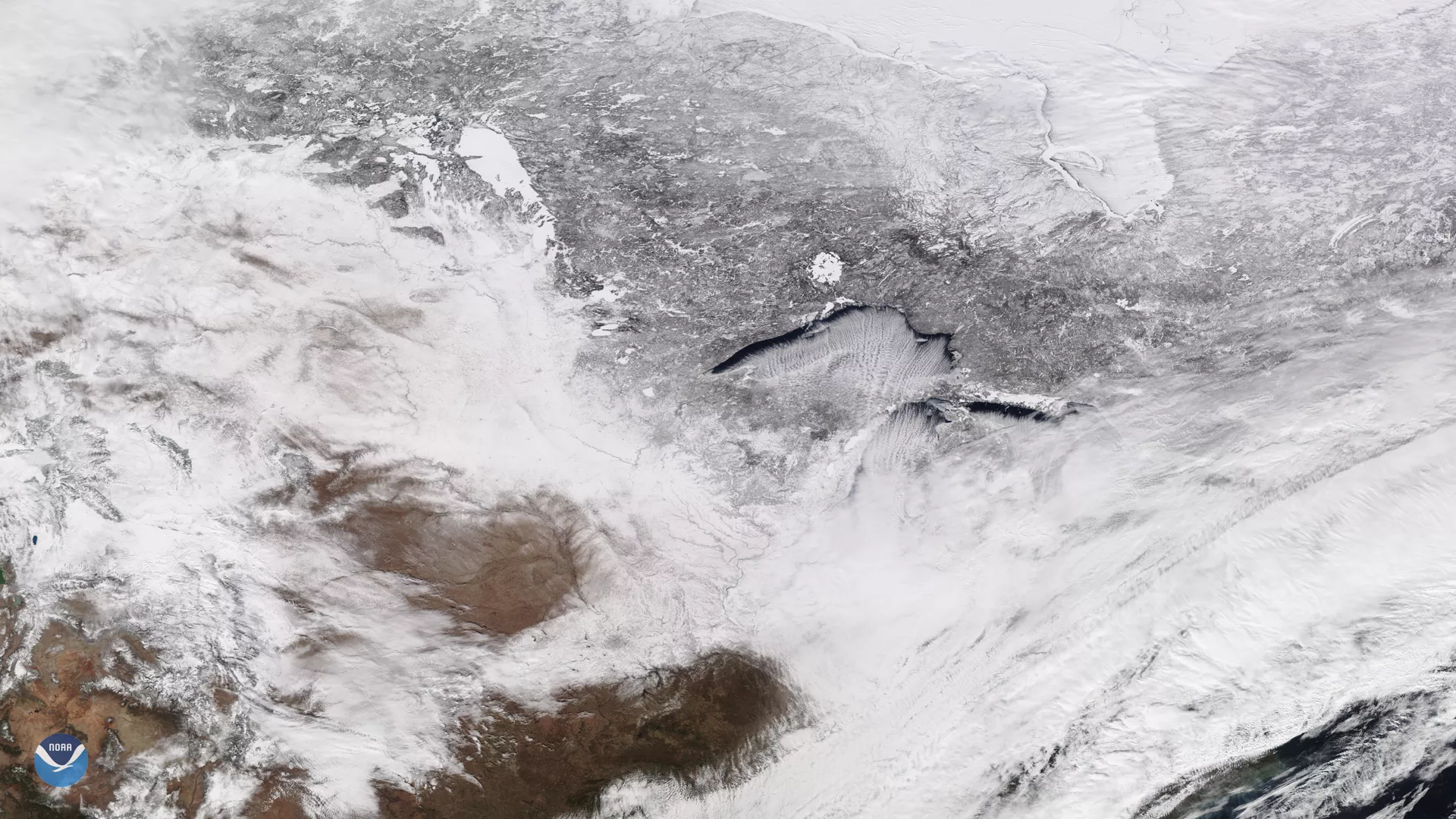
On Feb. 13, 2020, the NOAA-20 satellite viewed cloud streets over Lake Superior, signifying a cold air mass on the move. In fact, wind chill advisories were in effect on Thursday for a portions of the Great Lakes region and Northern New England, according to the National Weather Service.
Frigid air and wind Frigid Air and Bitter Wind Chills Blast the Northern U.S.
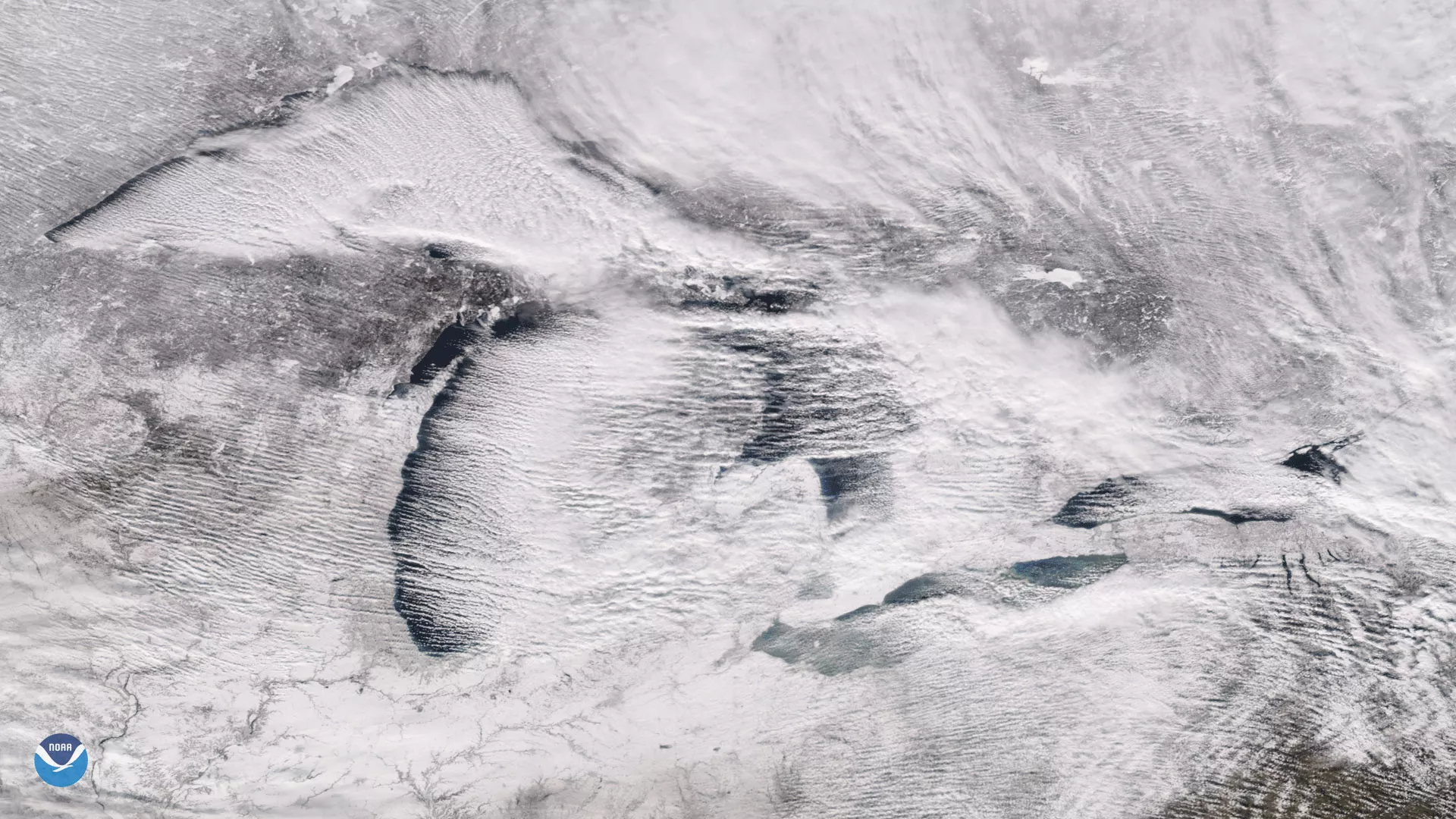
On Feb. 27, 2020, GOES-East was watching over the Great Lakes region, where the National Weather Service (NWS) forecasts “a major lake-effect snow event … as cold and blustery westerly winds blow across the still-warm lake waters.”
The lake effect Lake Effect Snow Dumps on the Great Lakes Region