
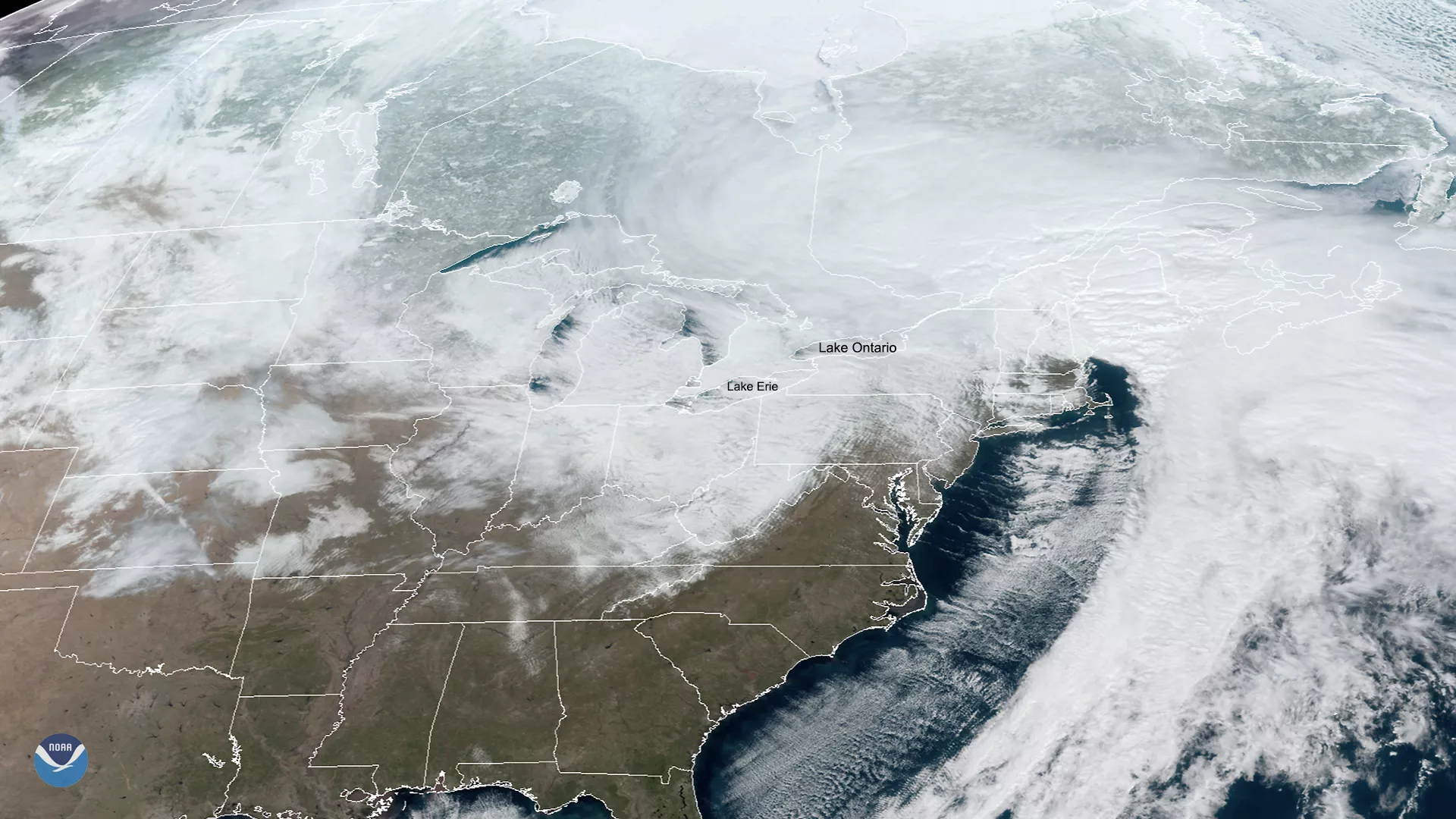
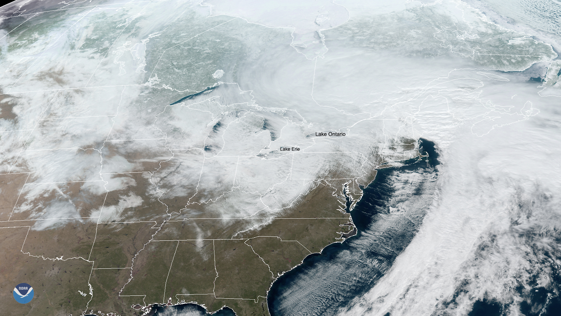
On Feb. 27, 2020, GOES-East was watching over the Great Lakes region, where the National Weather Service (NWS) forecasts “a major lake-effect snow event … as cold and blustery westerly winds blow across the still-warm lake waters.” According to NOAA’s Weather Prediction Center (WPC), more than two feet of snow is falling downwind of Lake Ontario within the next 24 hours, and blizzard warnings are in effect for parts of Western New York State that are downwind from Lake Erie and Lake Ontario.
Moreover, scientists from the Great Lakes Environmental Research Laboratory (GLERL) predict higher-than-normal waves in Lake Ontario and Lake Erie due to a combination of strong winds, high lake levels, and low ice cover. The Great Lakes’ maximum ice cover for 2020, so far, was only 18%, which is far from the long-term average of 55.7%. According to climate scientists, Lake Erie reached its highest water level of all time in 2019 and just made the record for the lowest January maximum ice cover in 2020. Waves are expected to reach up 20 feet in height for the eastern shores of Lake Huron, Lake Ontario, and Lake Erie moving into Friday.
Residents of the Great Lakes and Western New York are urged to put off non-essential travel for the next 72 hours. If one must travel, the NWS advises that travelers put extra water, flashlights, and other necessities in their vehicles in case of an emergency.
The GOES-East geostationary satellite, also known as GOES-16, keeps watch over most of North America, including the continental United States and Mexico, as well as Central and South America, the Caribbean, and the Atlantic Ocean to the west coast of Africa. The satellite's high-resolution imagery provides optimal viewing of severe weather events, including thunderstorms, tropical storms, and hurricanes.