
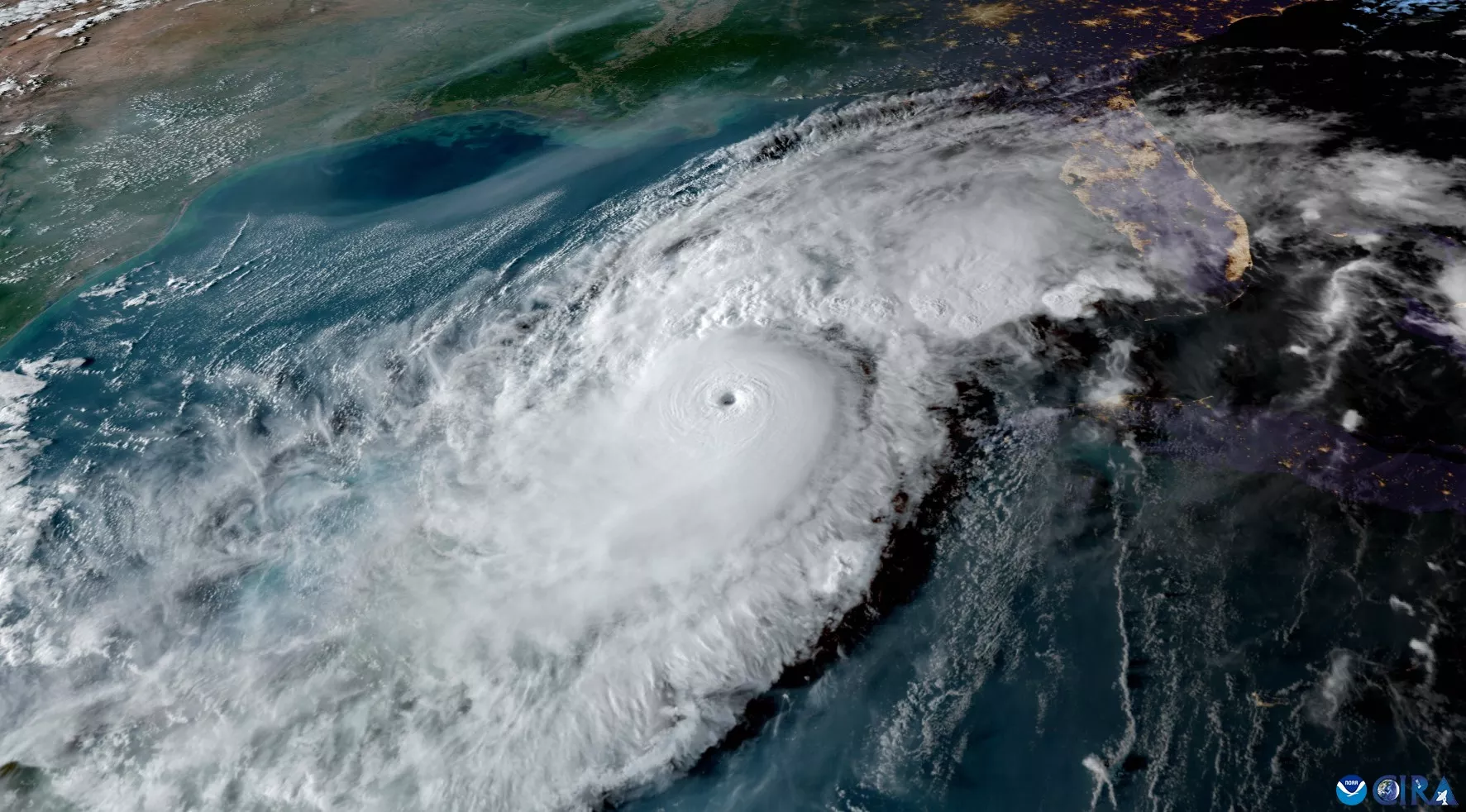
GOES-16 image of Hurricane Milton crossing the Gulf of America on October 8, 2024.
While NOAA’s National Weather Service (NWS) is responsible for issuing weather forecasts and warnings, its the Center for Satellite Applications and Research (STAR), a program office within the National Satellite and Information Service (NESDIS), develops the satellite-based products and tools that support those forecasts with high quality, consistent data.
These satellite products contribute critical, timely information to forecasters at the NWS and the National Hurricane Center (NHC), especially during tropical cyclone season. They help enable up-to-the-minute forecasts and advisories that can save lives and protect communities. These products provide critical environmental data such as ocean heat content, sea surface temperature, ocean surface wind and coastal flooding.
Sea Surface Temperature and Ocean Heat Content
To assess the ocean’s role in fueling hurricanes, STAR uses radar altimetry, which is a sensor measurement that can penetrate through clouds and measure sea surface height (SSH). This information gives unique insight into the water below the surface of the ocean. When combined with data from research ships and Argo profilers (automated drifting platforms), SSH data can give information about how much heat energy is available to fuel hurricanes.
STAR’s Satellite Ocean Heat Content algorithm transforms this information into products that are used operationally by the NHC for predicting a tropical cyclone’s strength and its potential for rapid intensification.
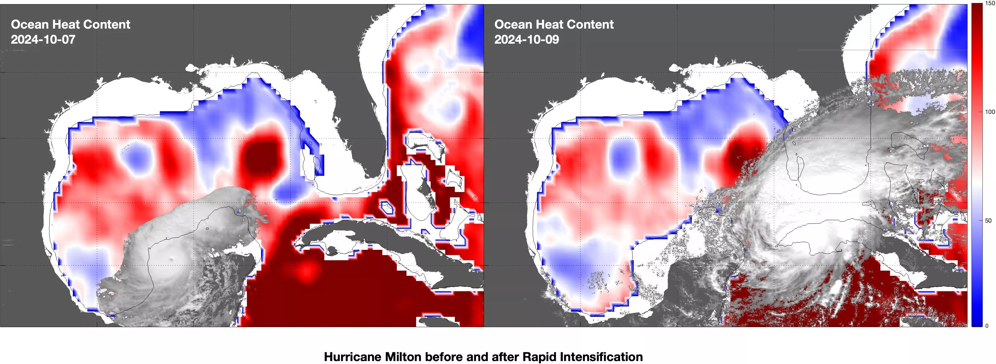
Satellite Ocean Heat Content based on altimetry and sea surface temperature, overlaid with GOES-16 ABI Band 2 imagery showing the location of Hurricane Milton. On October 7, Milton intensified rapidly after encountering the high ocean heat content (heat energy, shown as dark red areas) in the Loop Current and northern Caribbean Sea.
Hurricane Winds
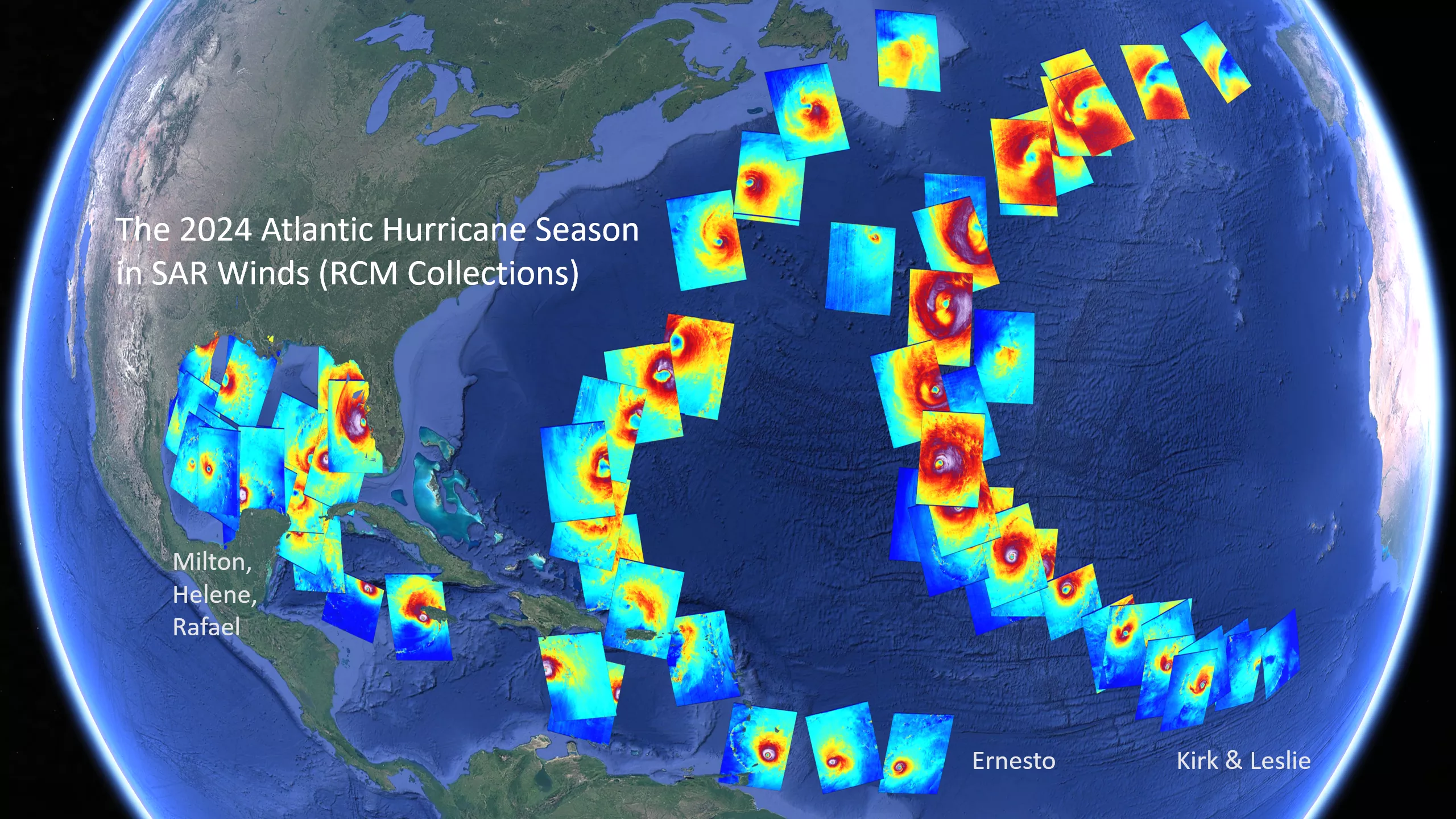
The 2024 Atlantic hurricane season captured in Synthetic Aperture Radar derived wind speeds from imagery provided by the Canadian Space Agency’s Radarsat Constellation Mission.
Synthetic Aperture Radar (SAR) is an imaging radar that can also penetrate through clouds, providing high-resolution (500-meter) images of the Earth’s surface. STAR has developed a fully automated system to use these radar measurements to determine tropical cyclone ocean surface wind speeds.
During 2024, the Canadian Space Agency’s Radarsat Constellation Mission and the European Space Agency’s Sentinel-1 satellites provided SAR imagery for over 80 tropical cyclones worldwide. The resulting wind speed maps were produced and shared in near real time with the NHC and the U.S. Navy’s Joint Typhoon Warning Center. The wind speeds and other cyclone characteristics are archived at STAR’s SAR Tropical Cyclone Winds site.
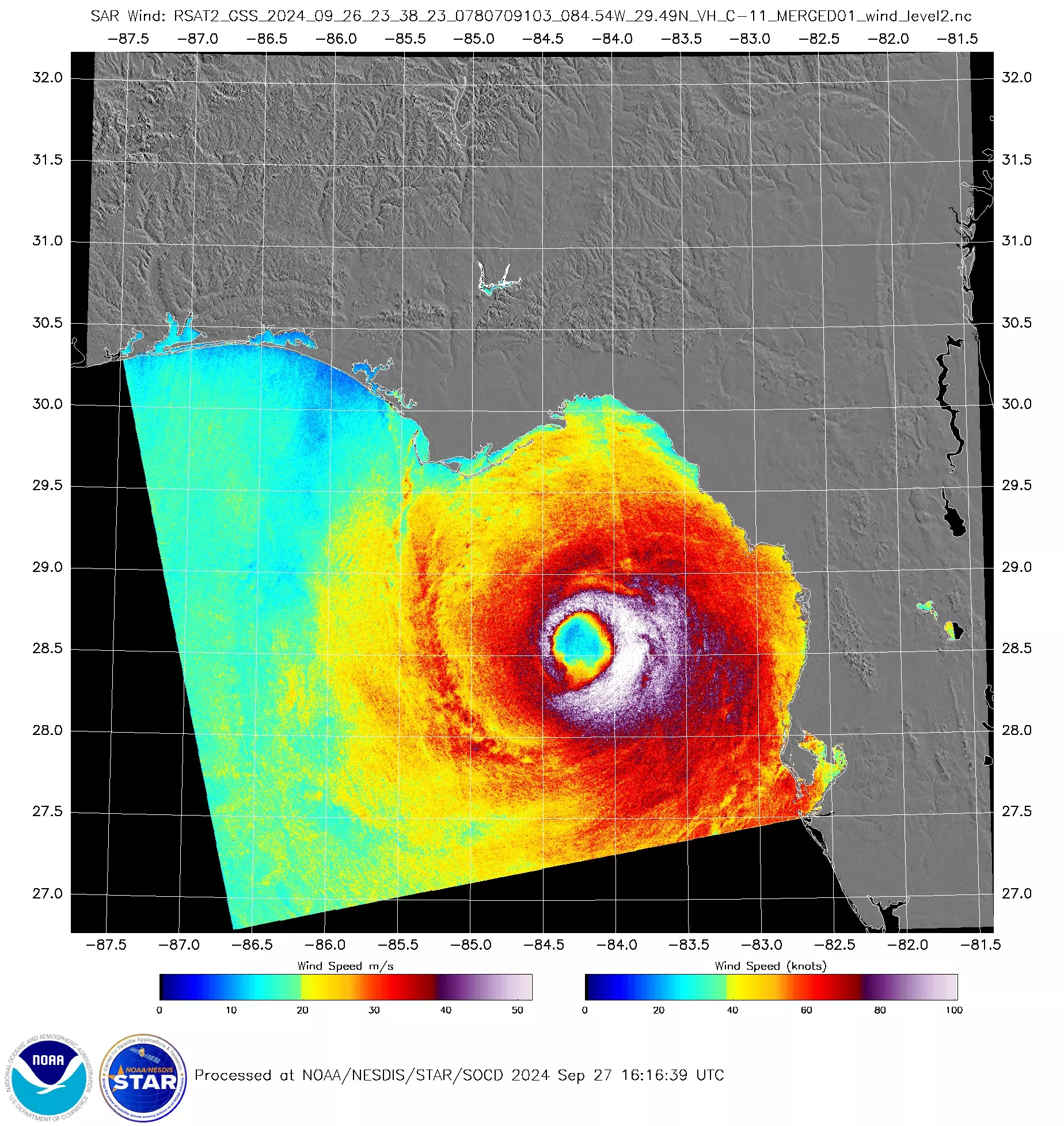
Radarsat-2 SAR wind measurement of Hurricane Helene on September 26, 2024.