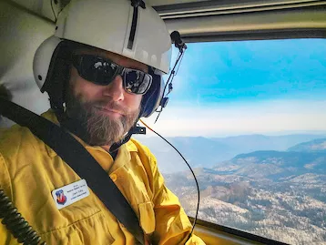
As wildfires become more frequent and severe, accurate forecasting is essential for saving lives, protecting property, and managing resources effectively.
NOAA's Fire Weather Testbed (FWT) is a new innovative collaborative platform that brings together researchers, meteorologists, and fire managers to evaluate and improve fire weather forecasting tools and techniques, integrating both physical and social sciences to refine technologies before being put into operational use. This initiative plays a vital role in ensuring that the forecasting tools used by agencies like the National Weather Service (NWS) are as advanced and accurate as possible.
The FWT is a joint effort between three NOAA line offices: the Office of Oceanic and Atmospheric Research’s Global Systems Laboratory (GSL), the National Weather Service (NWS), and the National Environmental Satellite, Data, and Information Service (NESDIS).
Zach Tolby is the Manager and Lead Scientist at NOAA’s FWT. He credits his previous experience as an incident meteorologist, working directly with firefighters and fire managers on the ground, with his passion for progressing the needs of operations to research back into operations to serve the fire community better.
We spoke with him to learn more about the FWT.
What is the mission of the Fire Weather Testbed, and when was it first established?
It’s relatively new—I joined about 15 months ago, so just over a year.
The mission of the FWT is to advance fire weather forecasting by finding innovative tools and technologies and assisting in transitioning them into operational use. The FWT integrates social science to ensure that innovations are practical and meet real-world needs. By evaluating new and existing fire weather prediction models and tools, the FWT supports critical NWS products, aids in the safe management of wildland fires and helps communities prepare for fire-related hazards.
The FWT has several key objectives:
- Evaluation of Tools and Models: The FWT rigorously tests and assesses fire weather prediction models and tools to ensure their accuracy and reliability, supporting NWS products that provide situational awareness and assist in fire management and mitigation.
- Putting Innovations Into Practice: The FWT focuses on quickly transitioning advanced technologies and new applications to operational platforms, such as its role in integrating the NESDIS Next Generation Fire System into NWS systems.
- Collaboration Across Disciplines: The FWT fosters cross-disciplinary collaboration by bringing together experts from various fields, including meteorology, fire management, and research, as well as building partnerships with Tribes, state agencies, municipalities, academia and non-governmental organizations.
- Operational Readiness: The FWT ensures that new tools and methodologies are ready for operational use by continuously gathering feedback from end-users, such as firefighters and emergency responders, and making necessary adjustments.
Through these efforts, the FWT plays a crucial role in improving fire-weather forecasting and enhancing the safety and preparedness of communities facing wildland fire hazards.
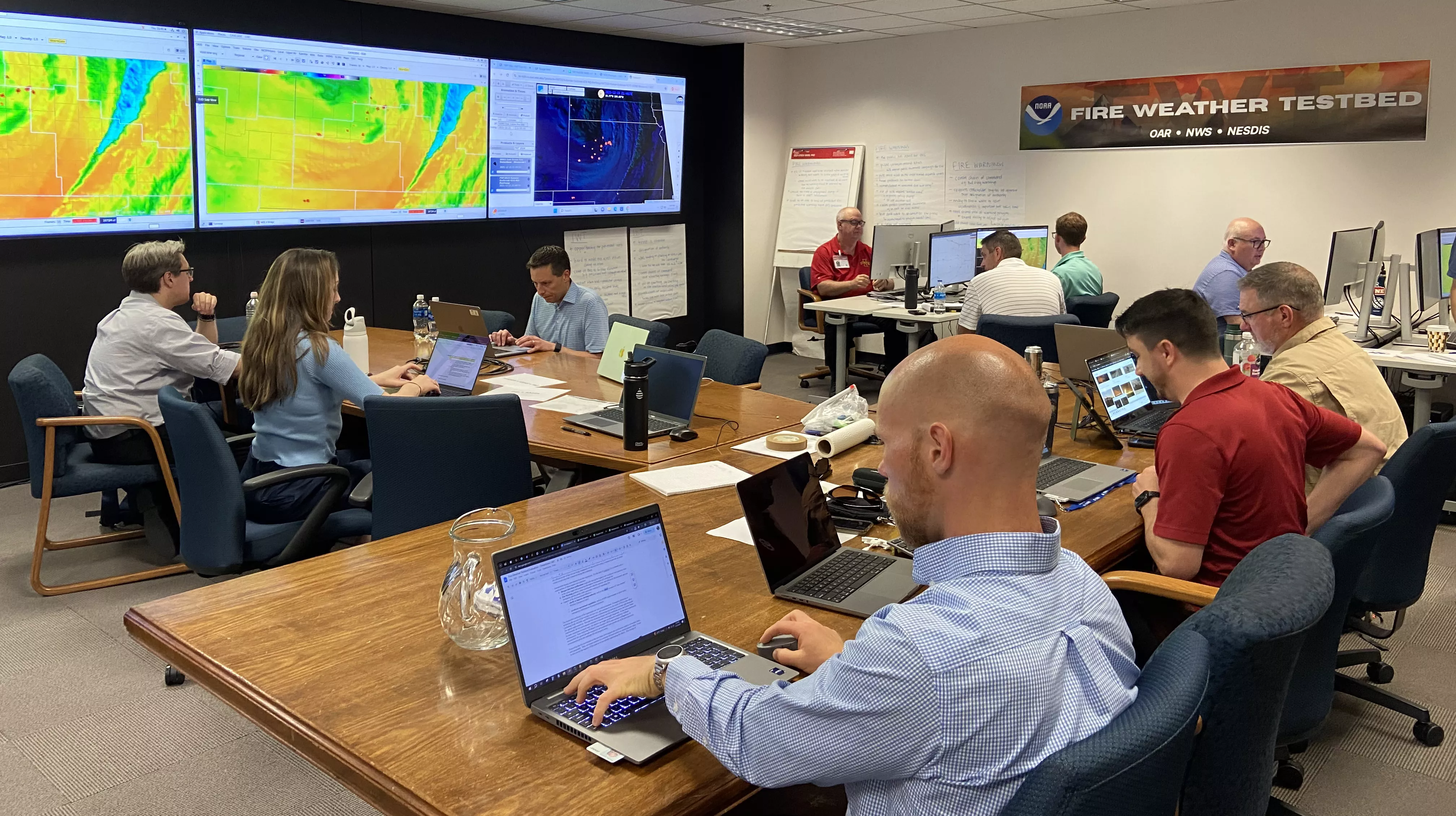
During the FWT's June evaluation, facilitators and researchers looked on during a fire weather outbreak simulation of NOAA's Integrated Warning Team's fire detection and warning capabilities.
What are some key milestones or achievements since the testbed was established?
Most recently, we held a large in-person evaluation of the NESDIS Next Generation Fire System (NGFS) for fire detection, and the National Weather Service's Integrated Warning Team, focusing on fire warnings. This was an end-to-end evaluation of NOAA's new fire detection and warning capabilities. This was our first in-person, week-long evaluation, which was complex.
While experts can detect fires in satellite imagery by identifying changes in infrared pixel color, it’s impossible to constantly track all data. The NGFS acts as a safety net, scanning for temperature changes and alerting users to potential fires. Weather forecasters and/or land managers can then review the alert and determine if it needs further attention. This tool could be a valuable addition to fire detection capabilities.
Testing a tool, like the NGFS was more straightforward, but the challenge was integrating an evaluation with a unique partnership like the NWS Integrated Warning Team, which was established in Oklahoma and Texas. In this unique partnership, meteorologists work closely with the state forestry department and land managers because wildfires require expertise beyond meteorology, involving factors such as land conditions, fuel dryness and topography.
In Norman, Oklahoma, this partnership has evolved to issue pre-evacuation fire warnings for rapidly moving wildfires. Unlike other weather events that a meteorologist can assess alone, wildfires require a multidisciplinary approach. Alone, a land manager might take over an hour to issue a warning, but with the National Weather Service's involvement and NGFS, this process can be reduced to as little as nine minutes, greatly speeding up the warning process.
So we basically evaluated all those things—the fire detection tool, the collaboration between these agencies and the effectiveness of issuing fire warnings for fast-moving wildfires.
During this week-long evaluation, we started with a day of training, followed by three days of simulated fire weather scenarios. State land managers and Weather Service forecasters worked together in mock Integrated Warning Teams, using NGFS to detect fires, relay those new detections to fire managers, and decide whether to issue fire warnings. We collected a large amount of data through pre-surveys, post-surveys, daily surveys, and focus groups, which will be analyzed to make recommendations for future improvements.
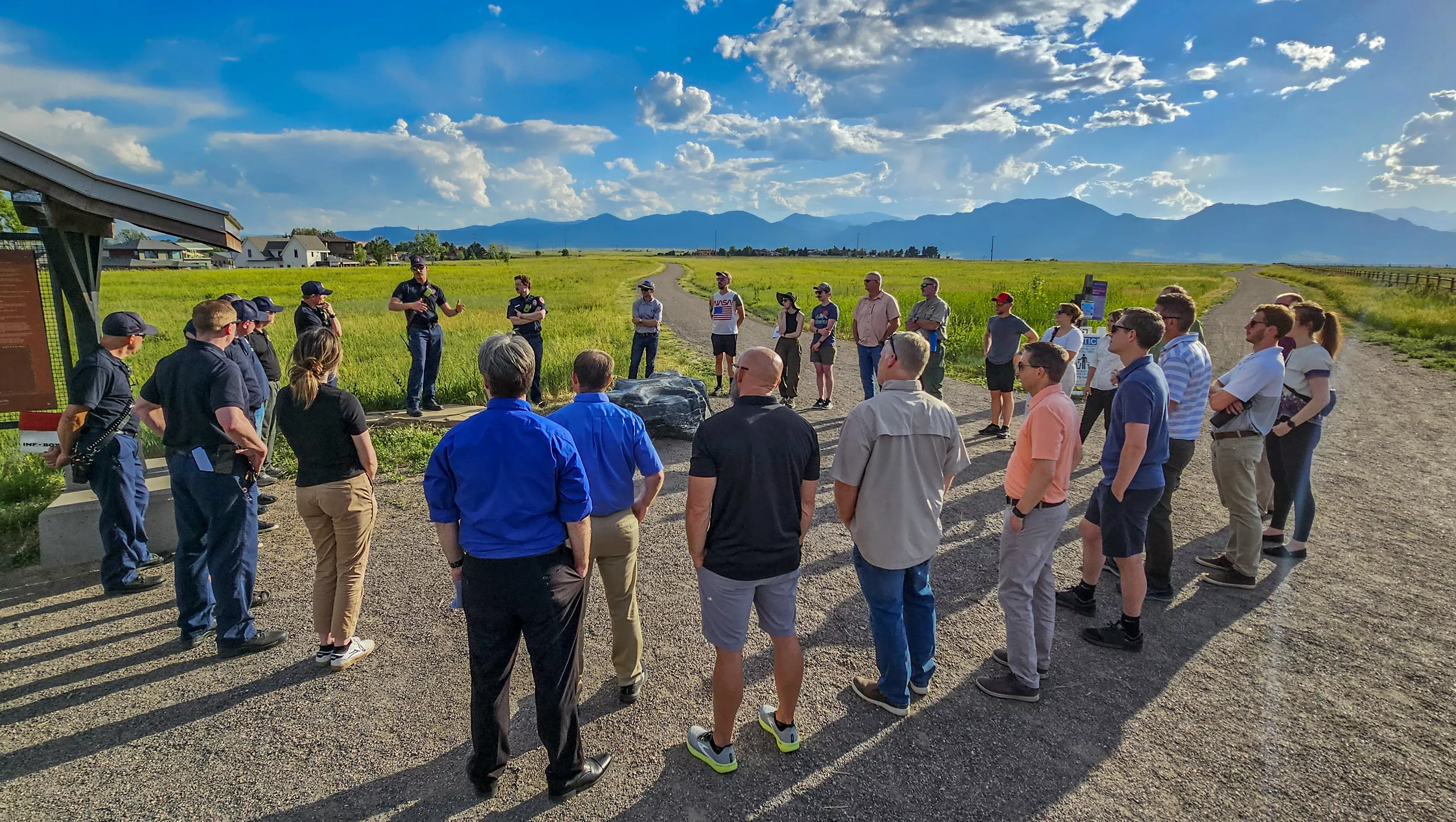
Firefighters from the Boulder, Louisville, and Mountain View Fire Departments share their experiences battling the wind-driven 2021 Marshall Fire with researchers and testbed participants during a field trip. The Marshall Fire, which occurred less than four miles south of the NOAA building now home to the Fire Weather Testbed, was the most destructive in Colorado history, claiming two lives and destroying 1,084 structures.
How does the testbed address the various challenges of forecasting fire weather in different regions (e.g., forests vs. grasslands)?
With the NWS aiming to issue fire warnings nationwide, we wanted to understand the challenges of doing so in different parts of the country with varying fire ecologies, population densities and partner capacities.
One of the unique aspects of fire weather is how much it varies regionally. Different ecologies create unique challenges—what works for grass fires may not be effective for large wildfires in forests or mountains. The variation makes it challenging to apply tools and technology universally. To address this issue when testing new tools, technologies, or communication techniques, we invite a diverse set of fire partners from different regions of the country to try and understand the unique challenges of different regions of the country.
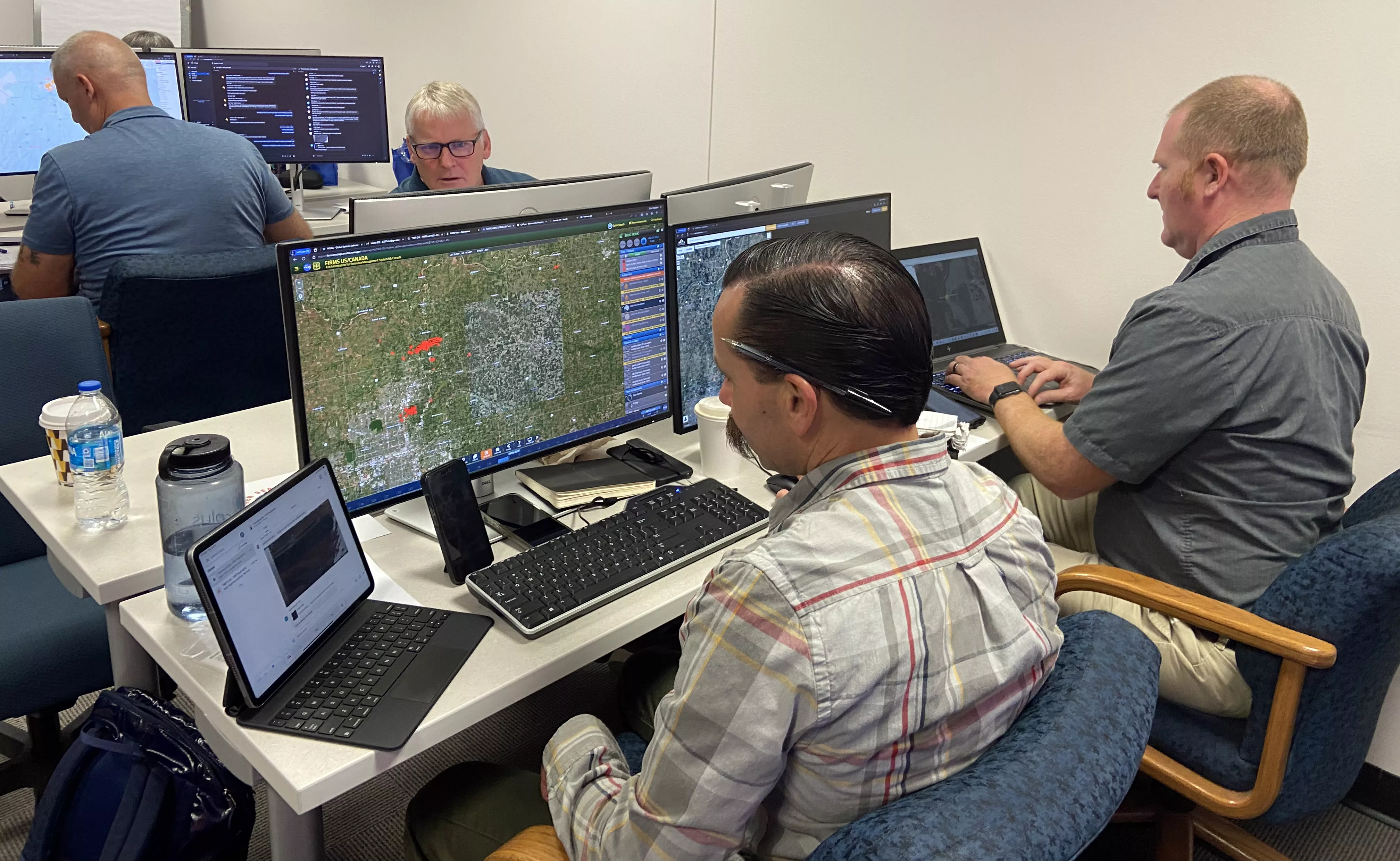
During the testbed evaluation, members of Cal Fire and the NWS form a simulated Integrated Warning Team to detect new fires, respond to them, and collaborate on issuing Fire Warnings.
What other advanced technologies and tools are being used in the Fire Weather Testbed?
We evaluated the Warn On Forecast system, developed by NOAA’s National Severe Storms Laboratory, which is a high-resolution, rapidly updating weather model originally designed for severe storms, like those that cause tornadoes, hail and strong winds. Unlike most weather models that run on a global or national scale, this one operates on a smaller scale and updates faster—every 15 to 30 minutes—using the latest radar and weather data.
While it's been used for severe weather in the Plains for years, we explored its potential application to fire weather. Working with incident meteorologists, we identified some promising benefits of using this system for fire weather forecasting.
How does the testbed facilitate collaboration between meteorologists, firefighters and emergency managers?
The most effective way to evaluate collaboration is to bring people together in person—have them go through an event together so you can really understand the challenges that arise during a wildfire. Using displaced real-time simulations of wildfire outbreaks allows for a deeper understanding and a more immersive experience, similar to real-life situations.
Although we can also conduct virtual evaluations, especially for testing tools with meteorologists, in-person sessions are better for observing collaboration between different groups along the decision-making timeline.
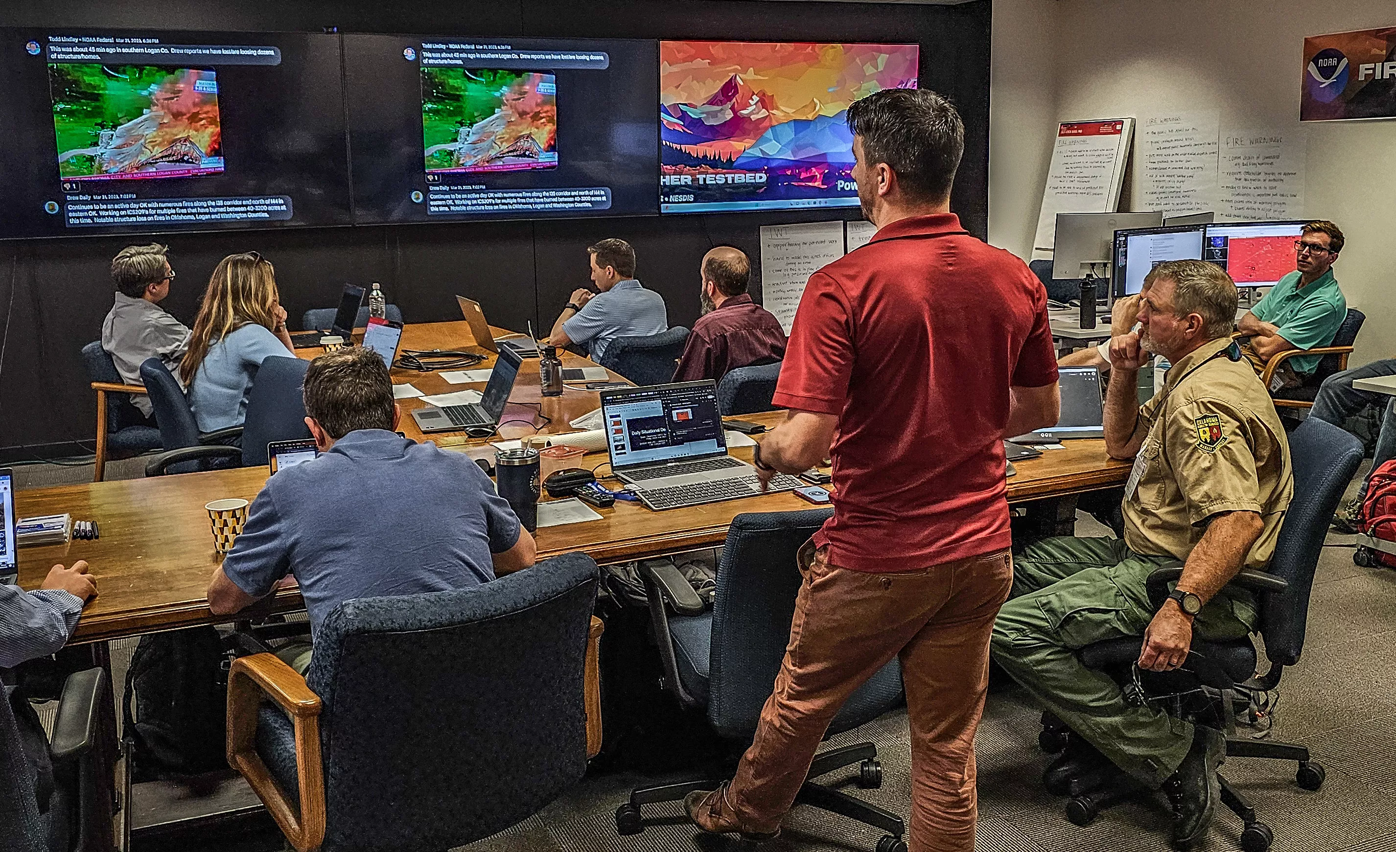
Kyle Thiem, a Test and Evaluation Meteorologist for the Fire Weather Testbed, provides a pre-brief before one of the displaced real-time fire outbreak simulations, in which participants practiced detecting new wildfires and issuing Fire Warnings.
Has that faster detection actually led to quicker response times, and has the work of the FWT directly influenced fire management strategies on the ground?
The NGFS recently detected a small wildfire, called the Dinosaur Fire, under a mile away from our building here in Boulder, Colorado.
According to the NWS, “the [NGFS] detection came about 10 minutes after a human saw the smoke, and called the National Institute of Standards and Technology (NIST) emergency operation team and Boulder Fire to coordinate response. That's exceptionally fast. I am amazed that the pixel within the pixel location of the first detection is SPOT on. The old detection tool we've used is typically a few kilometers from the actual fire.”
On July 22, 2024, the Bureau of Land Management also shared feedback on the use of NGFS in the Northern Rockies region, stating, “The [NGFS] is having a strong track record [in the region] this year. A few weeks ago, it detected the Horse Gulch fire when it was less than 10 acres, almost simultaneously with the smoke report. Last night, the Butler Fire was detected solely by NGFS, and none of our other systems.”
NGFS offers flexibility for land managers and can be integrated either through the National Weather Service, which would alert its partners, or directly by land management agencies like state authorities or the National Park Service, who might incorporate it into their own systems. The choice of approach will depend on the specific needs of each area.
However, NGFS is still a very new technology , so it hasn't seen widespread use yet. We expect that our evaluation report, expected to be published this winter, will help the technology continue to be improved and more widely adopted.
There’s also another system called FireGuard, run by the National Guard. This system involves human monitoring and is becoming more common, especially in states like California and Colorado.
A future Fire Weather Testbed is in the planning stages to better understand the needs and use cases for the NGFS with these land management agencies.
Who are the users you typically engage with? Are they private landowners, insurance professionals or businesses (big or small)? What's your main target audience when gathering input?
We aim to gather input from a diverse range of users, including utilities dealing with fire weather issues like Public Safety Power Shutoff (PSPS), federal agencies, Tribes and other governmental and non-governmental organizations.
We'll start by reaching out to major users and expand our network through referrals, a process similar to "snowball sampling" in social science. Our user-needs assessment team is also forming advisory groups to ensure we cover all relevant user groups and institutions involved with wildfire management.
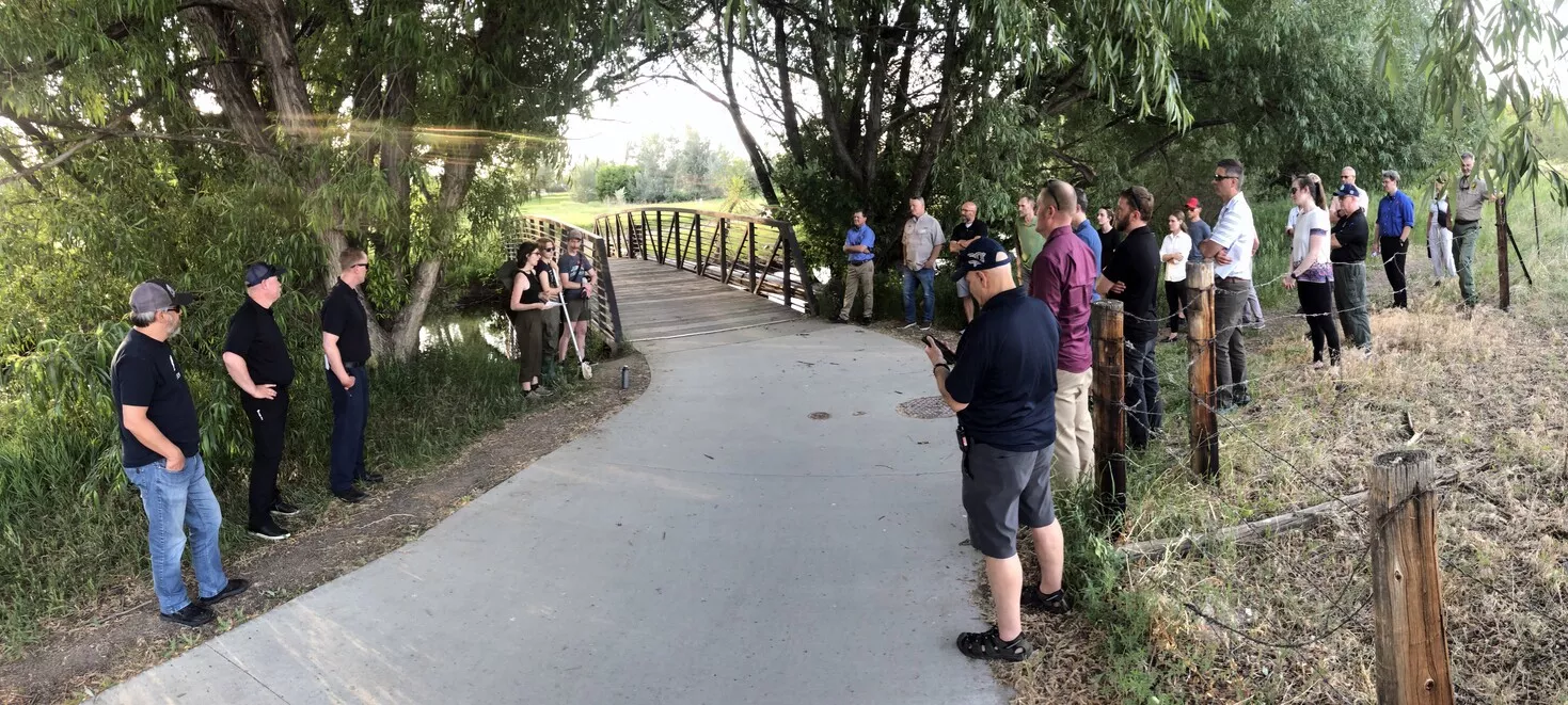
During the final stop of the week's field trip, a researcher, hydrologist, and analytical chemist share findings on post-fire water quality issues still impacting the areas surrounding and downstream of the Marshall Fire.
What are the biggest challenges faced by the Fire Weather Testbed in improving fire environment forecasting?
I think one of the biggest challenges in fire weather forecasting is getting high-resolution data in mountainous and valley terrain. Accurate wind and humidity forecasts are crucial in these areas. At the Global Systems Lab, where I work, we build high-resolution models, like the High-Resolution Rapid Refresh (HRRR) forecast, which is evolving into the Rapid Refresh Forecast System (RRFS). But even these high resolution models don’t fully resolve the very complex terrain where very accurate wind forecasts are needed. So, we are partnering with the U.S. Forest Service to plan a future collaborative evaluation of their high-resolution wind prediction capabilities for complex terrain.
We’re also interested in investigating complex fire weather phenomena, like plume-dominated fires or pyrocumulus, where fires can create their own weather, posing significant risks to firefighters. Forecasting these events is still a significant challenge, and improving forecasts for these complex problems is a high priority.
Another challenge we face with the FWT is that much of the research is still in its early stages. Unlike severe thunderstorms and tornadoes, which have decades of research and established technologies like nationwide radar systems, fire weather research is at a more foundational stage of the process.
As a result, we often have to do a lot of work trying to understand and figure out how new tools can be integrated into operations and how they can be improved. Another issue is the multidisciplinary nature of fire, which requires partnerships between different sciences, multiple governmental agencies, and a diverse set of fire partners.
What are the future plans or goals for the Fire Weather Testbed?
The increasing fire problem will require an inter-agency approach and we will continue to expand our partnerships beyond NOAA to include agencies like the Forest Service, NASA and the Bureau of Land Management to enhance fire and fire weather operations.
A unique aspect of our testbed is a user-needs assessment team that pairs social scientists with meteorologists to identify and address the needs of those working with fire weather. This includes feedback from meteorologists, emergency managers, firefighters, and those involved in prescribed burns. The team will ask people dealing with fire and fire weather what their real needs are. What are they missing? What is the part of the weather forecast that they most need to see improved in order to assist with their operations? This way, we can ensure that future research and testbed evaluations aim to fill those real-world gaps.
Earlier this summer, the Biden-Harris Administration announced a new initiative to enhance wildfire detection leveraging NOAA’s Geostationary Operational Environmental Satellite—R series (GOES-R) data. A $20 million investment from the Bipartisan Infrastructure Law supports this partnership between NOAA, the Department of the Interior, and the USDA’s Forest Service. This collaboration aims to rapidly detect and report wildfire starts, improving response times and accuracy. This initiative aligns with the Wildland Fire Mitigation and Management Commission’s recommendations to enhance wildfire management through technology and interagency cooperation, and will ensure NGFS products are optimized for Federal land management agency operations.
Fire weather presents challenges at all stages: before, during and after fires. We’re focusing on improving prescribed fire forecasts, communicating fire weather conditions during wildfires, and addressing post-fire debris flow risks. Ultimately our goal is to provide a platform to improve the Operations to Research to Operations of new tools and technologies to improve the accuracy and communication of fire weather forecasts.
