
On Jan 28, 2021, NOAA's GOES East satellite zoomed in on the eastern United States, and caught a few interesting weather phenomena.
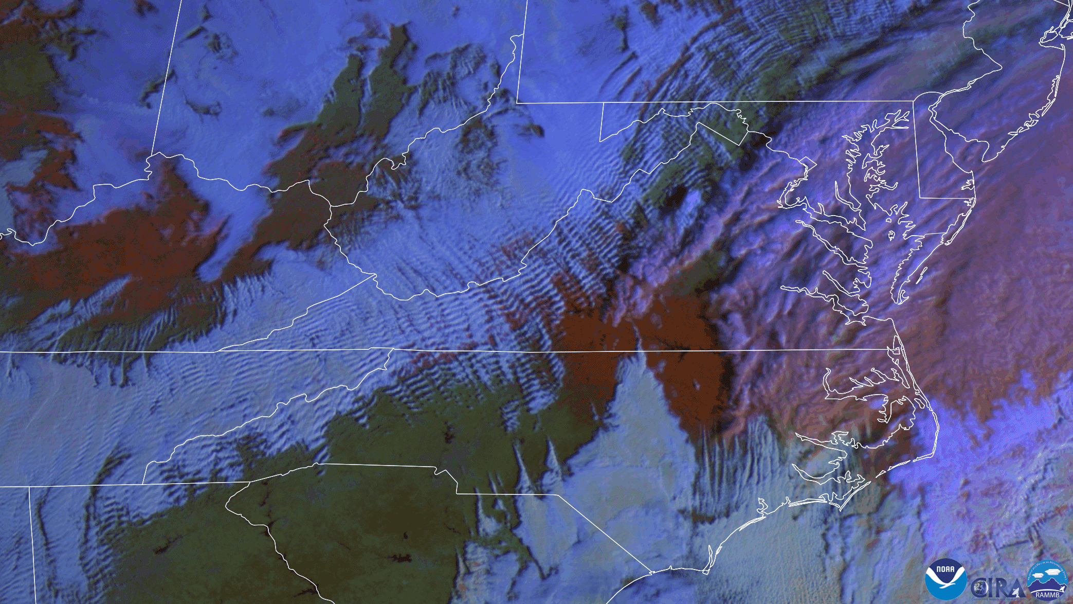
The imagery above utilizes the Day Snow-Fog RGB product, which helps distinguish snow from clouds. In this case, vegetation appears green, water appears black, snow on the ground appears reddish-orange, high icy clouds appear pinkish, and moisture-rich clouds are a blue-white color.
Notice the distinctive reddish streak of snow underneath the clouds, spanning from Indiana to North Carolina in this loop. More than four inches of snow fell in eastern North Carolina from a mid-week winter storm. Also, the chilly air funneling in behind this storm is producing lovely wave clouds over the Appalachian Mountains, which form when stable air moves over hills and mountains. Changes in air density cause the air to oscillate, similar to ripples in a pond, forming narrow rows of clouds parallel to mountain ranges.
The GOES East geostationary satellite, also known as GOES-16, keeps watch over most of North America, including the continental United States and Mexico, as well as Central and South America, the Caribbean, and the Atlantic Ocean to the west coast of Africa. The satellite's high-resolution imagery provides optimal viewing of severe weather events, including thunderstorms, tropical storms, and hurricanes.