Search
News
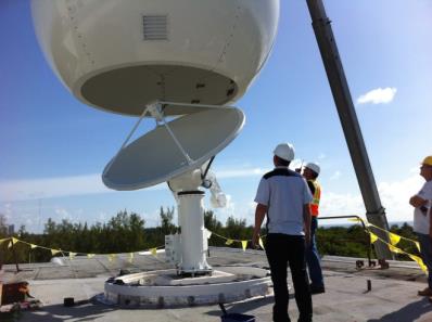
LATEST ANTENNA TO DIRECTLY RECEIVE SUOMI NPP POLAR SATELLITE DATA NOW INSTALLED
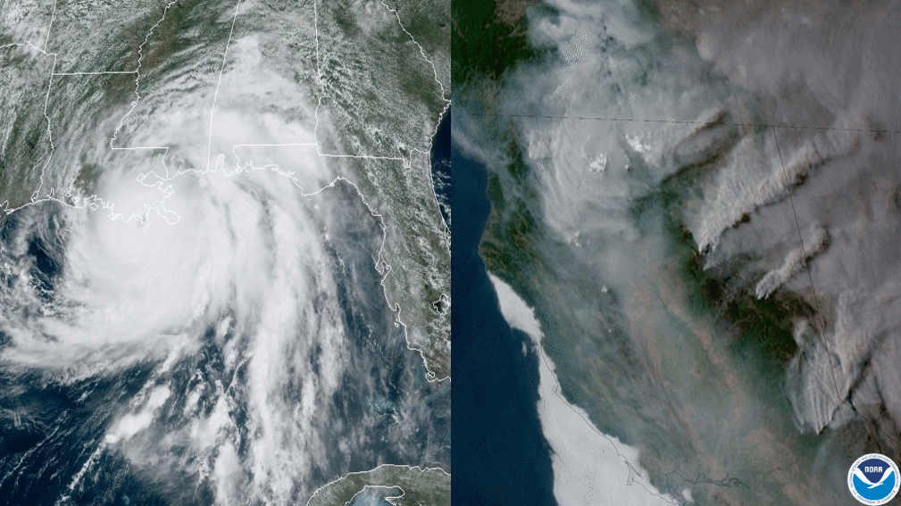
As severe storms grow in frequency…
As severe storms grow in frequency…
Page
NOAA’s JPSS satellites provide critical environmental data to support NOAA’s ongoing mission to understand and predict…
News
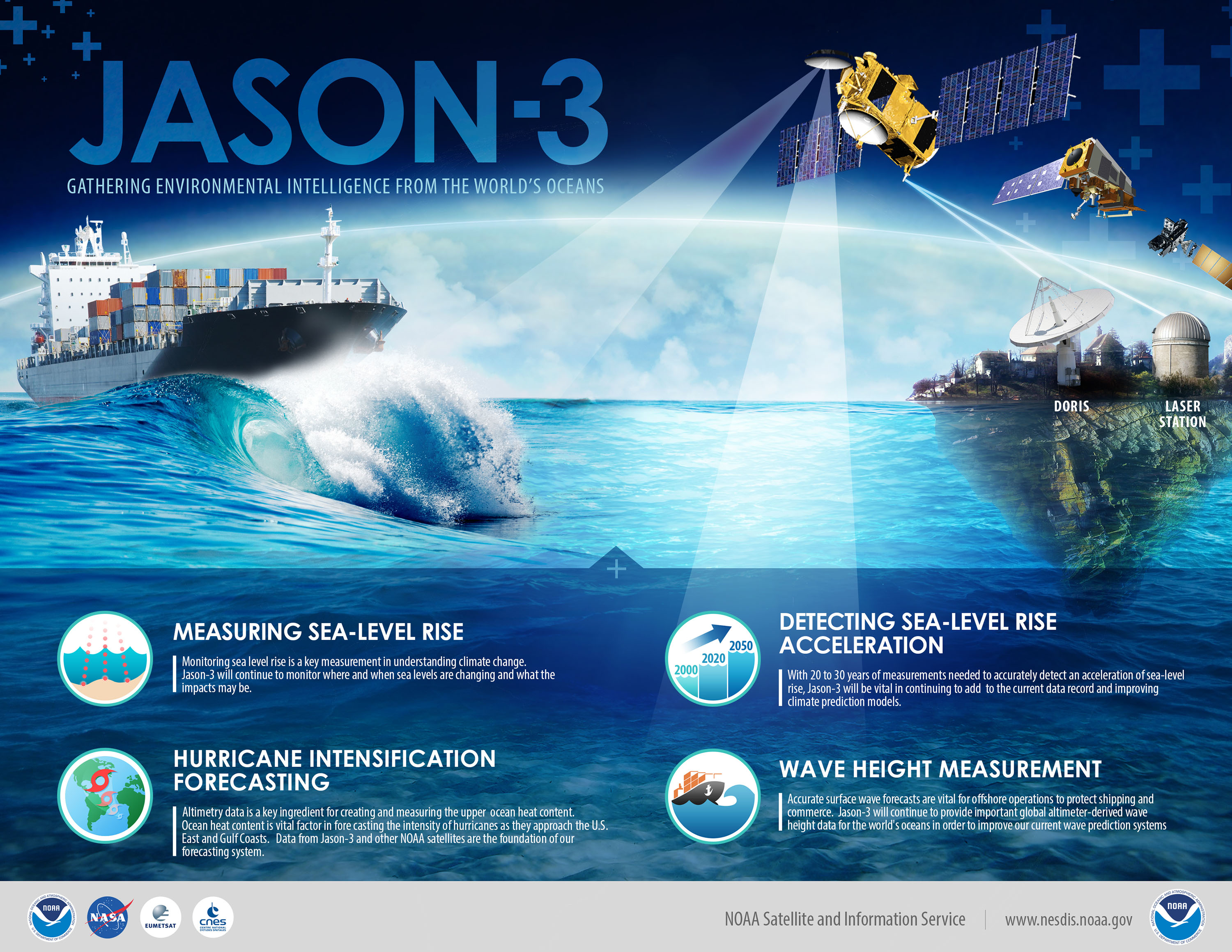
Jason-3: Gathering Environmental Intelligence from the World's Oceans
News
NCEI has released an innovative mapping tool that provides county-level information on natural disaster hazards across the…
News
June 10, 2020 Talk about dust in the wind! This plume blowing west over the Atlantic from the Sahara desert was captured on…
News
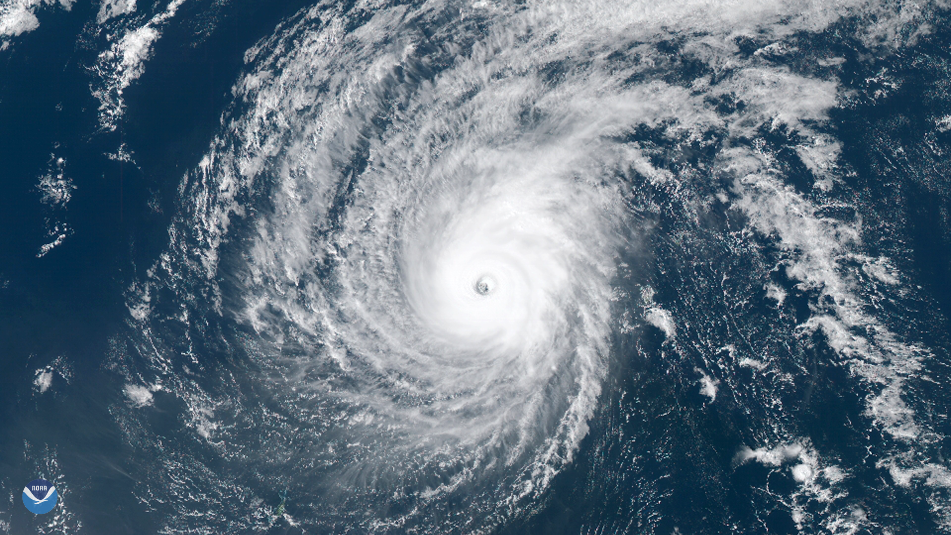
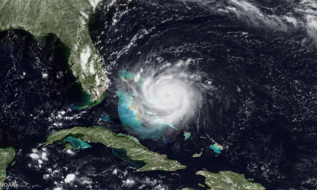
Typhoon Wutip, the strongest February storm seen in the western Pacific Ocean in 70 years, passed south of Guam and may…
News
The NOAA-20 satellite's VIIRS day night band captured this nighttime image of the remnants of subtropical storm Alberto…
News
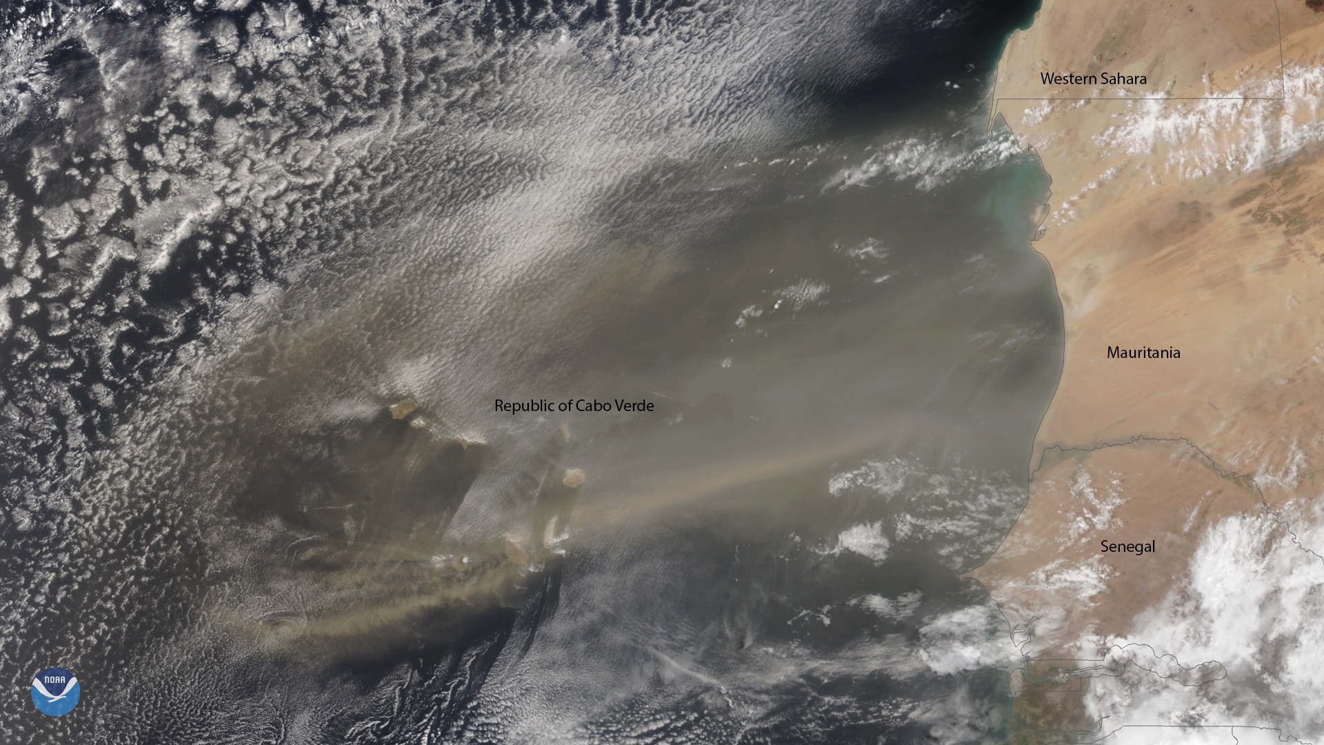
A plume of Saharan dust reaches beyond the Republic of Cabo Verde, which is located approximately 350 miles off the coast of…
News
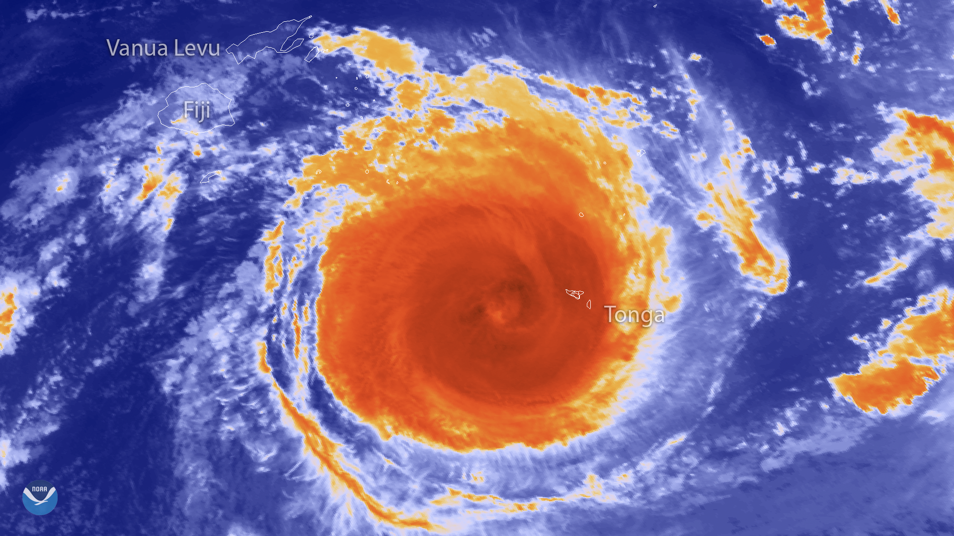
The Japan Meteorological Agency's Himawari-8 satellite captured this thermal infrared imagery of powerful Tropical…
News
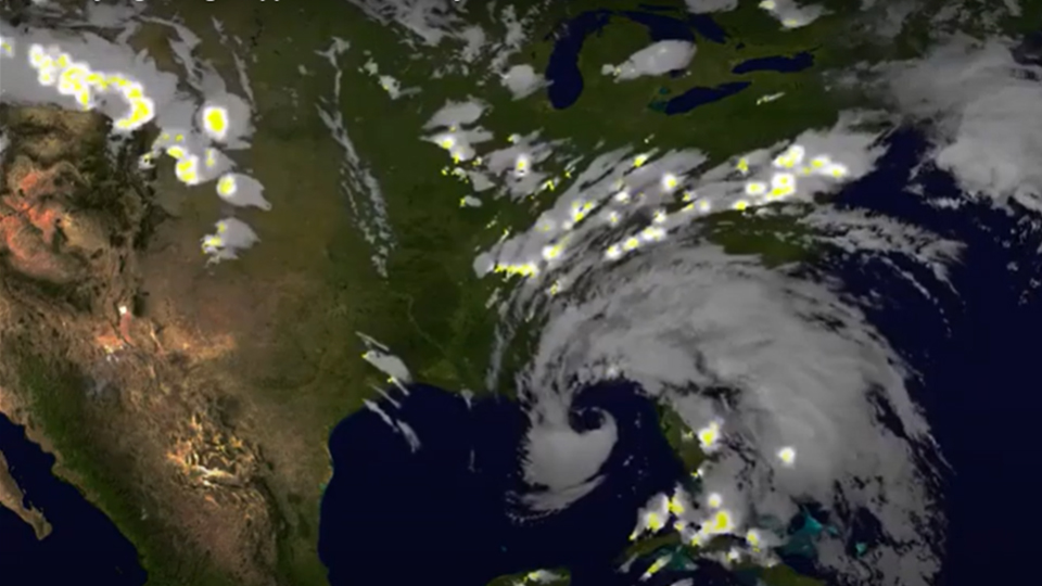
June 09, 2020 From June 1–9, 2020, NOAA’s GOES-East satellite viewed the formation, development, and dissipation of two…
News
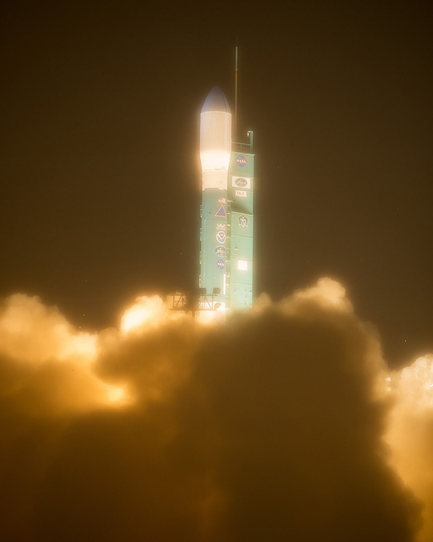
The Joint Polar Satellite System-1, the first in a new series of four highly advanced NOAA polar-orbiting satellites, lifted…
News
GOES-7 has the distinction of being the only satellite in the history of NOAA’s geostationary program to serve both as the…
News
GOES-13 has served in the GOES East position since April 2010. Ten years ago today, on May 24, 2006, GOES-13 was launched…
Page
The Fire & Smoke Initiative provides scientists and wildlife management experts with access to data products that can…
News
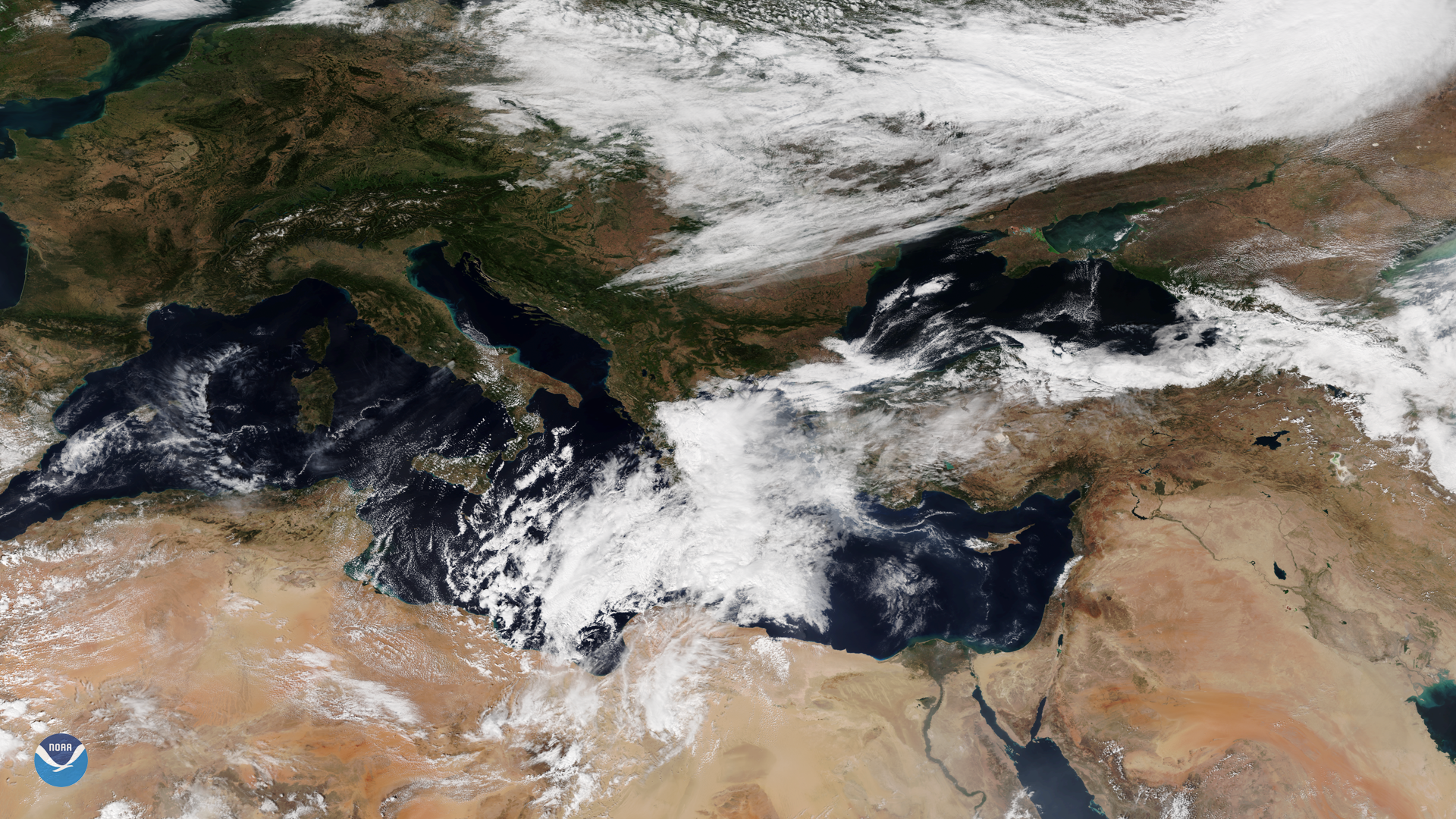
A tropical-like cyclone, known as a medicane, was seen by the NOAA-20 satellite over the Mediterranean Sea on Sept. 27, 2018.