
Protecting Boots On The Ground
NOAA contributes 90% of the weather information used by the defense and intelligence communities. Satellites offer a view unrivaled by terrestrial technology. NOAA works closely with the Department of Defense (DoD) to contribute data that feeds forecasting models. The military relies on those models when planning, thereby protecting warfighters and assets both at home and abroad. From preparing for extreme temperatures to developing strategies for complex operations, situational awareness of the weather is key to success.
The DoD manages hundreds of military installations on U.S. soil alone. These bases house military personnel as well as aircraft, equipment, communications, and weapons systems that are subject to extreme weather at any time. Proper preparation and real-time environmental monitoring protects lives, property, and the American taxpayer’s investment.
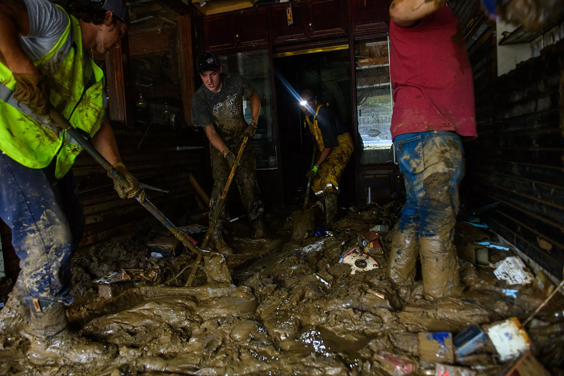
Business owners in Asheville, North Carolina clean up the aftermath of Hurricane Helene. Credit: Melissa Sue Gerrits via Getty Images
Accurate global weather data is essential to planning combat logistics as well as training operations. The microwave and infrared sounding instruments aboard NOAA's Low Earth Orbit (LEO) Joint Polar Satellite System (JPSS) satellites provide high-resolution input for forecasts globally, allowing personnel to plan military operations so that they use the weather to their advantage. Environmental conditions like cloud cover can aid in camouflage, but dust storms or severe weather could be dangerous for personnel, military equipment, and transportation plans. Rain, snow, and fog can jeopardize missions and risk lives. When the military is dealing with a time-critical target, inaccurate weather information could be catastrophic to the mission.
Extremely high temperatures on the ground are risks for military operations. NOAA satellites provide essential information for planning vehicle and troop movements in harsh environments. Heat exhaustion results in training and operations time being cut short. High temperatures harm infrastructure and equipment, from softening runway tarmac to reducing aircraft payload capacity and engine reliability.
NOAA space weather data is also used for land, air, sea, and space operations, where several types of space weather can affect radio communication. Solar flares, solar energetic particle (SEP) events, and geomagnetic storms can create atmospheric conditions that disrupt or block different parts of the radio spectrum. In December 2023, solar activity caused a complete blackout of both plane-to-plane and plane-to-ground VHF (very high frequency) communications for eight minutes, almost triggering Federal Aviation Administration (FAA) closure of most northwestern U.S. airspace. NOAA satellite data feeds into 3D models of atmospheric forecasts that inform the nation of communications blackouts, so radio operators know when to expect communications or scanning outages. Additionally, even moderate space weather effects can temporarily reduce GPS precision by dozens to hundreds of meters.
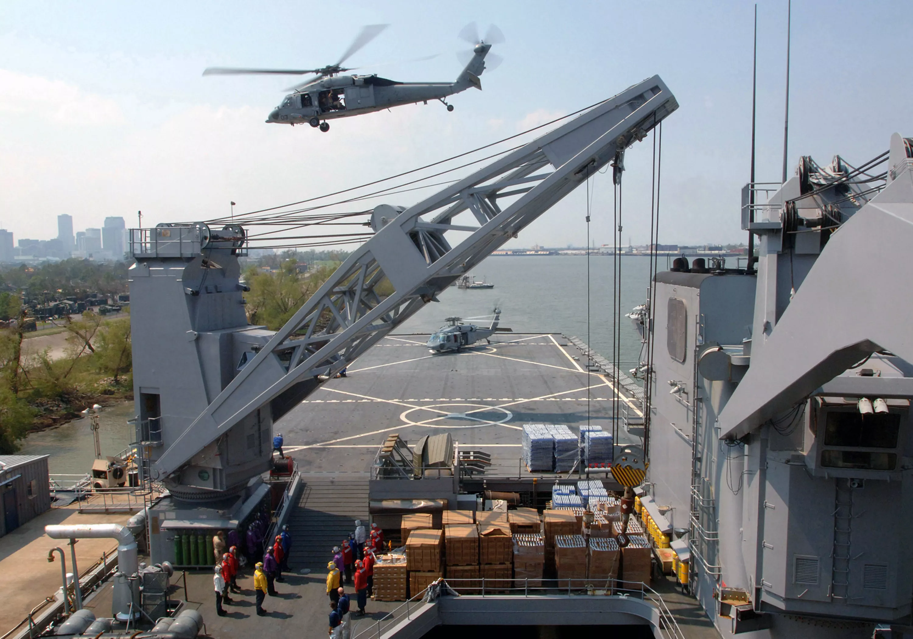
USS Tortuga (LSD 46) provided air evacuations and relief during the aftermath of Hurricane Katrina.
The Geostationary Operational Environmental Satellites (GOES) Data Collection System (DCS) supports the U.S. Army Corp of Engineers’ flood risk management mission, which delivers, on average, over $200 billion of value to the country per year. DCS relays signals from 40,000 platforms on Earth that measure environmental information like water height, wave height, air quality, wind speed, and temperature. DCS provides eight million observations per day and monitors surface water, groundwater, stream flow, river levels, and precipitation to predict flooding and manage dams, locks, and levees. The DCS system provides ocean current information allowing vessels to plan travel to save fuel by traveling with the currents instead of against them. DCS also monitors ocean height for storm surge and tsunami warnings, aiding emergency response preparations. NOAA provides flood data to the Federal Emergency Management Agency (FEMA) and its partners, including DoD, for responses to domestic disasters like the April 2025 flooding of the Ohio and Mississippi Rivers. During one of the recent storms to hit Texas, the primary Army command for domestic disaster response prioritized their relief efforts using NOAA flooding maps. The Army National Guard also relied on Visible Infrared Imaging Radiometer Suite (VIIRS) data for coordinating the response to floods in 2019.
Surveying The Seas
The Navy, Marine Corps, and Coast Guard operate in high winds, punishing waves, and extreme temperatures. Maritime navigation requires environmental intelligence of potential risks and obstacles that would be impossible to see without satellite data. NOAA satellites provide data necessary for forecasting tropical cyclones, severe storms, wave heights, wind prediction, high-tide flooding, and visibility.
Accurate information helps protect tens of billions of dollars of American assets in personnel, weapons, systems, and vehicles. Proper weather forecasting is critical for preserving supply chains against disruption when time is of the essence. "Wars are won through logistics," Steven Morani, Acting Assistant Secretary of Defense for Sustainment, told the Worldwide Logistics Symposium. Extreme weather exacerbates the need for robust planning and access to supplies.
LEO satellites have a unique view of the polar regions due to their paths over the north and south poles. Satellites can survey ice thickness, which is of particular interest to submariners. JPSS tracks melting sea ice, which is hazardous for ships. In some areas, ice melt opens new routes, which increases international traffic through the Arctic Circle. In others, thinning ice packs shed more loose chunks. In the last 20 years, the safe transit season of the Beaufort Sea north of Alaska has halved as large sheets of broken-up ice choke shipping lanes.
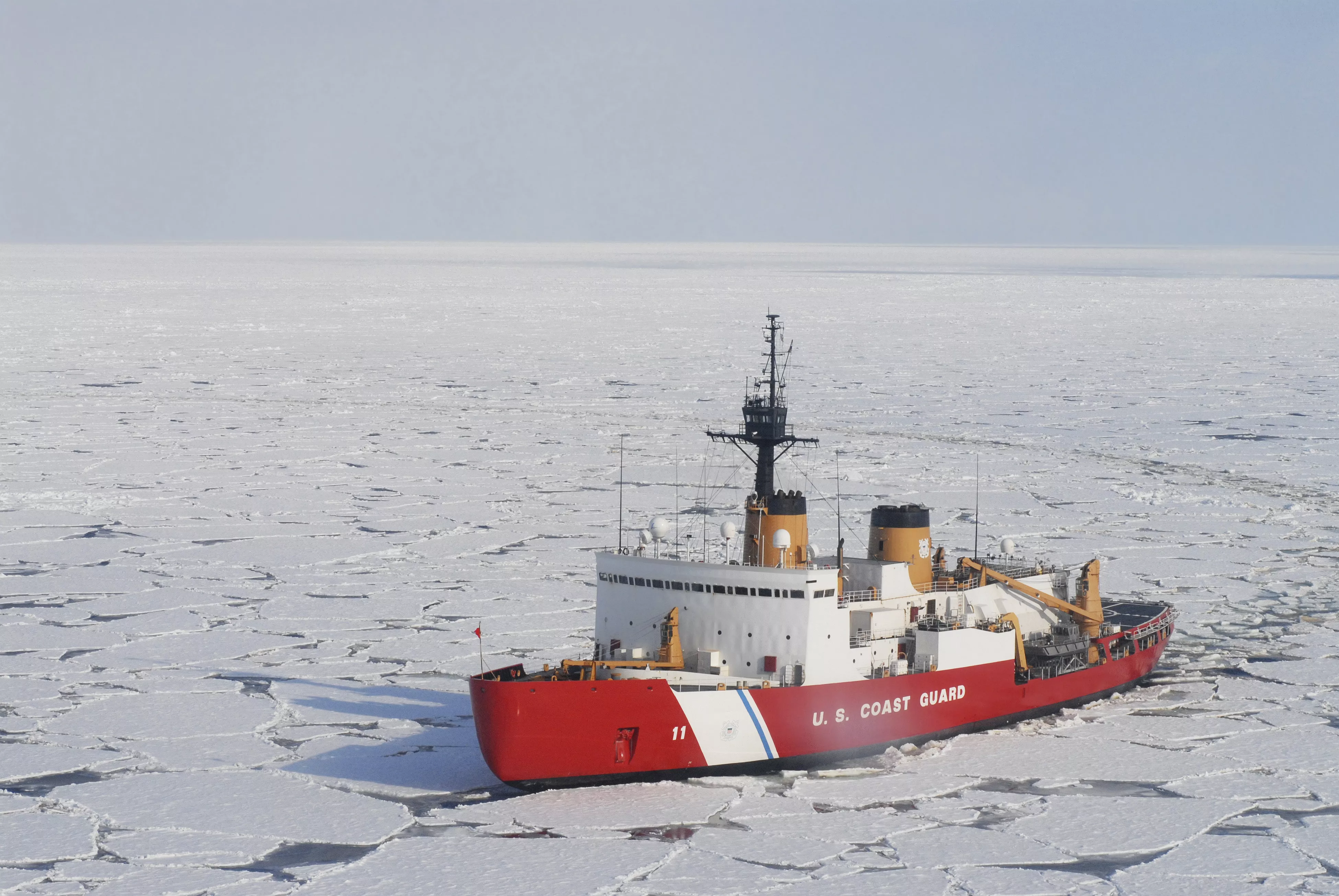
USCGC Polar Sea on an expedition in the Beaufort Sea. Credit: Stocktrek Images via Getty Images
Organizations like the Navy’s 2nd Fleet and the Coast Guard’s 9th District also use LEO and geostationary satellites (GEO) imagery to monitor shipping traffic, maintain border security, and enforce trade restrictions. The VIIRS onboard JPSS captures nighttime imagery used to track ships, particularly those fishing illegally. While nighttime often masks illicit activity, VIIRS sees fishing vessels through the veil of darkness.