
Search
Showing 281 - 288 of 611 results
News
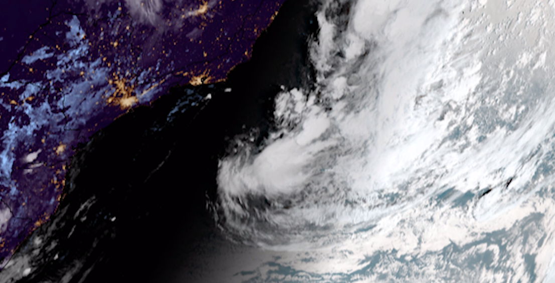
NOAA’s GOES East satellite witnessed a rare event in the South Atlantic, as Tropical Depression 01Q strengthened into…
News

The Visible Infrared Imaging Radiometer Suite (VIIRS), the first instrument for NOAA’s next polar-orbiting weather satellite…
Page
NOAA plans to include a lightning mapper as part of the GeoXO system.
News

Here are NOAA's most captivating satellite images of 2024, based on your votes!
News
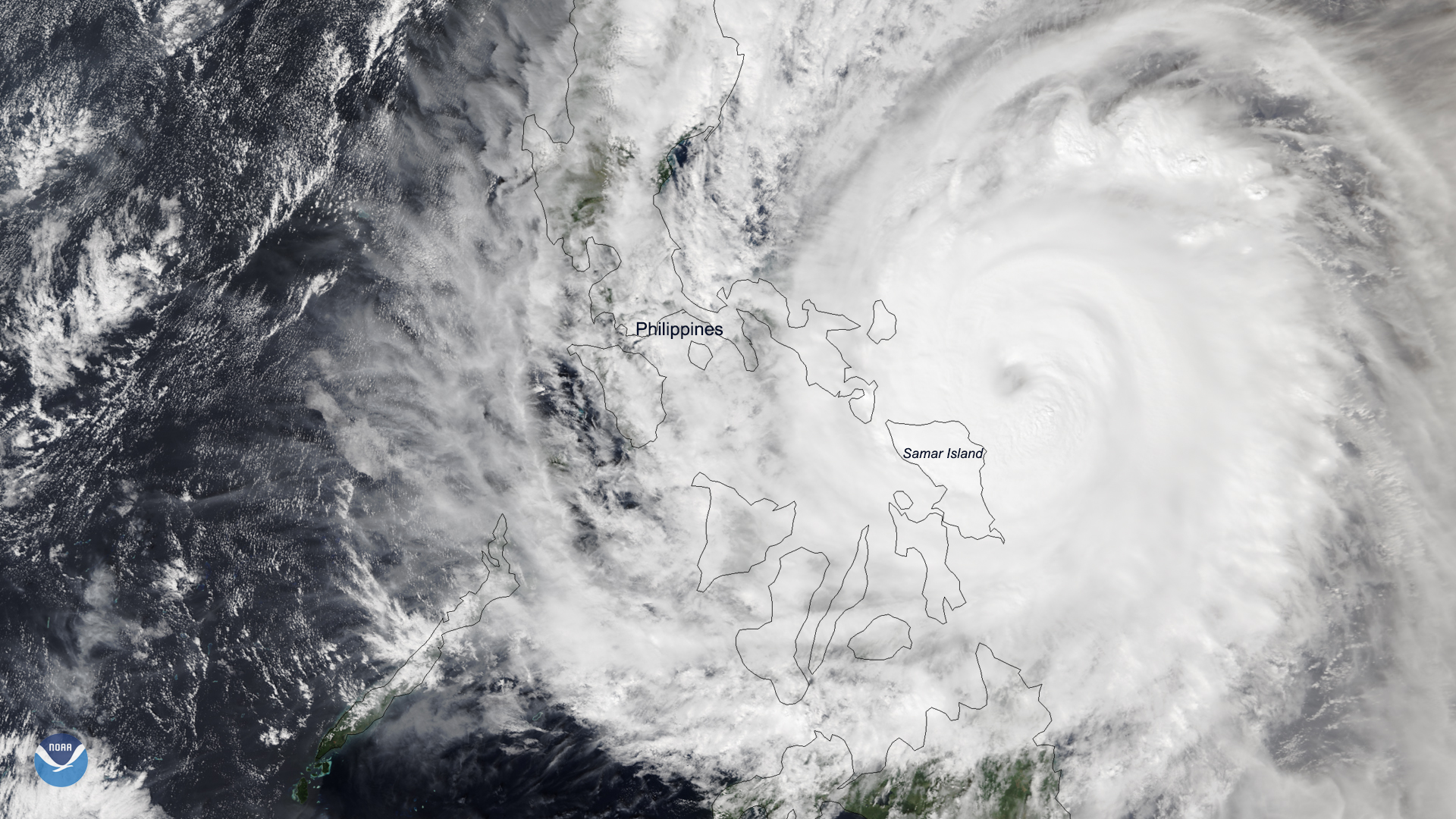
A rare late-season typhoon is bringing heavy rain and strong winds to the eastern islands of the Philippines. Typhoon…
Page
Jason-3 is a satellite mission that supports scientific, commercial and practical applications related to sea-level rise,…
Page
In 2025, NOAA celebrates 50 years of its heralded Geostationary Operational Environmental Satellite program, known as GOES.
News
January 27, 2021 The image above, created from VIIRS data from the Suomi-NPP and NOAA-20 satellites, shows the extent of…