

We asked you to help choose the most compelling images from NOAA satellites in 2024– and we appreciate you showing (and sharing) your love for satellite imagery! The 20 contenders – 10 from NOAA’s GOES satellites and 10 from NOAA’s JPSS Program satellites – provided captivating, and occasionally sobering, views of hurricanes, wildfires, space weather and more from around the globe last year. With help from followers across X, Facebook and Instagram, the imagery received thousands of likes and comments, and helped shine a spotlight on our dynamic planet as seen from Earth orbit.
Below are the rankings of the 20 images, starting with the two you ranked as “most compelling”:
Number 1-ranked image from NOAA’s JPSS Program satellites:
With more than 2,100 likes, this beautiful aurora image from NOAA’s polar-orbiting satellites was the most liked image of 2024.
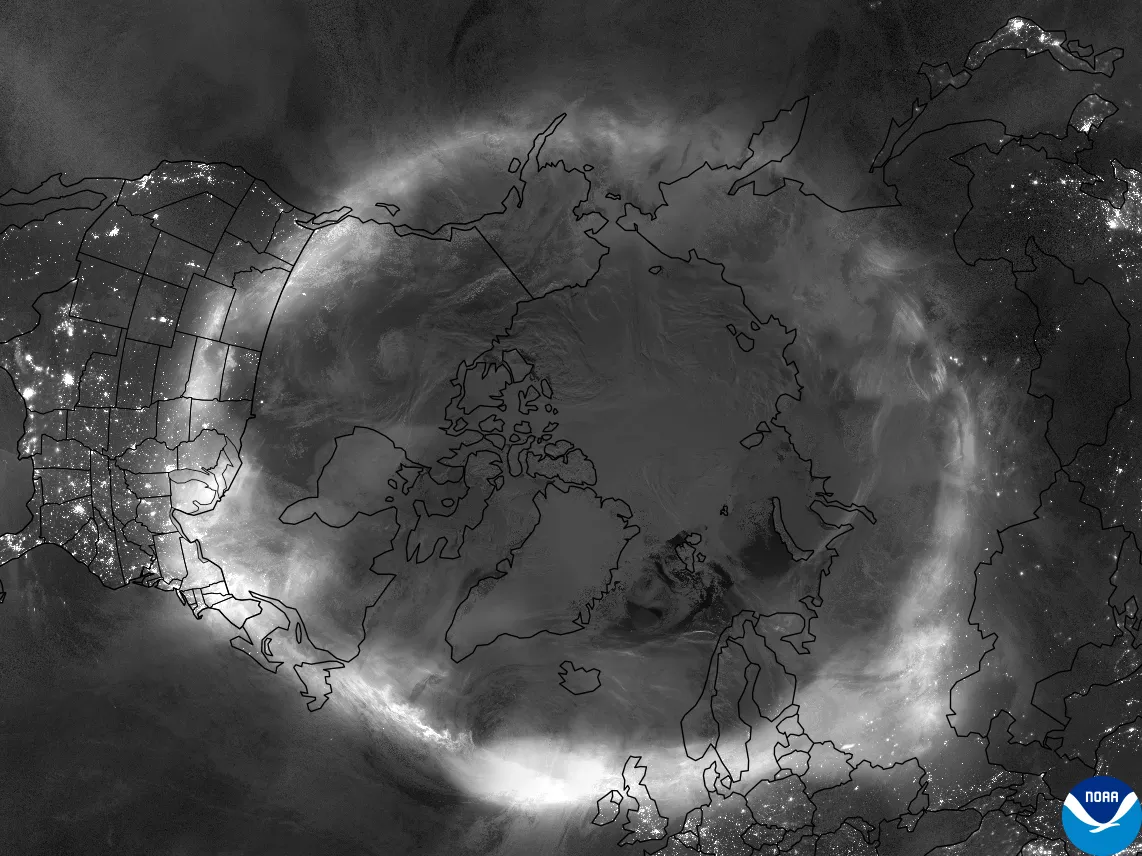
A Day-Night Band image from NOAA’s JPSS satellites of the aurora encircling the Northern Hemisphere on May 10-11, 2024.
Number 1-ranked image from NOAA’s GOES satellites:
With just under 2,000 likes, this stunning image of von Kármán vortices as seen from NOAA’s geostationary satellites was the most liked GOES image of 2024.
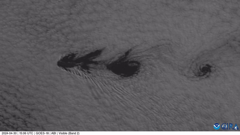
Visible imagery of mesmerizing von Kármán vortices over the Pacific Ocean from GOES West on April 30, 2024.
Below are the rest of the rankings, one each from NOAA’s JPSS and NOAA’s GOES:
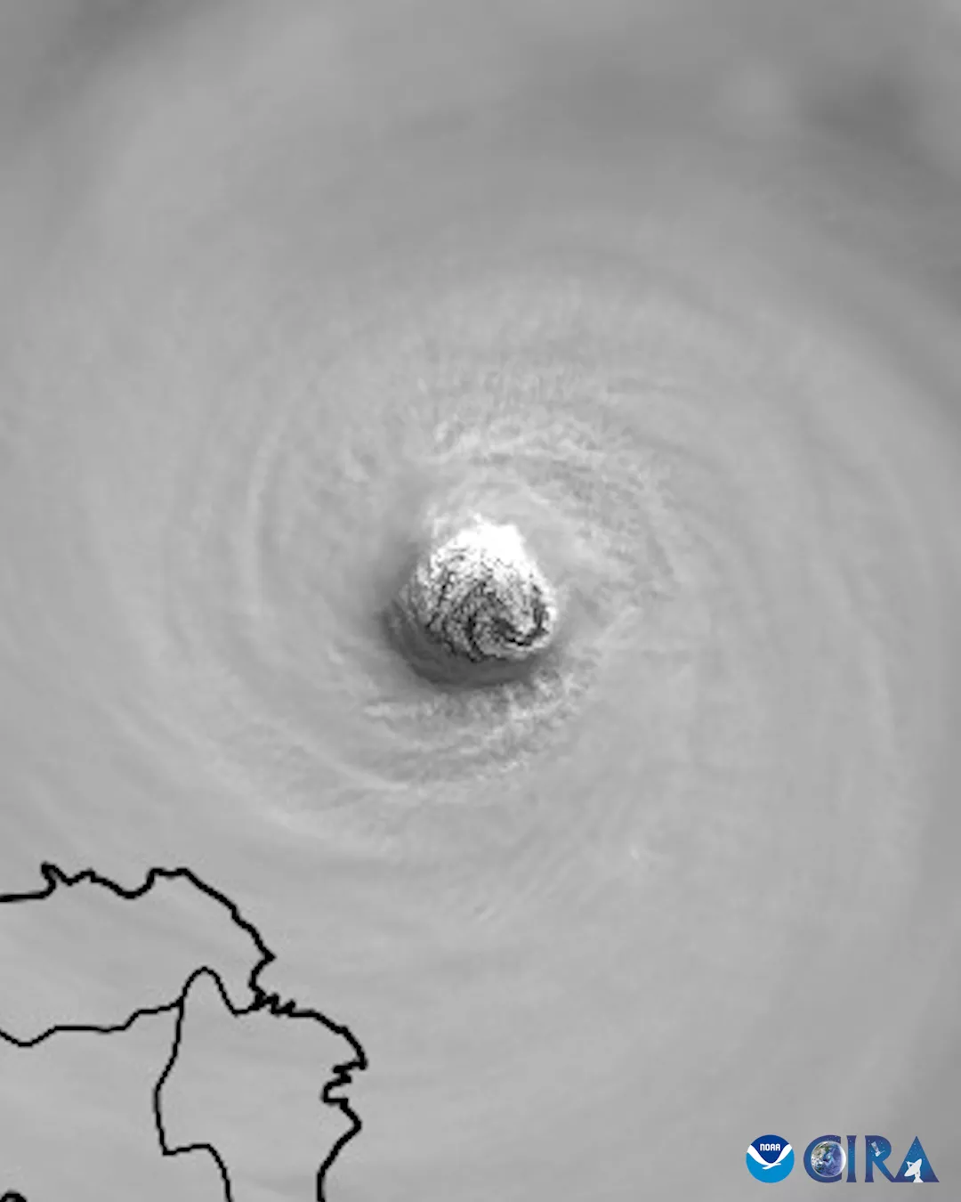
Number 2 from JPSS
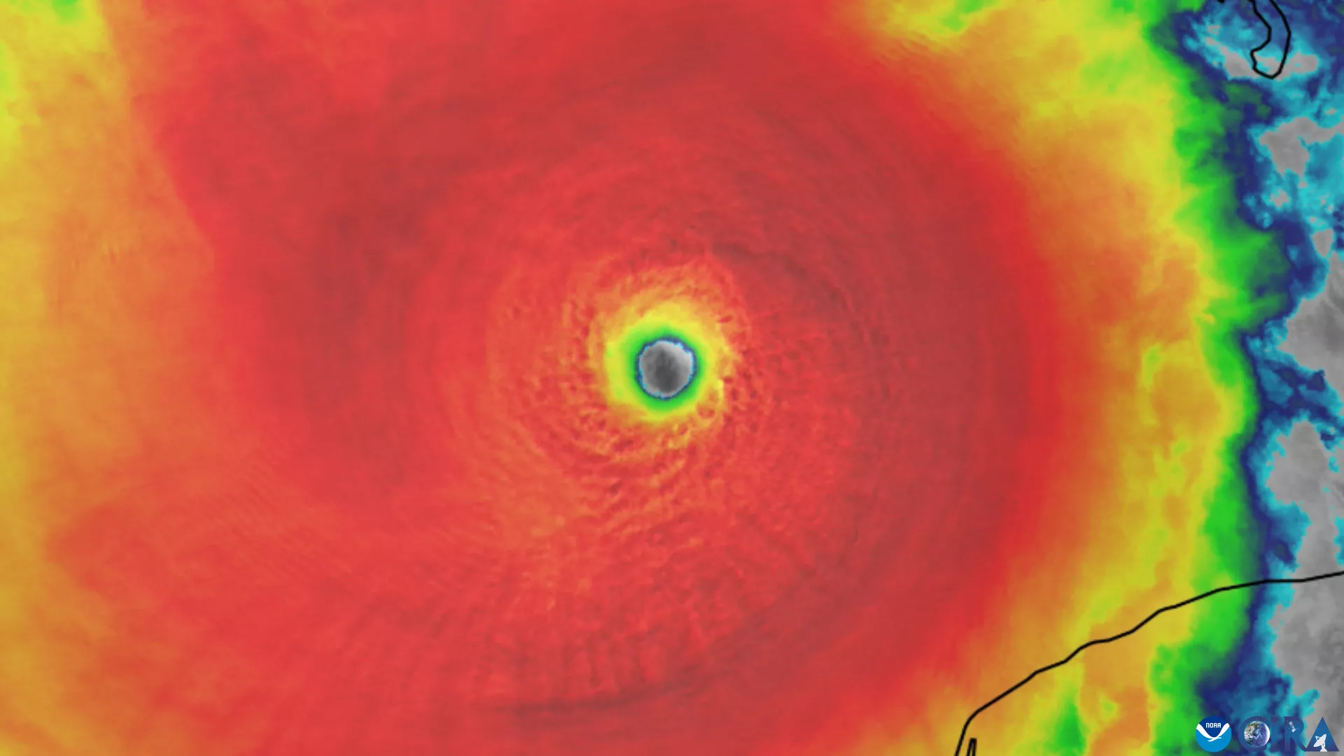
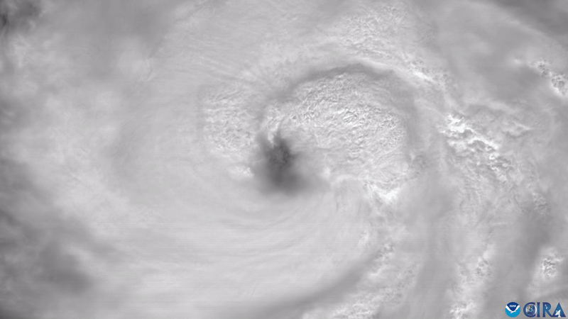
An infrared image of Hurricane Milton’s powerful eye from NOAA-21 on Oct. 7, 2024.
Number 2 from GOES
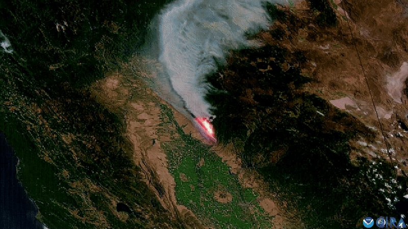
GeoColor/Fire Temperature composite imagery from GOES West of California’s Park Fire on July 25, 2024.
Number 3 from JPSS
Visible image from NOAA-21 of the powerful eye of Category-5 Typhoon Man-yi approaching the Philippines on Nov.16, 2024.
Number 3 from GOES
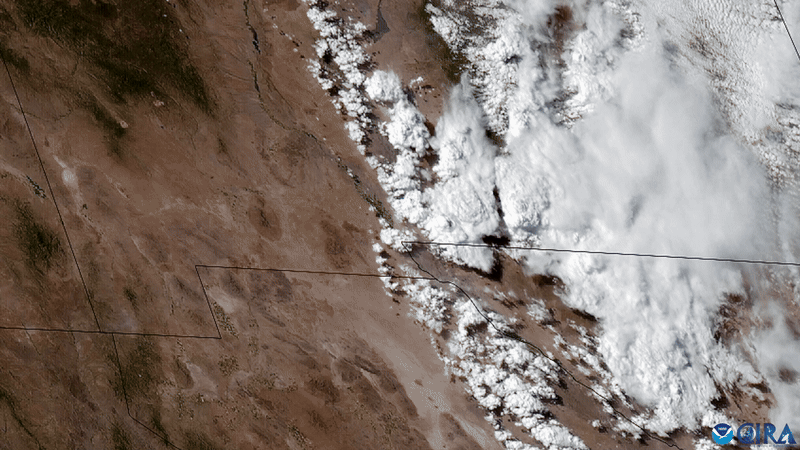
GeoColor imagery from GOES East of a large dust storm (haboob) pushing across the Southwestern U.S. on June 19, 2024.
Number 4 from JPSS
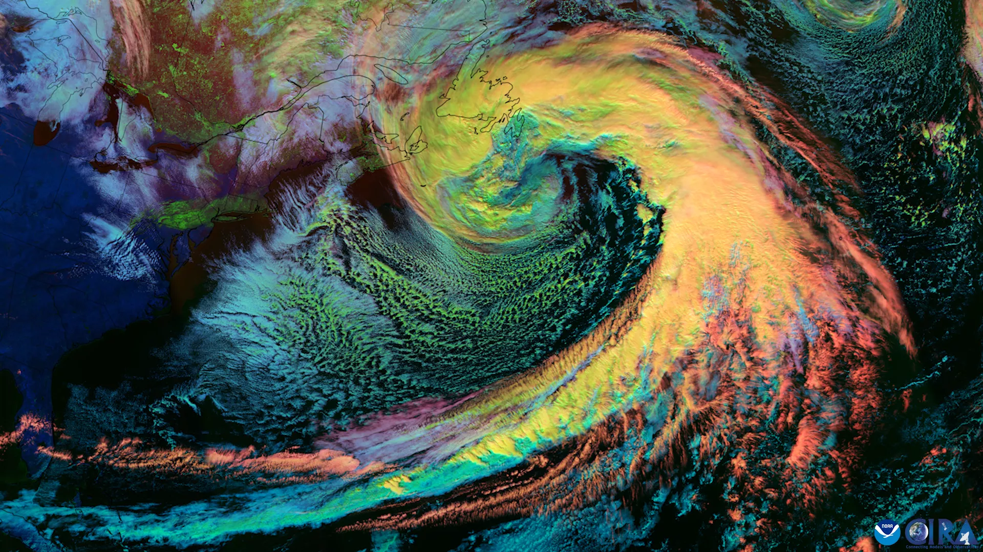
Day-Cloud Phase Distinction imagery from NOAA’s JPSS satellites of a large nor’easter pushing away from the Eastern U.S. on Feb. 14, 2024.
Number 4 from GOES
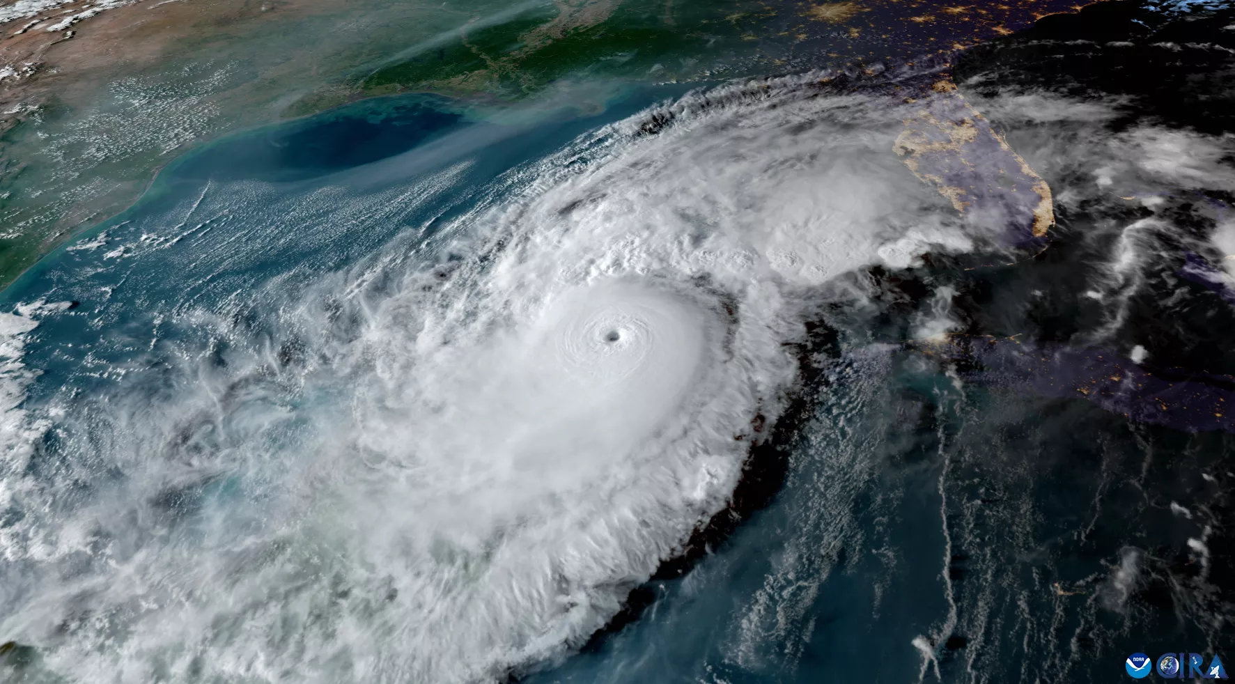
A GeoColor image of Hurricane Milton in the Gulf of Mexico around sunset on Oct. 8, 2024, from GOES East.
Number 5 from JPSS
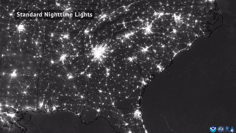
Day-Night Band before-and-after imagery from NOAA’s JPSS satellites of the reduction in nighttime lights after Hurricane Helene in Aug./Sept. 2024.
Number 5 from GOES

Near-infrared imagery from GOES East of the total solar eclipse passing over North American on April 8, 2024.
Number 6 from JPSS
Day-Land-Cloud imagery from NOAA’s JPSS satellites of the total solar eclipse passing over North American on April 8, 2024.
Number 6 from GOES
Visible/Geostationary Lightning Mapper composite imagery from GOES East of Hurricane Helene moving just west of Tampa Bay on Sept. 26, 2024.
Number 7 from JPSS
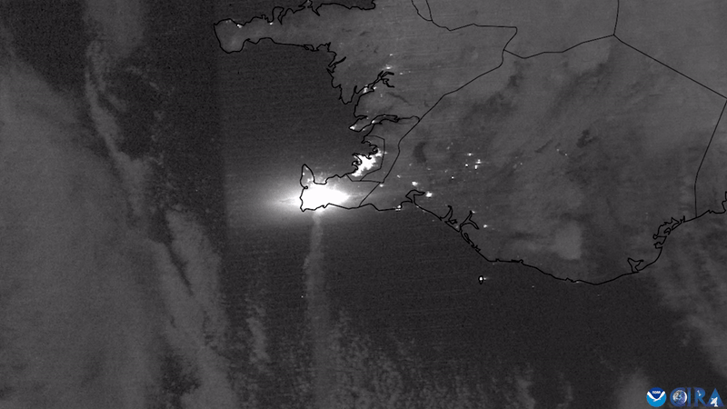
Day-Night Band imagery of the ash plume and light from a volcanic eruption on Iceland’s Reykjanes Peninsula as seen from NOAA’s JPSS satellites on Nov. 21, 2024.
Number 7 from GOES

Visible/Infrared/Geostationary Lightning Mapper composite imagery from GOES East of a line of severe thunderstorms pushing through East Texas on May 16, 2024.
Number 8 from JPSS

Visible imagery timelapse from NOAA’s JPSS satellites of the world’s largest iceberg, A23a, moving through the Southern Ocean during Feb. 2024.
Number 8 from GOES

Water vapor imagery from GOES West of an atmospheric river impacting the U.S. West Coast from Feb. 3-8, 2024.
Number 9 from JPSS
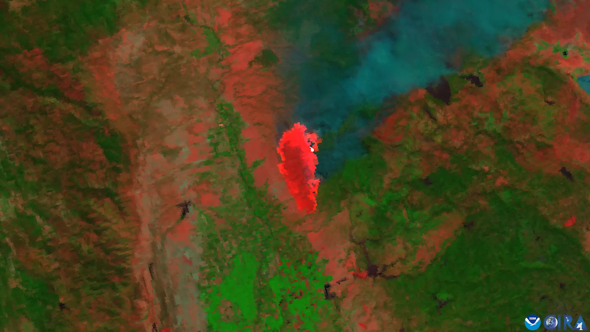
A Day-Fire Band composite image from NOAA-20 and NOAA-21 of California’s Park Fire from July 24-26, 2024.
Number 9 from GOES
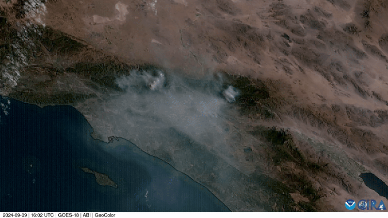
GeoColor imagery from GOES West of multiple wildfires producing pyrocumulus clouds over Southern California on Sept. 9, 2024.
Number 10 from JPSS
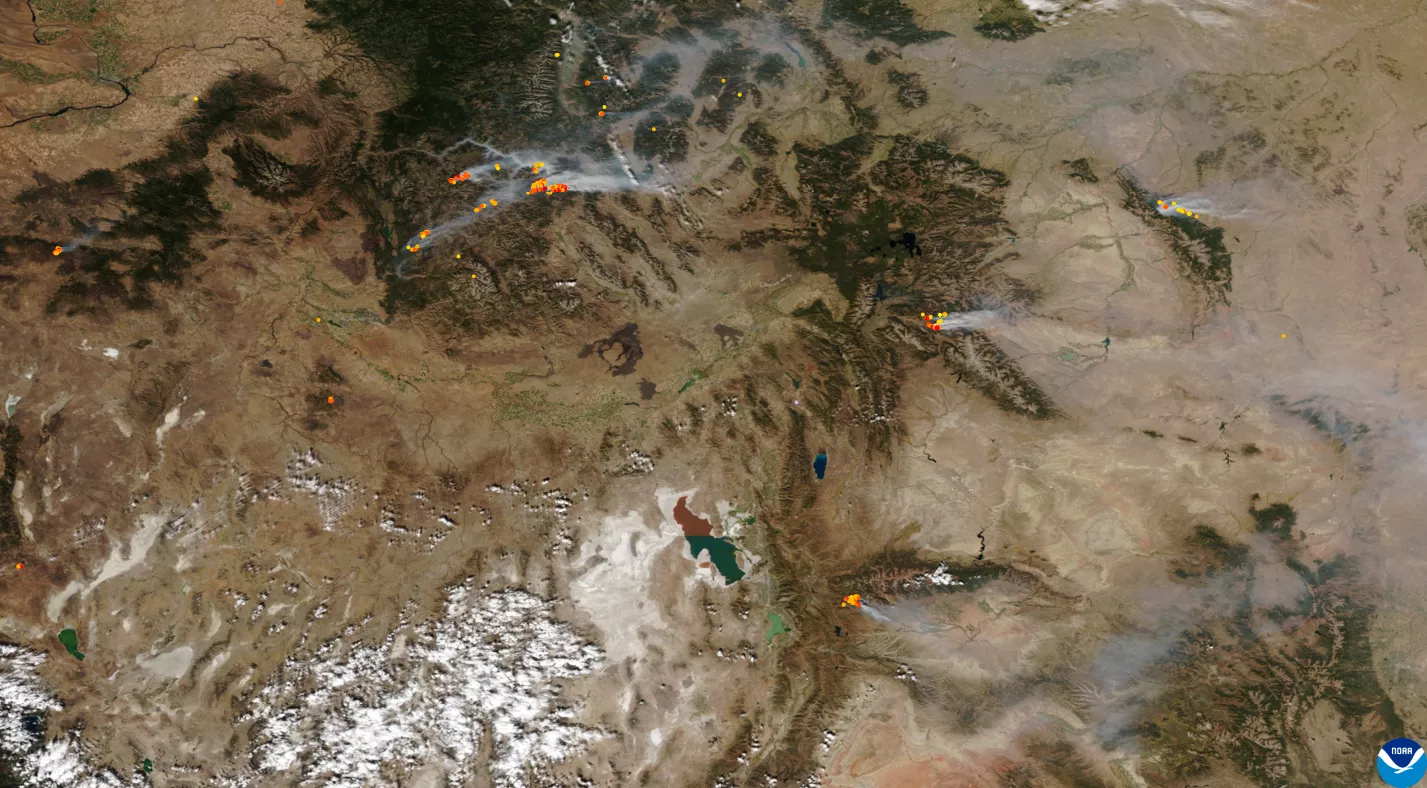
Image from NOAA-20 of numerous wildfires burning around the Great Basin with a two-toned view of the Great Salt Lake in the center on Oct. 6, 2024.
Number 10 from GOES
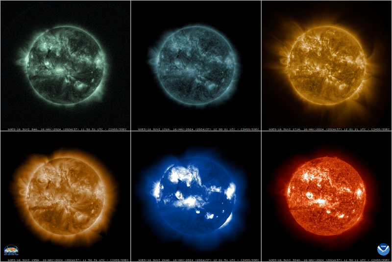
Six different views of solar storms as seen from GOES East’s Solar Ultraviolet Imager on May 29, 2024.
NOAA Satellites would like to thank everyone who took the time to help us rank the best NOAA satellite images from 2024. Here’s to more awe-inspiring views from space in 2025!