Search
Page
![River Ice & Flooding Initiative](https://nesdis-prod.s3.amazonaws.com/styles/webp_large/s3/2023-05/NOAA-logo_16x9_NoBorder.png.webp?itok=qg3l7mLt)
Since its inception in November 2013, the River Ice and Flooding Initiative has grown, serving regions affected by ice jam…
News
![Recent Ohio River Flooding Detected by Satellites](/s3/migrated/iod312.jpg)
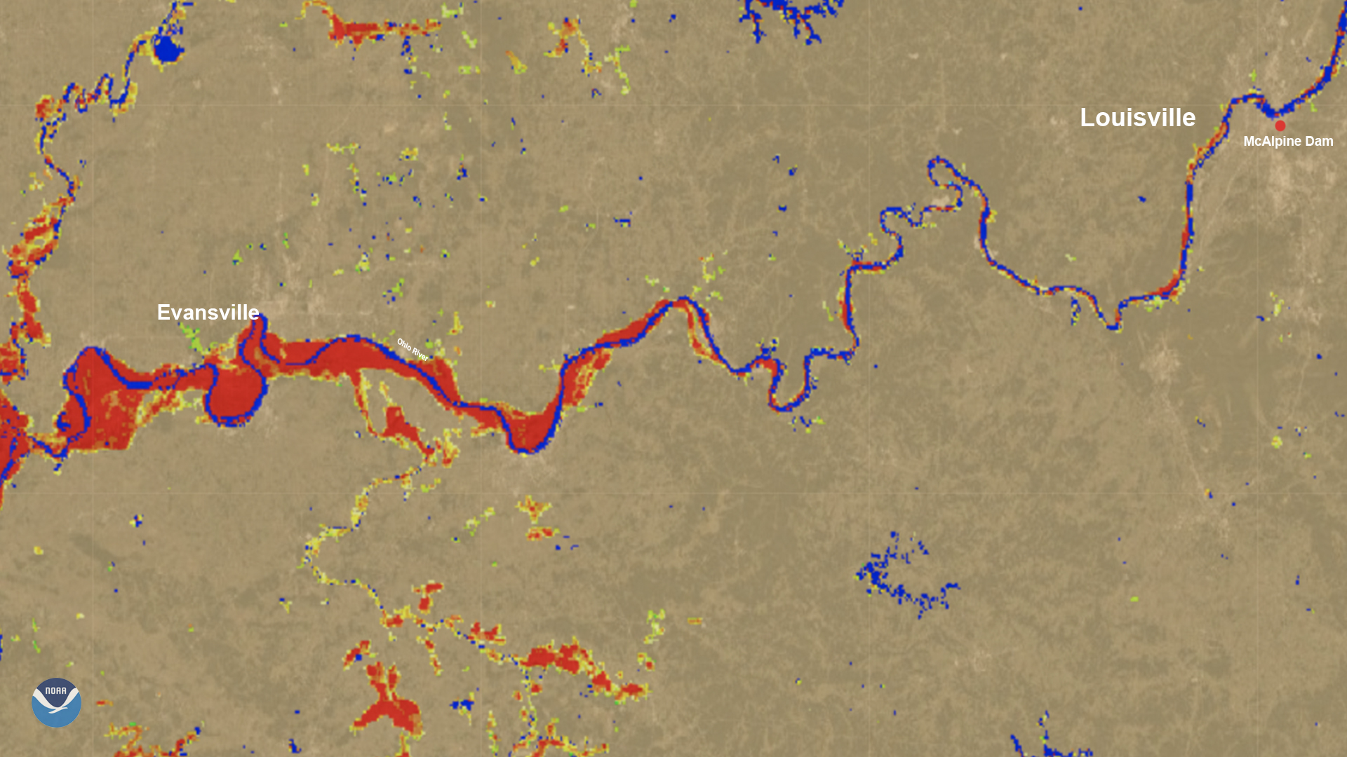
On March 6, the River Flood product showed flooding along the Ohio River on the Kentucky/Illinois/Indiana border.
News
![Severe Storms Trigger Flooding From Texas to Wisconsin](/s3/migrated/20190508-centralUS.jpg)
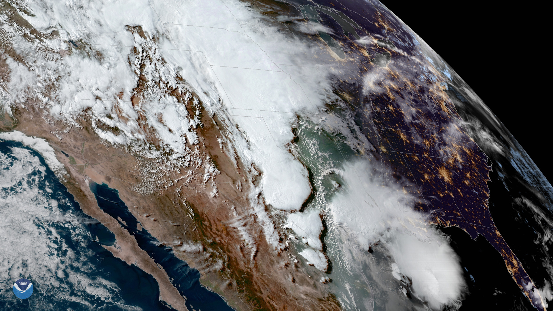
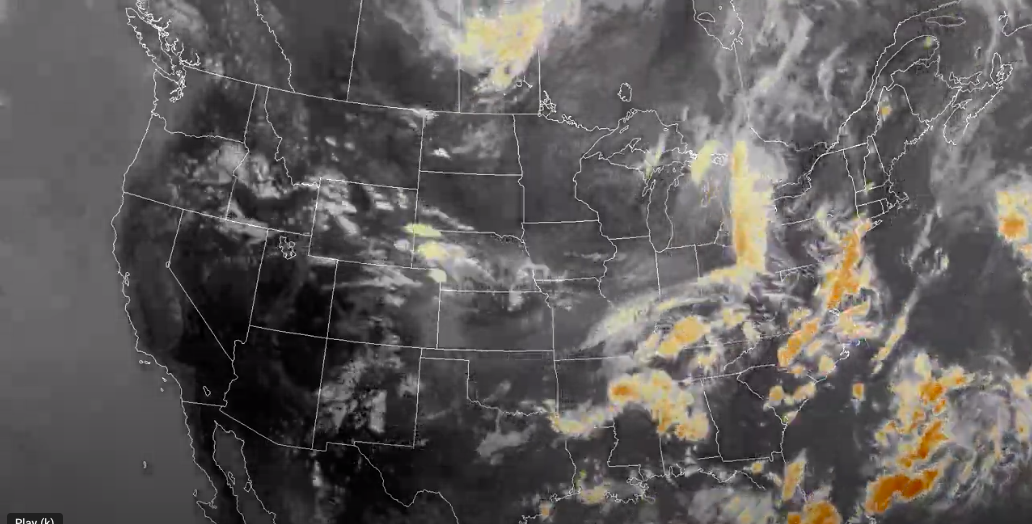
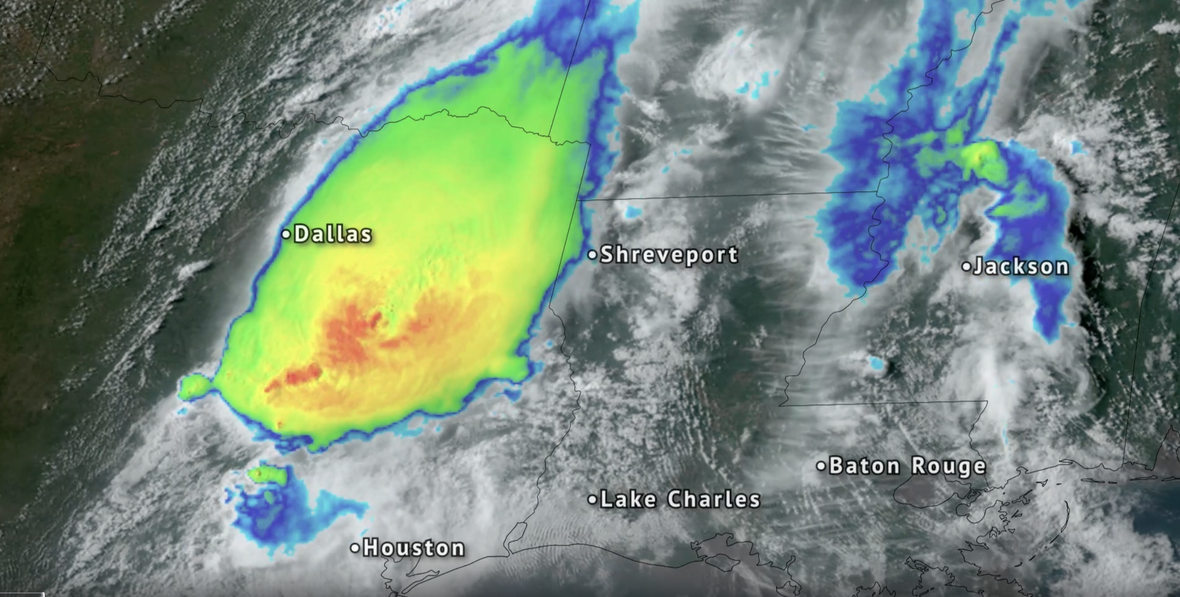
Severe storms and heavy rain continue to trigger flooding from Texas to Wisconsin. Flash flooding across Houston and parts…
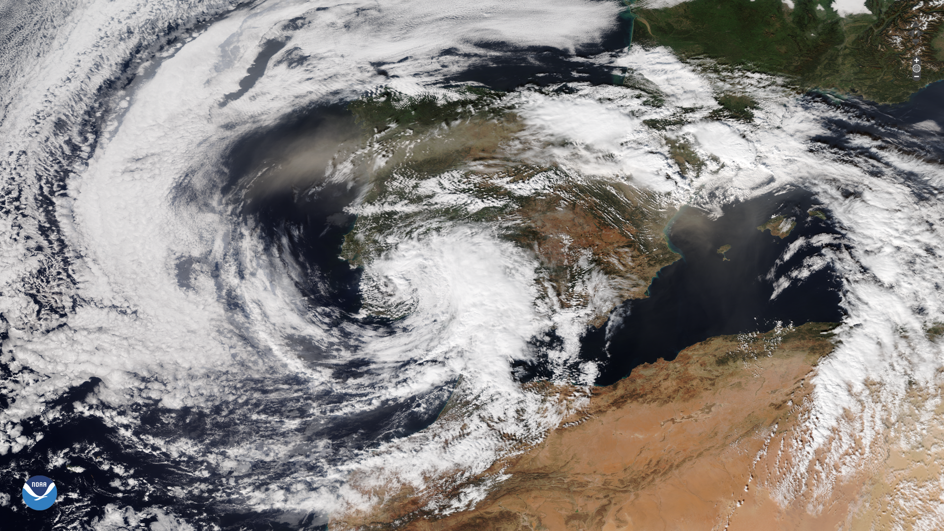
News
![Kentucky and Missouri Devastated by Flash Flooding](/s3/2022-08/2022_08_04_KYandMODevastedbyFlooding_STILL_NO_TEXT.png)
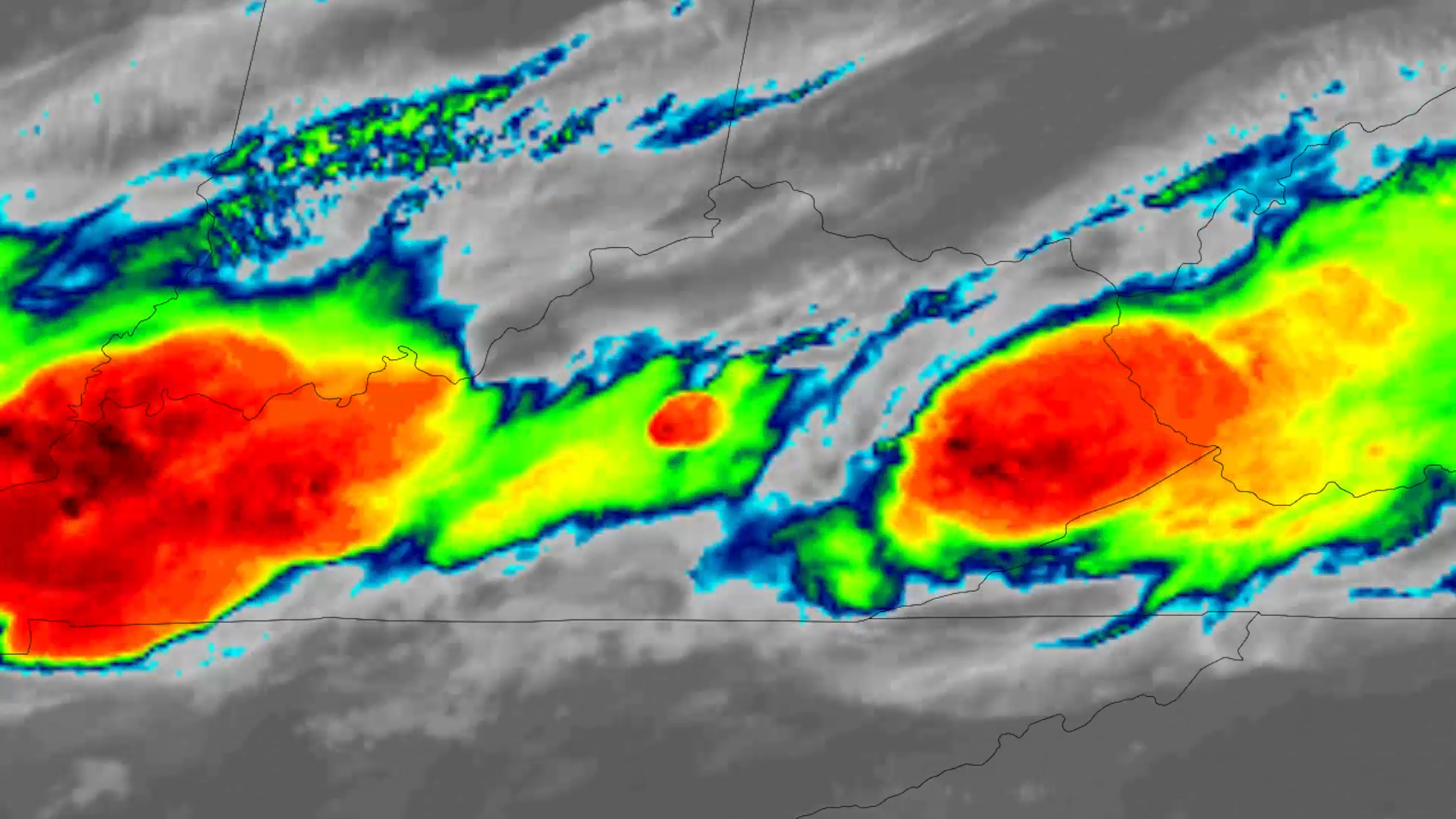
Hundreds of miles apart, but connected by the same weather system, urban St. Louis and rural Appalachia have experienced…
News
![Intense Storms in the Northeast Cause Catastrophic Flooding](/s3/2023-07/Water_vapor_US_July_9_2023.png)
Intense rainstorms that left a trail of damage across the Northeast brought particularly heavy rain and flooding to Vermont.
News
![Slow Moving Storms Flood Texas](/s3/2024-05/GOES-16-Flooding-storms-for-eastern-Texas-April-28-2024.png)
NOAA’s GOES East (GOES-16) satellite watched severe thunderstorms that brought tornadoes, damaging winds and flooding rain…
News
![Suomi NPP Keeps an Eye on Hazardous River Ice and Floods](/s3/migrated/suomi_npp_google_earth.gif)
As part of the River Ice and Flooding Initiative, NOAA scientists with the Joint Polar Satellite System are working with…
News
![NOAA Satellites Provide Detailed Imagery of Michigan Floods](/s3/migrated/midlandphoto.jpg)
Tuesday, May 26, 2020During a recent major flooding event, scientists unveiled a newly-developed algorithm derived from…
News
![Satellite Imagery of Near-Record Flooding Along Mississippi and Ohio Rivers](/s3/migrated/721_20110428-Cairo2011.jpg)
As of April 29, 2011, the National Weather Service lists 369 locations around in the country as flooded, based on river…
News
![Rising Sea Levels and Sirocco Winds Worsen Flooding for Venice](/s3/migrated/Venicetimeditfinal.jpg)
The NOAA-20 satellite captured imagery of Venice, Italy, on Nov. 14, 2019, after devastating floods disrupted essential…
News
![NOAA Satellites Help Locate Flooding After Cyclone in Mozambique](https://nesdis-prod.s3.amazonaws.com/styles/webp_large/s3/2023-05/NOAA-logo_16x9_NoBorder.png.webp?itok=qg3l7mLt)
January 27, 2021 The image above, created from VIIRS data from the Suomi-NPP and NOAA-20 satellites, shows the extent of…
News
![GOES East Sees Moderate Flooding in Mississippi River Delta and Mobile Bay](/s3/migrated/2020-01-15.jpg)
On Jan. 15, 2020, GOES East captured this image of the Mississippi River Delta and Mobile Bay as it experienced flash…
News
![NOAA Satellites Capture Flooding from Dam Failure in Midland, Michigan](/s3/2021-06/20200520-VIIRS_Flooding%20%281%29.png)
May 21, 2020 On May 20, 2020, the VIIRS instrument , aboard both the Suomi-NPP (S-NPP) and NOAA-20 satellites, showed record…
Event
Nov 21 2022
November 21, 22
Kate Abshire has served as the National Flash Flood Services Lead in the Water Resources Services Branch since 2017.
News
NOAA’s GOES-16 and NOAA-NASA Suomi NPP provide FEMA with the first comprehensive view of flood zones, and aircraft see the…