
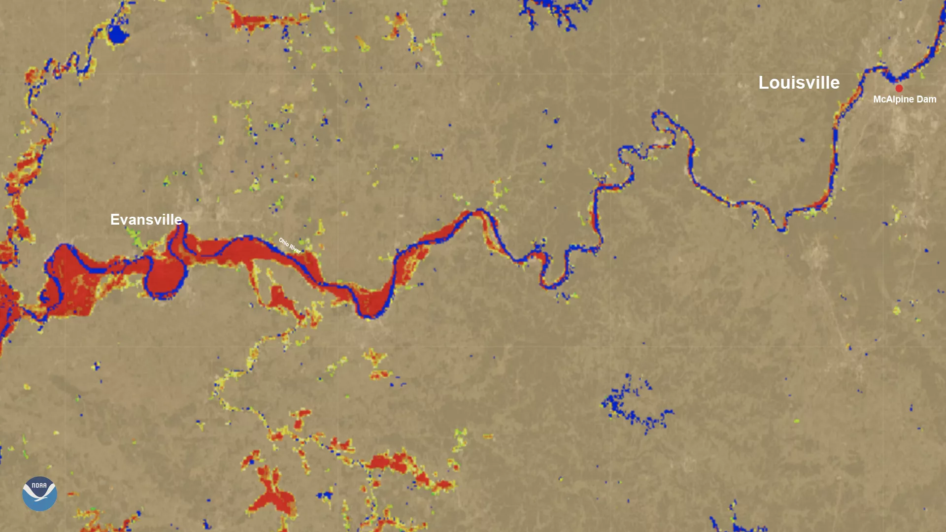
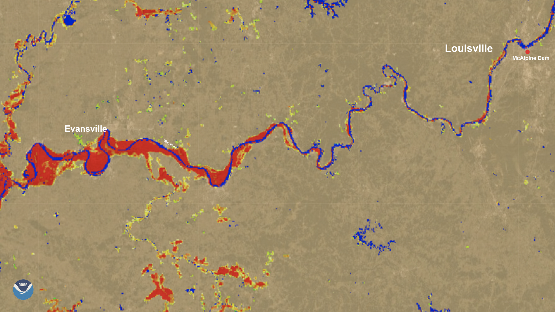
On March 6, the River Flood product—which combines imagery from the VIIRS instrument onboard both of the JPSS satellites along with the ABI instrument on NOAA’s GOES East—showed flooding along the Ohio River on the Kentucky/Illinois/Indiana border. At 10 a.m. EST that day, Louisville authorities measured the river’s crest at 60 feet at McAlpine Dam’s lower gauge, tying a record high set in 2019. The event still fell short of the all-time flooding record set in 1937.
Significant flooding also occurred in nearby Evansville. Researchers at George Mason University, led by Sanmei Li, used a water-fraction product that could better determine the extent of flooding in that area using the high resolution channels (375m) on VIIRS. Recent improvements to this algorithm have allowed them to generate 30-meter (m) flood maps from the imagery from VIIRS over the continental United States, such as the map generated below.
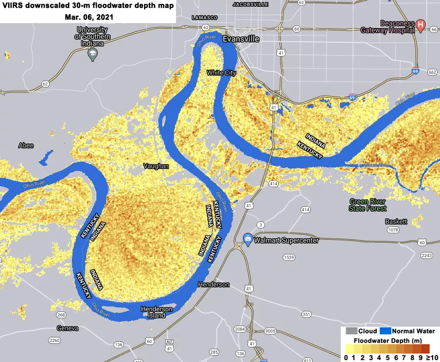
Both images show the difference between normal water levels and floodwaters. The blue color represents where normal areas of water are located, such as the Ohio River that runs between Indiana and Kentucky. The green and yellow colors in the larger map represent minor to moderate flooding extent, while the red and orange colors in both maps represent major flooding as detected by the instruments.
The VIIRS instrument aboard both the S-NPP and NOAA-20 satellites can scan the entire Earth twice per day at a 375-meter to 750-meter resolution. Multiple visible and infrared channels allow it to detect atmospheric aerosols, such as dust, smoke, and haze associated with industrial pollution and fires. The polar-orbiting satellites circle the globe 14 times daily and capture a complete daytime view of our planet once every 24 hours.