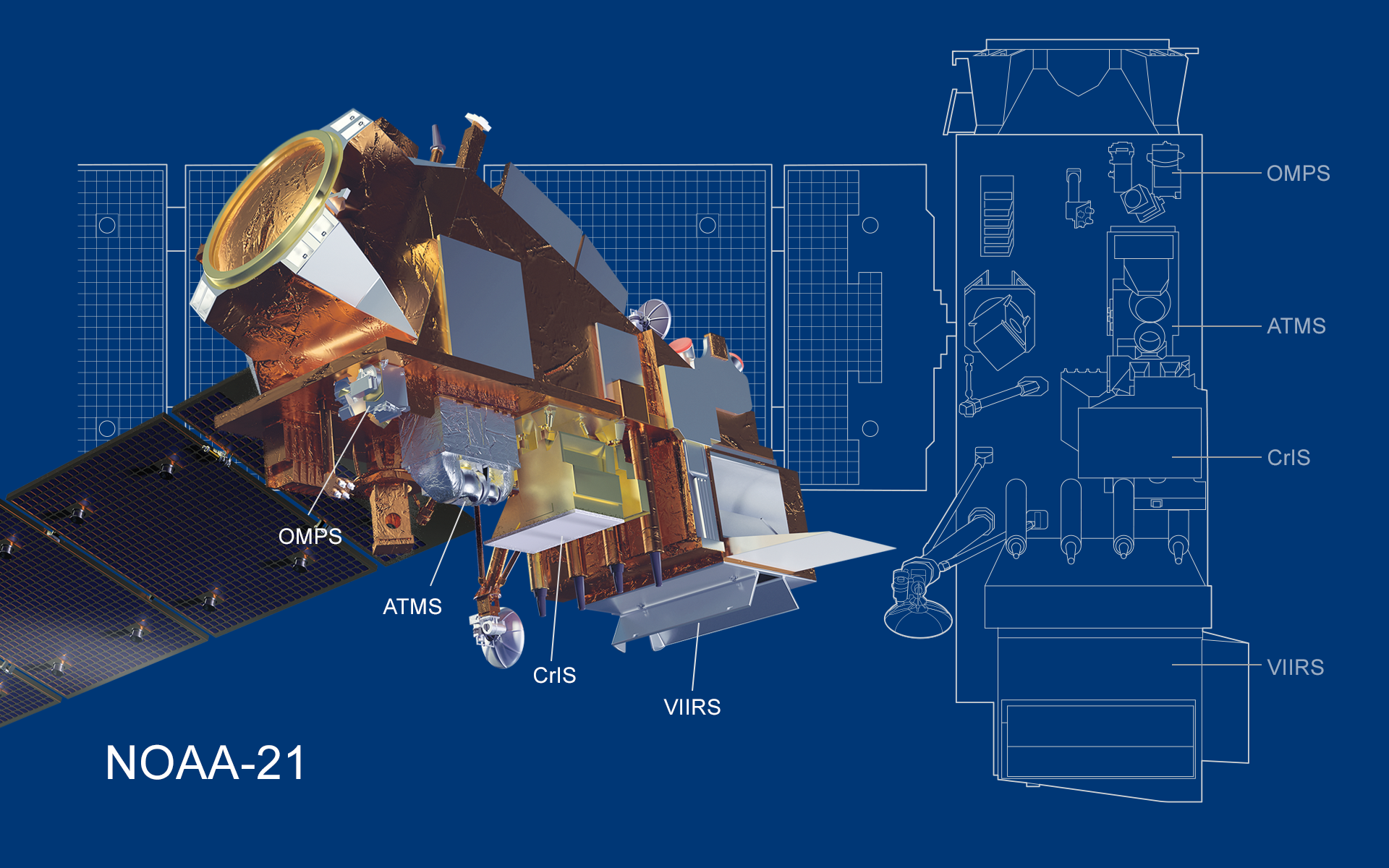
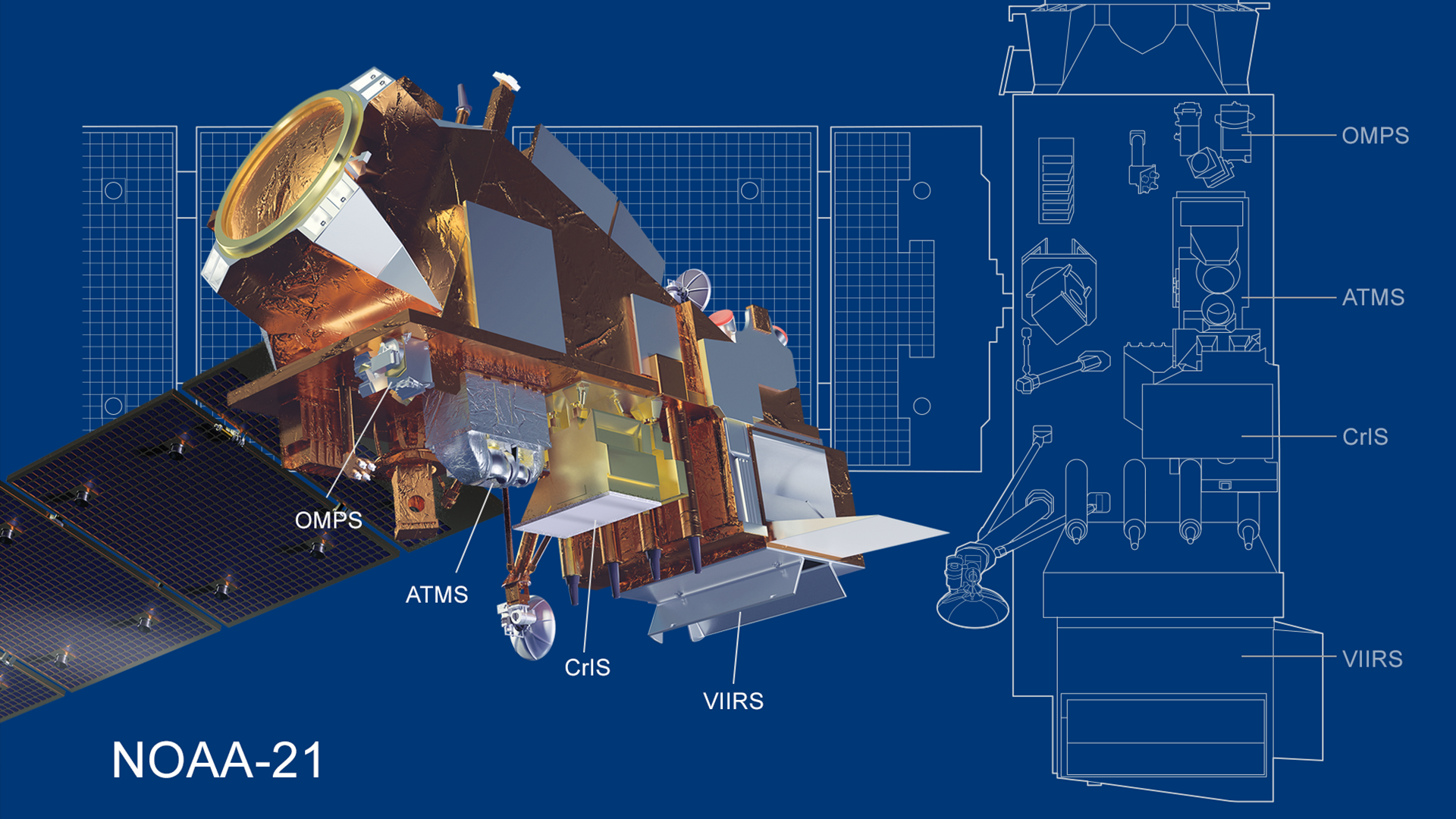
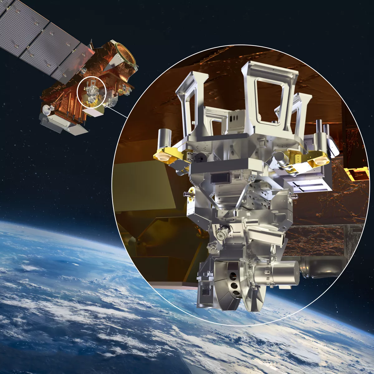
JPSS Mission and Instruments

You use satellite data every day. Millions of bits of data infuse your local weather forecast, severe weather warnings, predictions about the global food supply, decisions about commercial flight paths, and more.

But where does that data come from?

As much as 85 percent of the data in your local weather forecast comes from polar-orbiting satellites, like those in the Joint Polar Satellite System (JPSS). These satellites circle the Earth from pole to pole as the Earth rotates beneath them, each one completing 14 orbits every day. This allows them to provide a complete view of the entire globe twice a day. 

While they do this, instruments on the satellite gather measurements of conditions in the atmosphere, ocean and on land. Some of these measurements and observations include land and sea surface temperatures, rainfall rates, snow and ice cover, fire locations, smoke plumes, temperatures in the atmosphere, water vapor, and pollutants.
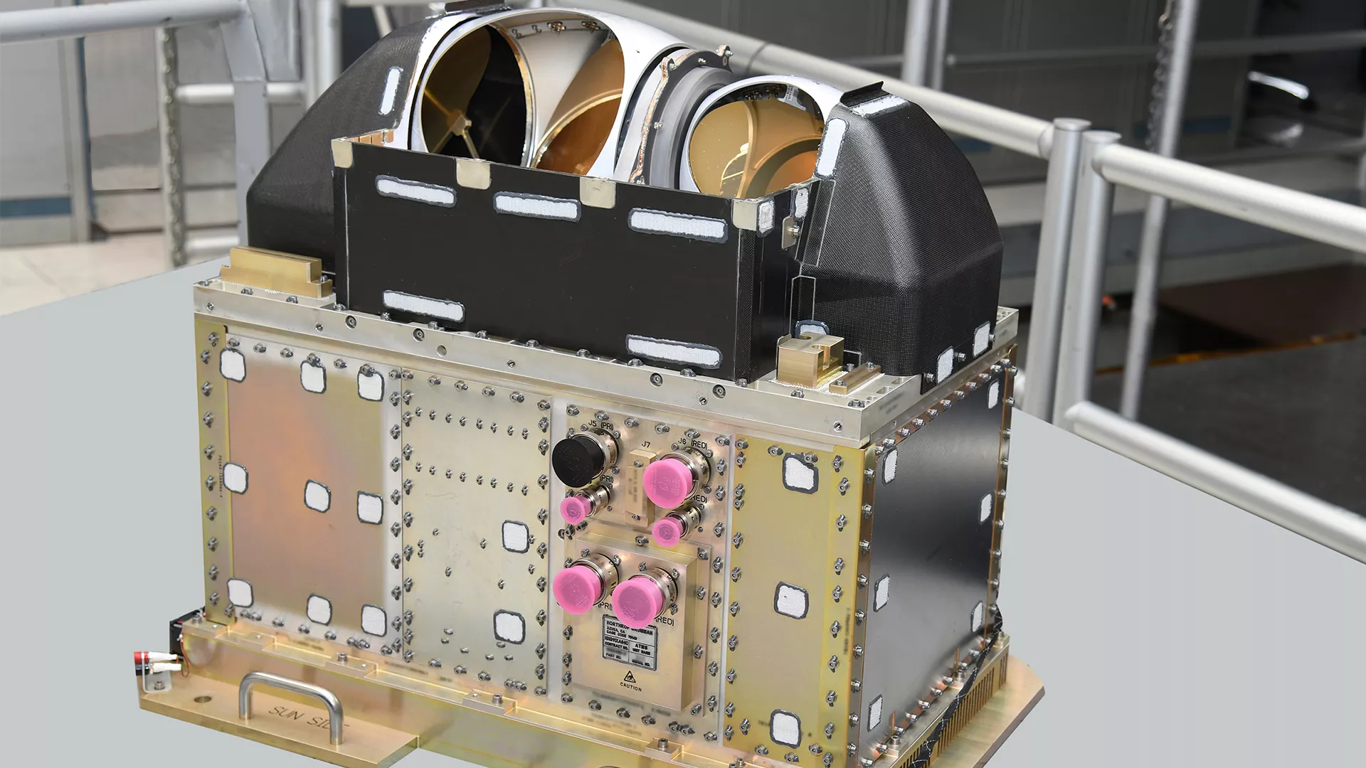
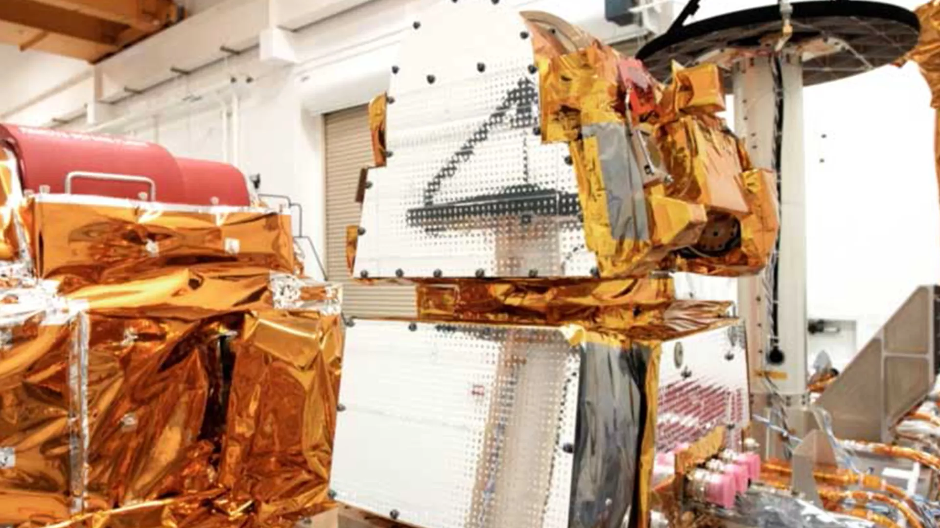
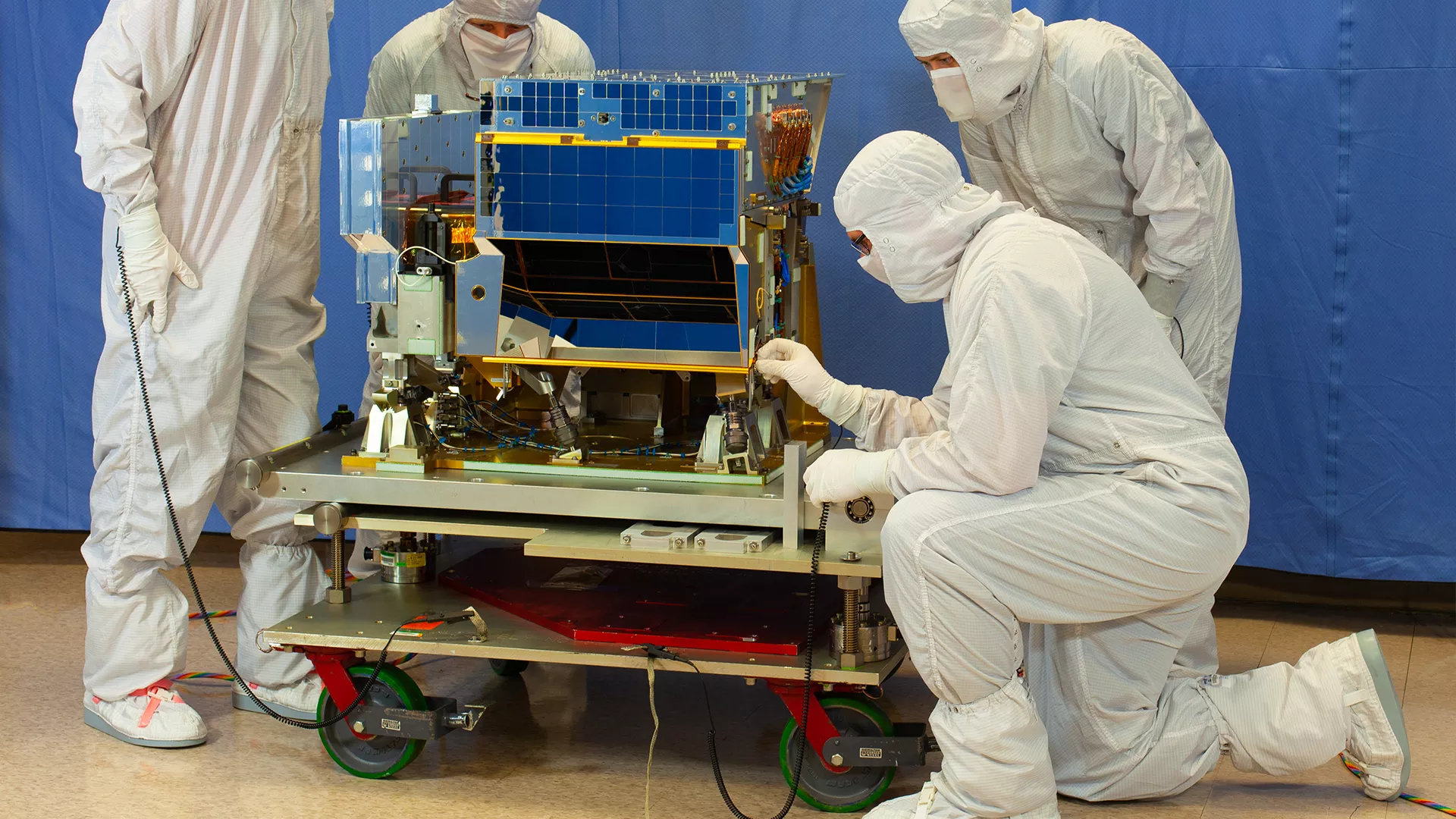
These are key to products and services that help promote and protect the nation’s environment, security, economy, and quality of life. They allow government agencies to forecast severe weather days in advance and assess environmental hazards, such as droughts, forest fires, poor air quality, and harmful coastal waters.

Artist's digital rendering of the JPSS-1/NOAA-20 satellite

Through its series of five satellites, JPSS will provide these critical observations well into the 2030s.

JPSS is a collaborative program between the National Oceanic and Atmospheric Administration (NOAA) and the National Aeronautics and Space Administration (NASA).


JPSS Satellites

The Joint Polar Satellite System currently includes two satellitesthe Suomi National Polar-orbiting Partnership (Suomi NPP), and NOAA-20. 

Suomi NPP was launched in October 2011 as the bridge between NOAA’s legacy polar satellite fleet, NASA’s Earth-observing missions, and the JPSS constellation. NOAA-20, previously known as JPSS-1 while in development, launched in November 2017.

It total, JPSS will include five satellites, launched on a regular cadence, to ensure that there are always at least two in orbit. 

The next three satellites in the series (JPSS-2, -3 and -4) will launch in 2022, 2027 and 2032, respectively.


Instruments

Advanced Technology Microwave Sounder (ATMS)

Image of the Advanced Technology Microwave Sounder (ATMS)

The Advanced Technology Microwave Sounder (ATMS) provides information about the physical properties of our atmosphere, such as temperature and moisture, which heavily influence weather patterns. Because it observes in the microwave portion of the electromagnetic spectrum, it can see through clouds and into storms. Suomi NPP and NOAA-20 both carry an ATMS, and JPSS-2, -3 and -4 will each have one as well.


Clouds and the Earth’s Radiant Energy System (CERES)

Image of Clouds and the Earth’s Radiant Energy System (CERES)

Measurements from the Clouds and the Earth's Radiant Energy System (CERES) instrument help scientists understand the links between the energy being absorbed and emitted by Earth’s climate as well as the properties of the atmosphere (like clouds) that affect that energy balance. This helps with climate and weather science, and applied science research. CERES currently flies on Suomi NPP and NOAA-20 and will be replaced by the Libera instrument on JPSS-3.


Libera

Image Libera instrument is a new sensor that will fly on the JPSS-3 mission and observe the balance between solar radiation entering Earth’s atmosphere

The Libera instrument is a new sensor that will fly on the JPSS-3 mission and observe the balance between solar radiation entering Earth’s atmosphere and the amount absorbed, reflected and emitted. Libera is a follow-on to the Clouds and the Earth’s Radiation Energy System (CERES) instruments that flew on Suomi NPP and NOAA-20.


Cross-Track Infrared Sounder (CrIS)

Image of Cross-track Infrared Sounder (CrIS)

The Cross-track Infrared Sounder (CrIS) instrument provides more accurate, detailed atmospheric temperature and moisture observations for weather and climate applications. Because CrIS provides limited observations in cloudy conditions, it works in tandem with the ATMS instrument. Both the Suomi NPP and NOAA-20 satellites carry a CrIS instrument and the JPSS-2, -3 and -4 satellite missions will each carry one as well.


Ozone Mapping and Profiler Suite (OMPS)

Image Ozone Mapping and Profiler Suite (OMPS)

The Ozone Mapping and Profiler Suite (OMPS) tracks the health of Earth’s ozone layer and measures the concentration of ozone and other aerosols in the Earth's atmosphere. This helps with climate and weather science. OMPS flies on board the Suomi NPP and NOAA-20 satellites and the JPSS-2, -3 and -4 satellite missions will each carry an OMPS as well.


Visible Infrared Imaging Radiometer Suite (VIIRS)

Image of Visible Infrared Imaging Radiometer Suite (VIIRS)

The Visible Infrared Imaging Radiometer Suite (VIIRS) instrument collects visible and infrared images and global observations of the land, atmosphere, cryosphere and oceans. VIIRS generates many critical environmental products pertaining to snow and ice cover, clouds, fog, aerosols, fire, smoke plumes, dust, vegetation health, phytoplankton abundance and chlorophyll. VIIRS currently flies on Suomi NPP and NOAA-20, and is scheduled to fly on the JPSS-2, -3 and -4 satellite missions.