
Search
Showing 289 - 296 of 611 results
News
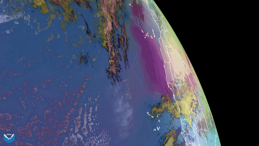
NOAA’s GOES East satellite captured dust from the Saharan Air Layer (SAL) as it wafted its way over the Atlantic Ocean and…
News
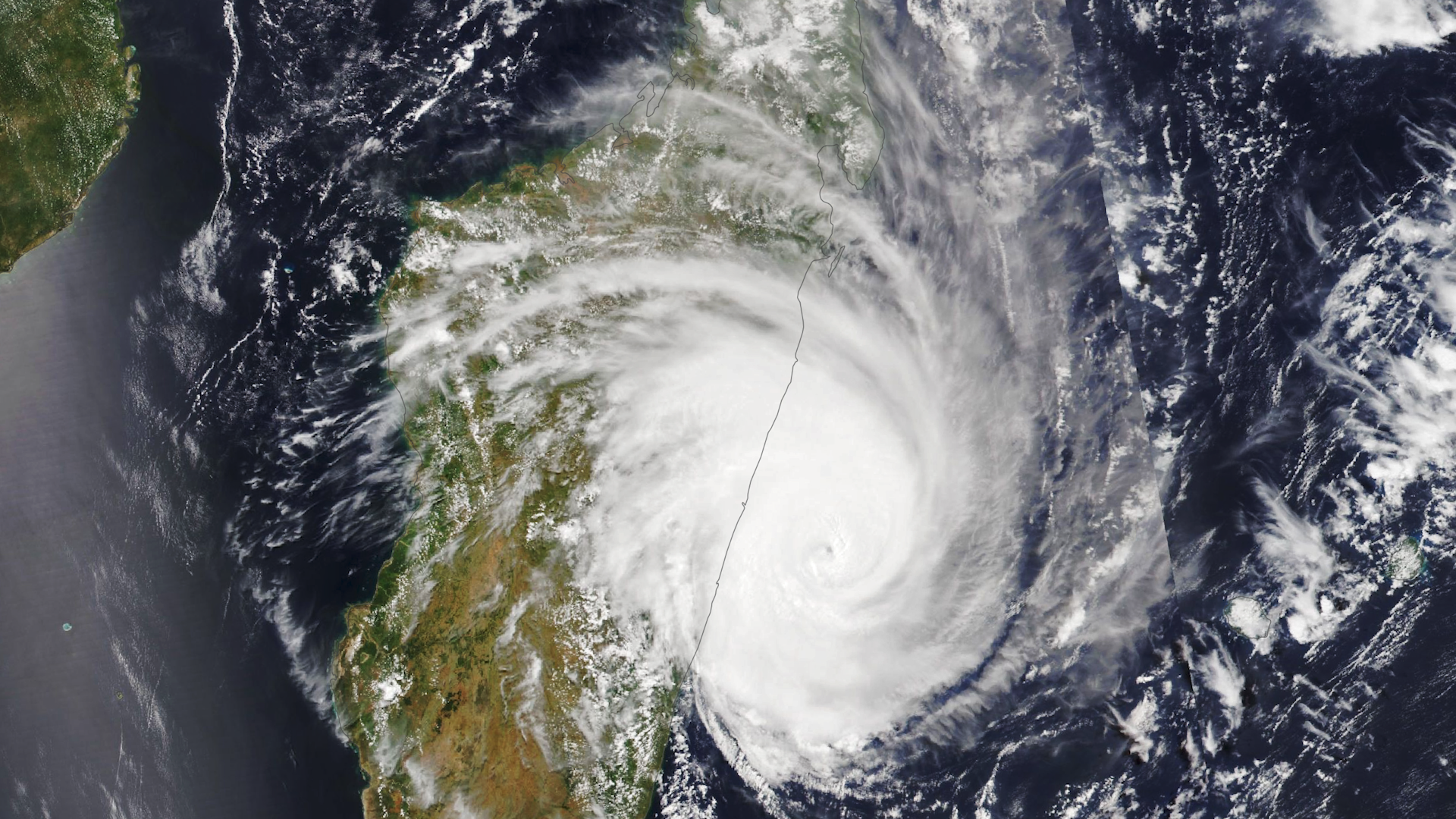
Around 7:20 p.m. local time on February 21, 2023, Tropical Cyclone Freddy made landfall on the eastern coast of Madagascar…
Page
General overview of GOES-U's satellite mission as well as instruments, benefits, and more.
News

The successful launch of Jason-3 on January 17, 2016, was a major accomplishment for the Jason mission, but it is by no…
News
The Advanced Technology Microwave Sounder (ATMS) instrument onboard the NOAA-21 satellite captured its first global image on…
News

NASA Selects Ball Aerospace to Develop NOAA’s GeoXO Sounder Instrument
News
On May 18, 2020, the Himawari-8 satellite caught this imagery of Tropical Cyclone Amphan, heading toward the border of India…
News
NCEI's ADT-HURSAT has been irregularly updated historically. A recent update extended the record from 1981-2017 to 1981…