
NOAA satellites see our planet from a unique and captivating perspective. Every year, our satellites see the beauty and wrath of Mother Nature unfold beneath them—devastating hurricanes, raging wildfires, erupting volcanoes—as well as the changing seasons, ocean color and nighttime lights. And their scope isn’t just limited to Earth; NOAA satellites can also capture images of our Moon and the Sun as we all spin our way through our place in space.
Below is our list of some of the most compelling images from 2022 as seen from orbit by NOAA’s satellites.
All of the images are available for download and repurposing, with credit to NOAA.
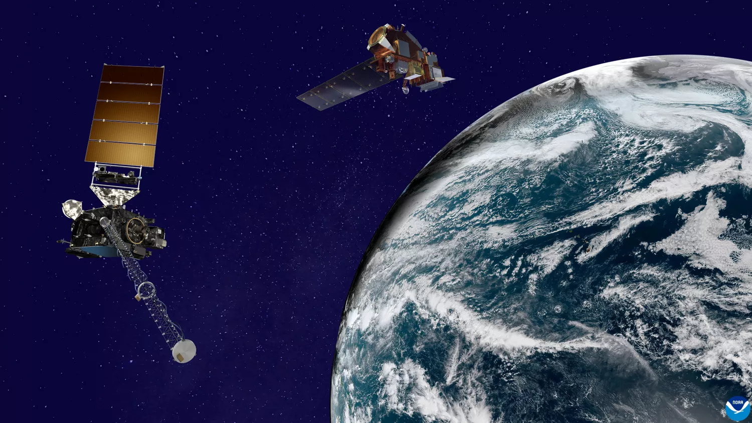
Artist’s rendering of a NOAA GOES satellite (left) and a NOAA JPSS satellite (right) orbiting Earth. Image not to scale.
We started off the year with a bang—literally—as the Hunga Tonga–Hunga Haʻapai volcano explosively erupted in mid-January 2022. NOAA’s GOES-17 satellite was watching as the volcano produced the most powerful eruption recorded since the Krakatoa eruption of 1883. NOAA satellites proved crucial again when, later in 2022, another volcano roared back to life in Hawaii (more on that farther down this article).
GeoColor imagery of the Hunga Tonga–Hunga Haʻapai eruption from NOAA’s GOES-17 satellite taken on January 15, 2022.

Infrared imagery of the Hunga Tonga–Hunga Haʻapai eruption from NOAA’s GOES-17 satellite taken on January 15-16, 2022.
NOAA’s Joint Polar Satellite System (JPSS)—comprised of the NOAA/NASA Suomi NPP, NOAA-20 and NOAA-21 satellites—is the nation’s advanced series of polar-orbiting environmental satellites. Considered the backbone of the global observing system, JPSS satellites circle Earth from pole to pole 14 times daily—providing full global coverage twice a day. They also capture some breathtaking views of our blue planet.
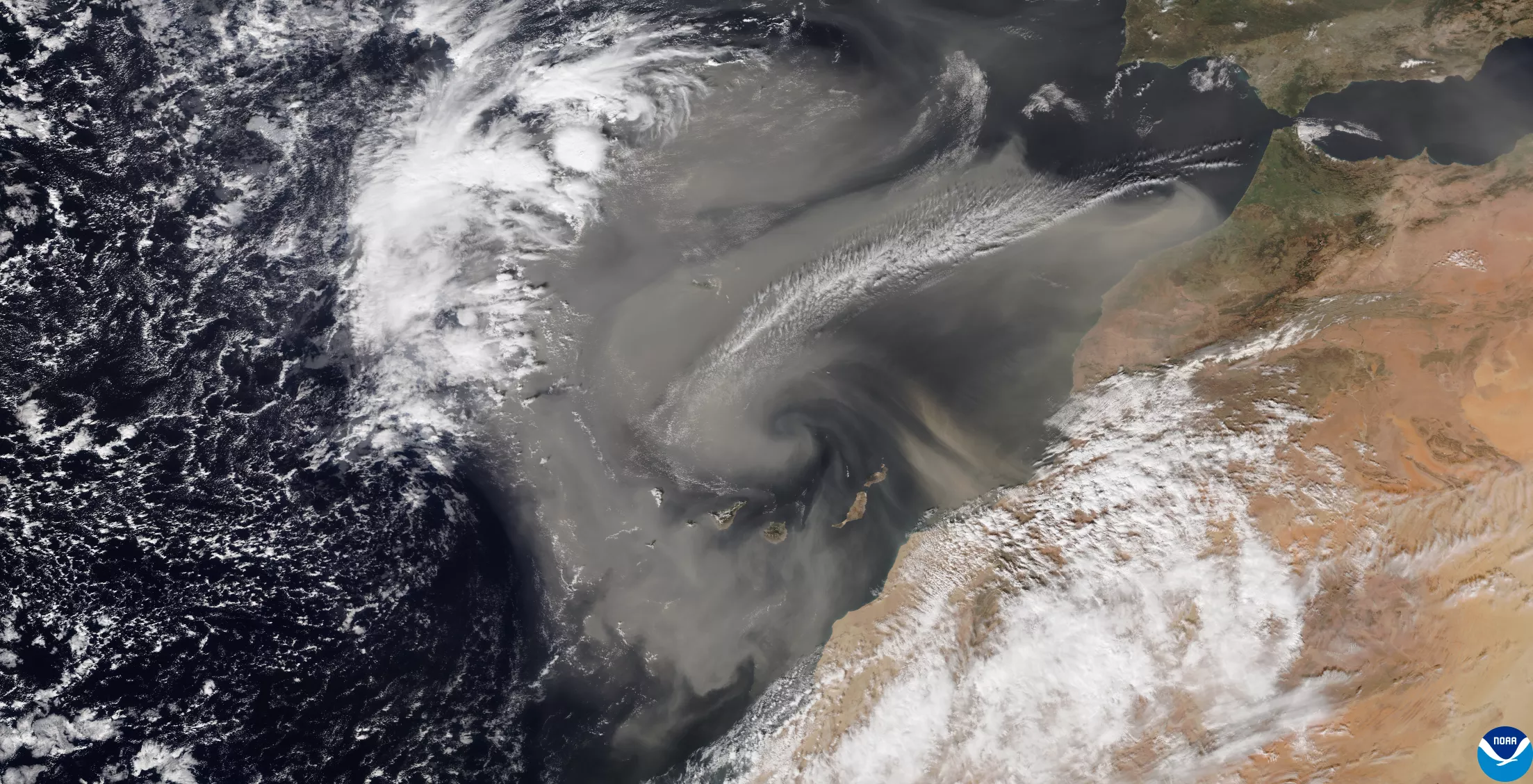
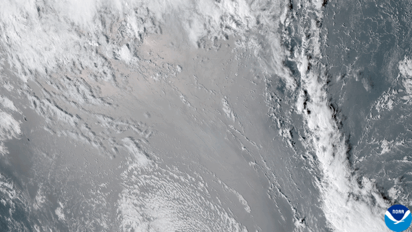
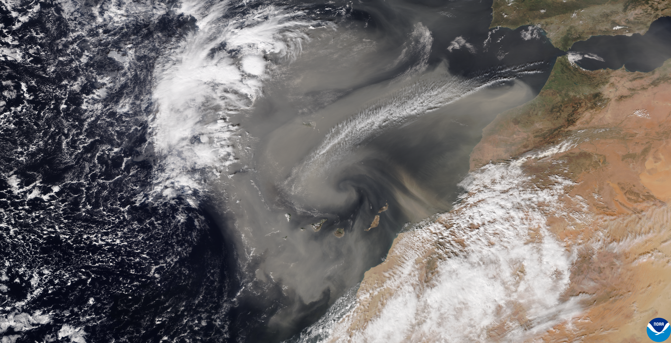
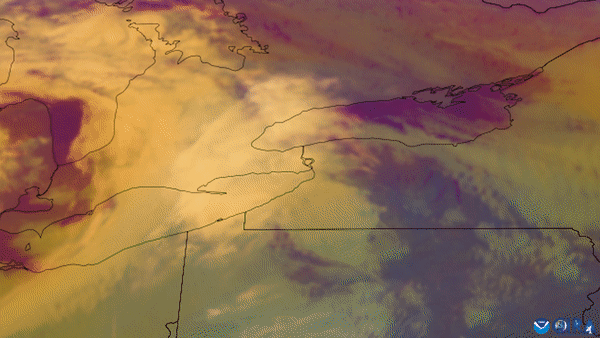
Image from the NOAA-20 satellite showing dust from the Sahara Desert lofted into the air and blowing over the eastern Atlantic Ocean, seen on January 30, 2022.
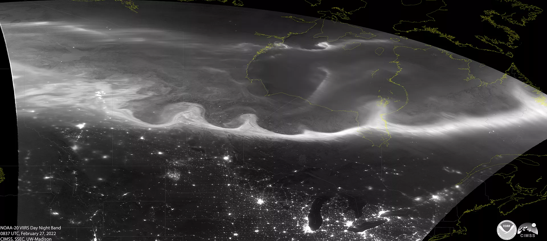
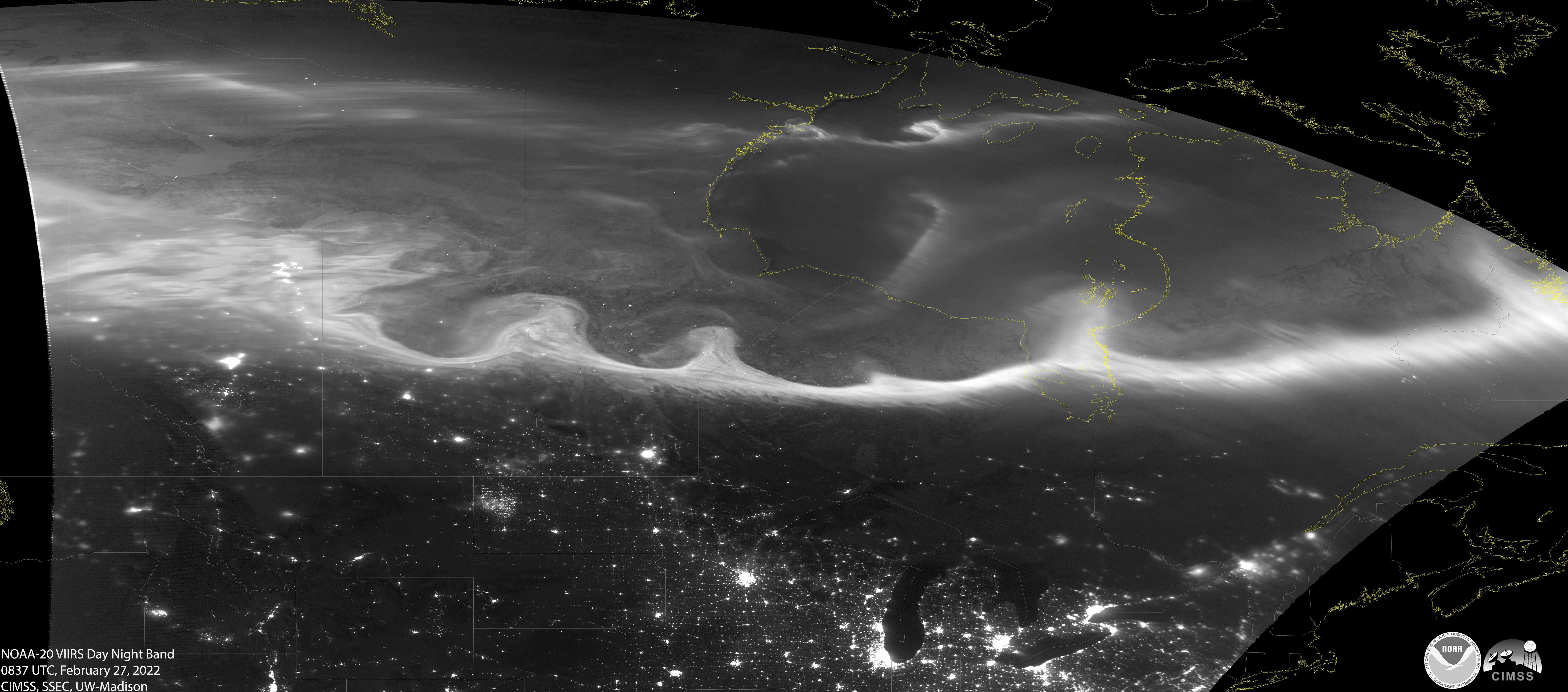
JPSS satellites can occasionally see the Aurora Borealis (Northern Lights) delicately dancing over the northern latitudes of the world. In this image from NOAA-20 on February 27, 2022, you can see the swirling streams of the aurora toward the top of the image as well as the nighttime lights of many U.S. cities below.
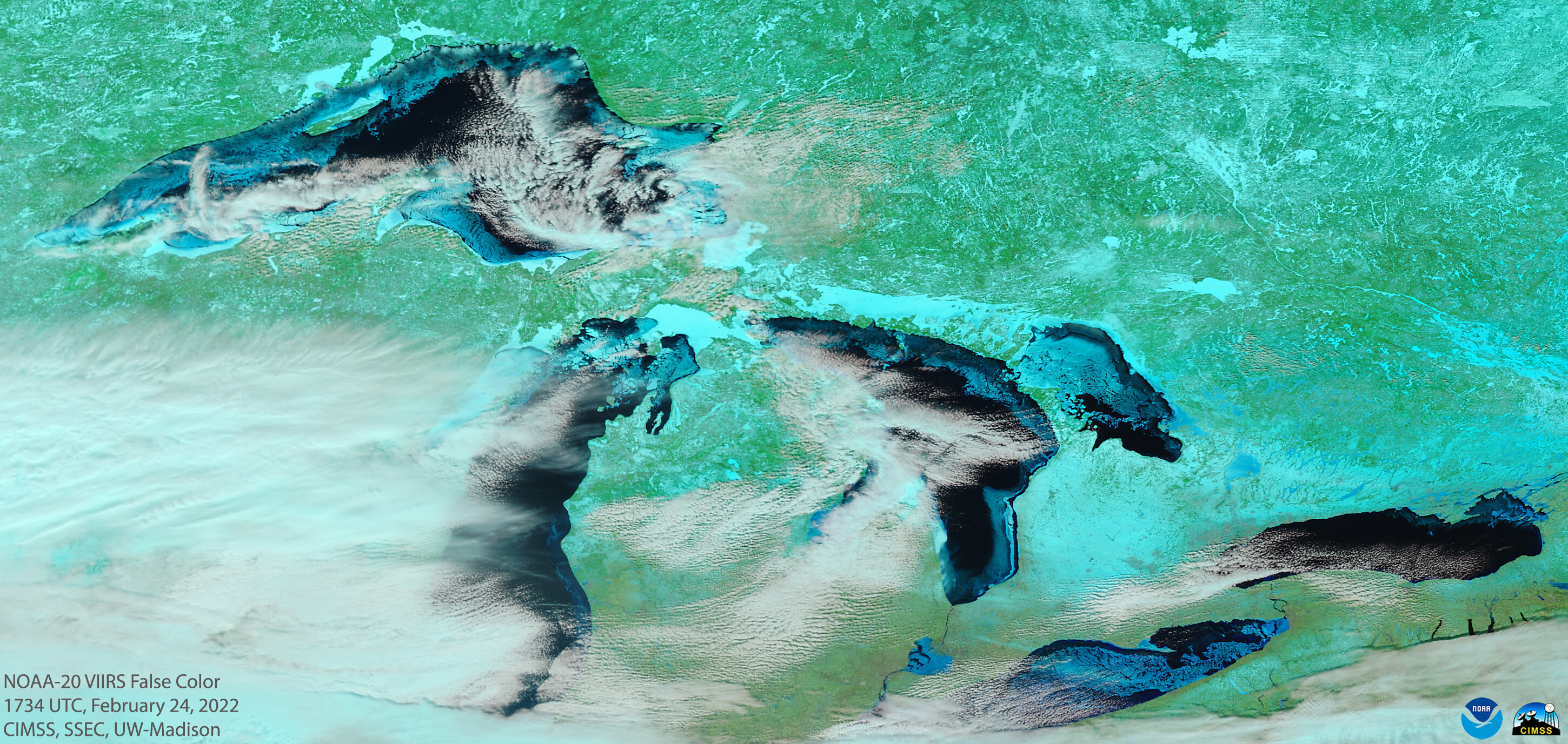
The mighty Great Lakes—sometimes called America’s “Third Coast”—look stunning from space! From about 500 miles above the Earth, the NOAA-20 satellite can tell a lot about the lakes, including areas of lake ice, phytoplankton blooms and water temperatures.
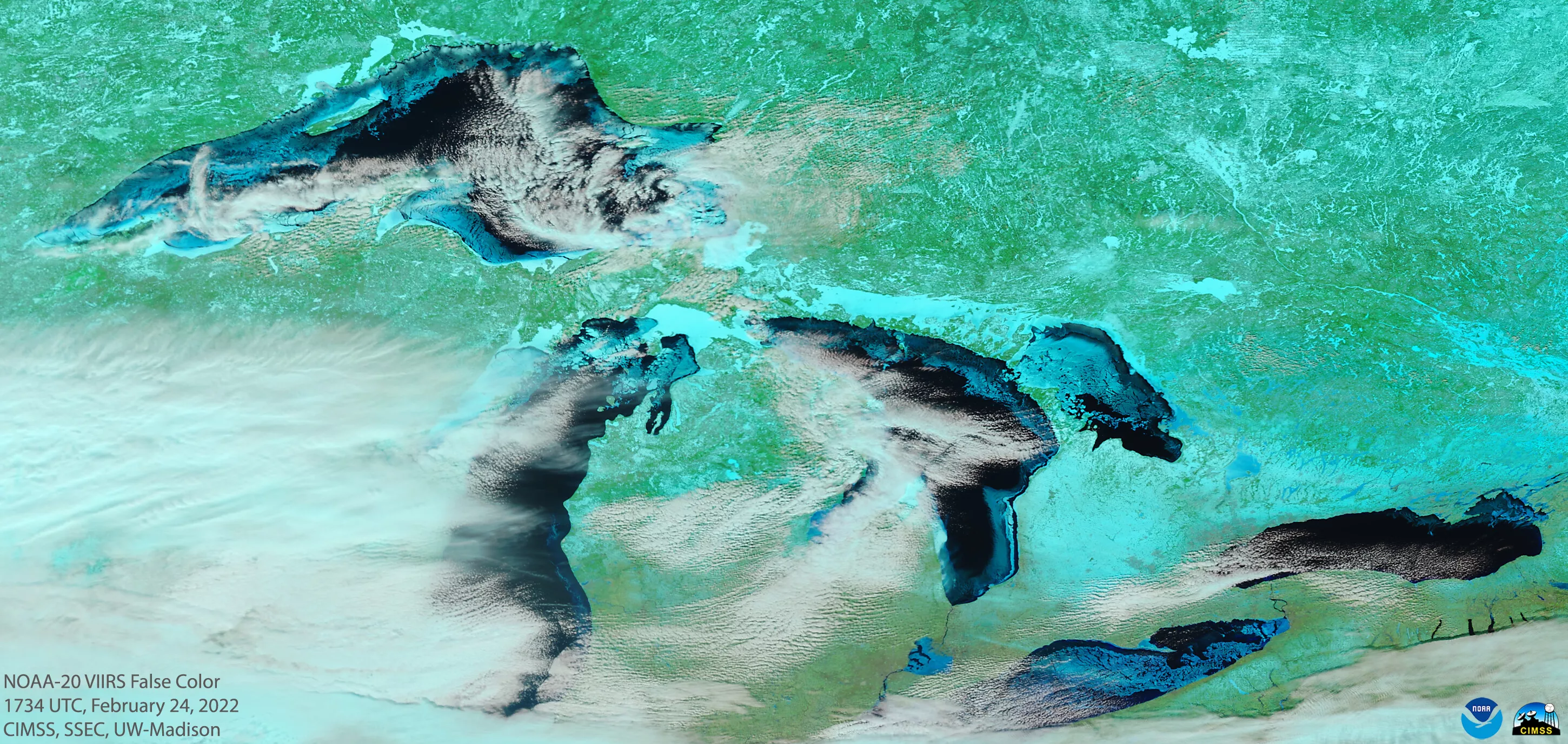
Color-enhanced VIIRS image from NOAA-20 taken at 12:34 pm ET on February 24, 2022.

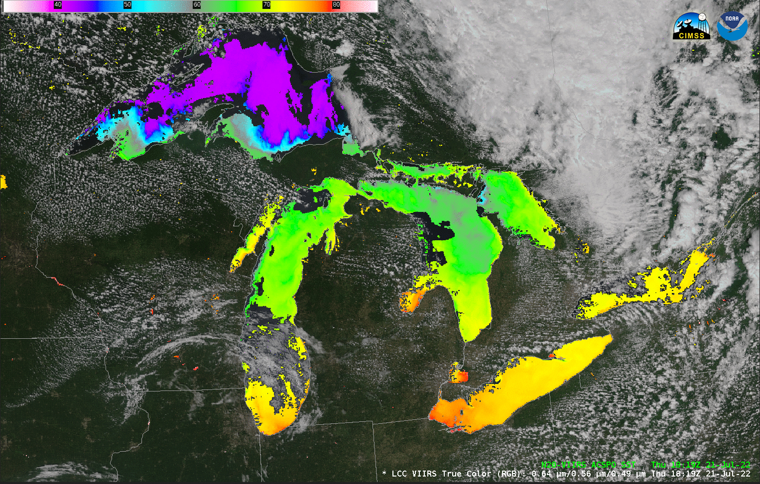
VIIRS image from NOAA-20 showing the water temperature of the lakes, taken at 4:19 pm ET on July 21, 2022. Note the cooler water in Lake Superior (blue/purple) compared to the relatively warmer water of Lake Erie (yellow/orange).
The Solar Ultraviolet Imager (SUVI) instrument onboard NOAA’s GOES satellites provides critical imagery and data about our nearest star. SUVI monitors the Sun in the extreme ultraviolet wavelength range and provides vital information about space weather. It also occasionally captures some fascinating celestial displays.
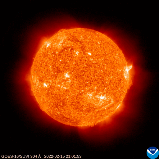
SUVI imagery of a coronal mass ejection (CME) from the Sun taken from NOAA’s GOES-16 satellite on February 15, 2022. This CME did not impact Earth.

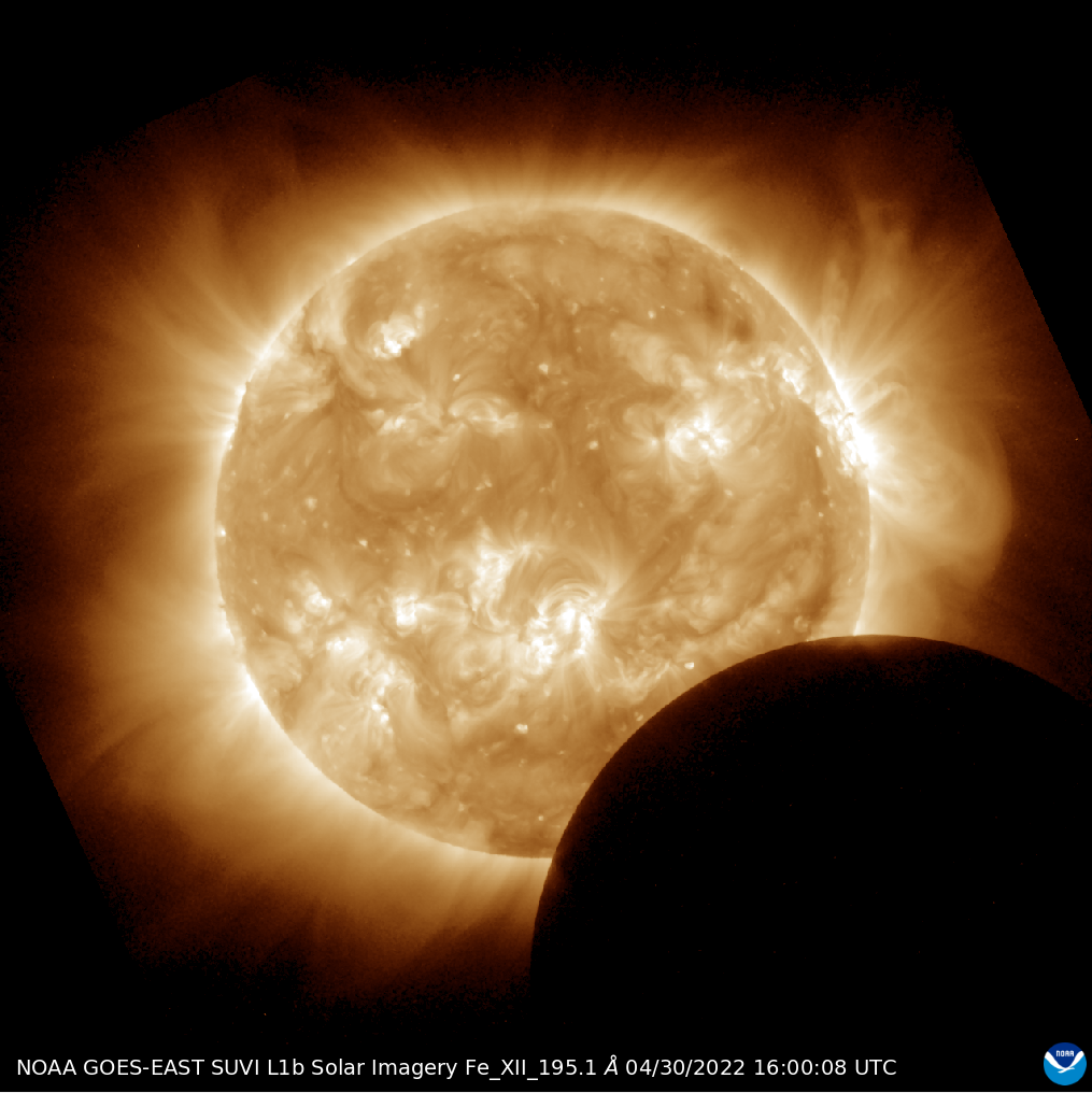
SUVI imagery from NOAA’s GOES-16 of the Moon passing across the lower disk of the Sun during a partial solar eclipse on April 30, 2022.
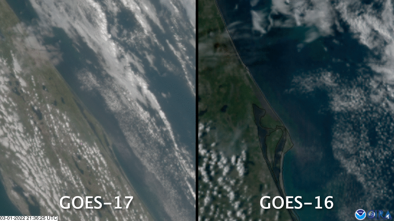
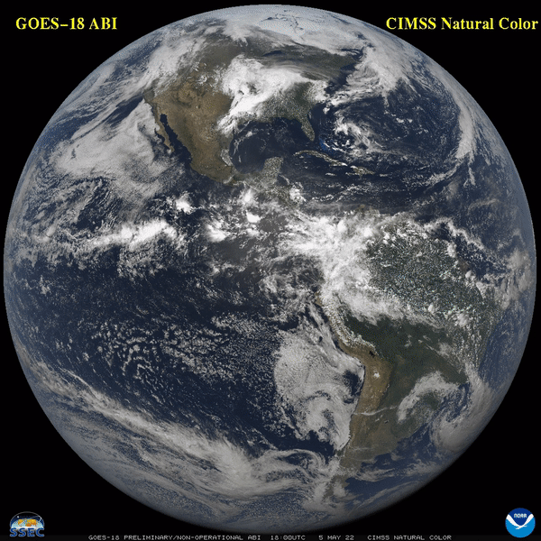
NOAA added two new Earth-observing satellites to its fleet in 2022. On March 1, 2022, the latest GOES satellite—GOES-T—launched from Kennedy Space Force Base. Once in orbit, it was renamed GOES-18 and provided a stunning first-light image of our hemisphere.

GeoColor imagery from NOAA’s GOES-17 and GOES-16 of the smoke plume from the GOES-T launch on March 1, 2022.

Full disk first-light imagery from the NOAA GOES-18’s Advanced Baseline Imager (ABI), which provides 16 channels of imagery, from May 5, 2022.
Later in the year, NOAA added another JPSS satellite—JPSS-2—which launched from Vandenberg Space Force Base on November 10, 2022. Once in orbit, it was renamed NOAA-21, and like its fellow JPSS satellites, provided striking first-light images of the weather occurring across the globe.

Image of the heat signature from the JPSS-2 launch rocket, as seen from NOAA’s GOES-17 satellite on November 10, 2022.
First light VIIRS composite Image from the NOAA-21 satellite taken between December 5-6, 2022. In this image, you can see the weather systems moving around the globe, as well as smaller details like ocean color in the Bahamas and smog in southern Asia.
When dangerous dust storms blow across the landscape—called haboobs in some parts of the U.S.— NOAA’s GOES satellites can help forecasters track and monitor their progress in near real-time. Last year, GOES-16 caught several dust storms, including the two seen below in the spring of 2022.
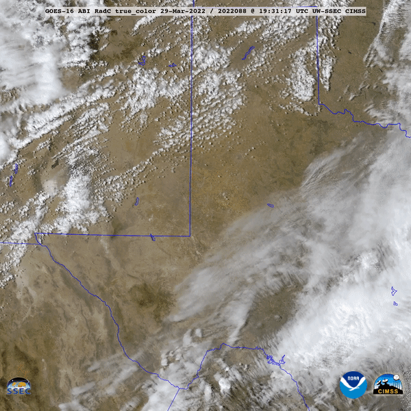
In this True Color imagery from NOAA’s GOES-16, the satellite watched as a dust storm was kicked up by strong wind and blew across the southern Plains on March 30, 2022.
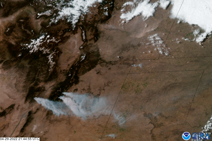
Nearly a month later, NOAA’s GOES-16 tracked another dust storm in the Plains, as wildfires burned hundreds of miles away in New Mexico, on April 29, 2022.
Onboard NOAA’s GOES satellites is an instrument called the Geostationary Lightning Mapper (GLM). The GLM is the first operational lightning mapper flown in geostationary orbit and provides critical information to forecasters, allowing them to focus on developing severe storms before they produce damaging winds, hail or even tornadoes. GLM data can also assist with short-range forecasts of heavy rainfall and flash flooding.

This visible/lightning composite imagery from NOAA’s GOES-16 shows thunderstorms erupting along a dryline over Kansas and Nebraska on April 13-14, 2022.
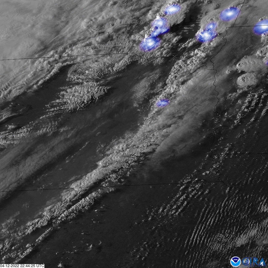

GeoColor/lightning composite imagery from NOAA’s GOES-16 of thunderstorms within a damaging derecho that moved across the Plains on May 11-12, 2022. This derecho was one of the year’s “billion-dollar disasters”, with an estimated $2.6 billion in damage.

This GeoColor/lightning composite imagery from NOAA’s GOES-16 shows the thunderstorms that led to devastating flooding in parts of Missouri and eastern Kentucky in July 2022. These storms were one of the year’s “billion-dollar disasters”, with an estimated $1.2 billion in damage.
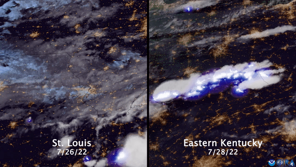
NOAA’s GOES and JPSS satellites provide critical data during wildfires. Not only does satellite imagery allow us to see where smoke plumes from fires are, but it also allows us to track how a fire is growing and moving as well as the temperature at which it’s burning. Satellite imagery also can show us burn scars—areas that have been burned by fire—which is vital information for decision-makers. This satellite assistance was especially important in 2022, when more than 65,000 fires burned over 7.4 million acres across the U.S.
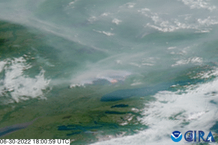
GeoColor/fire temperature composite imagery from NOAA’s GOES-17 of wildfires burning across southwestern Alaska on June 30, 2022.

California’s Mosquito Fire as seen in this GeoColor/fire temperature composite imagery from NOAA’s GOES-18 on September 13, 2022. Burning more than 76,700 acres, it was California’s largest wildfire in 2022.
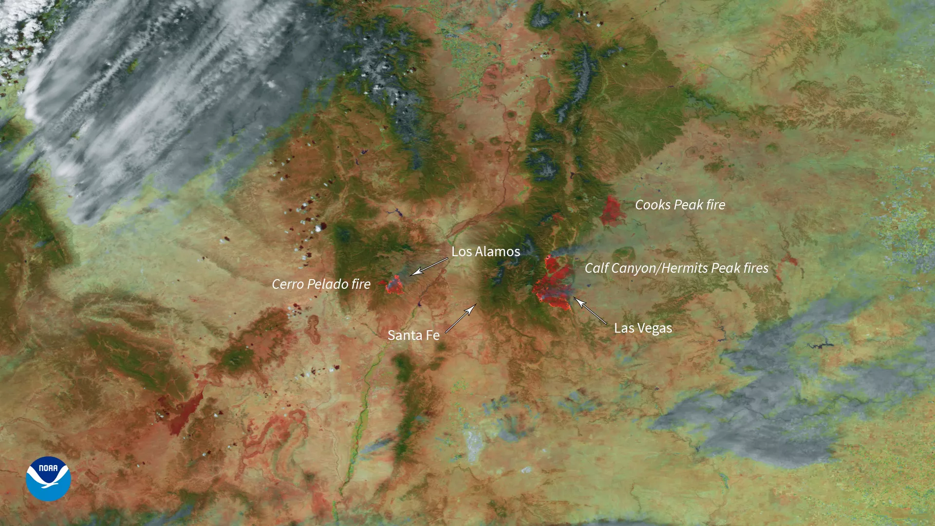
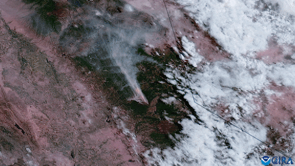
Color-enhanced image (with added text) from the NOAA-20 satellite of wildfires in New Mexico, seen around 1:50 pm MT on May 3, 2022. The red spots indicated active fires burning across the state.
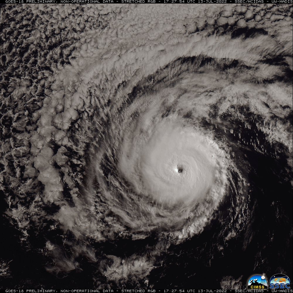
NOAA satellites are invaluable eyes in the sky during hurricane season, providing a critical perspective from above for these destructive storms. GOES-R Series satellites can monitor environmental conditions in high-resolution detail to help identify tropical systems as they’re developing. Once a hurricane forms, the ABI instrument can monitor the storm in near real-time, identify cloud features and patterns, and provide crucial estimates of central pressure and maximum sustained winds. JPSS satellite images taken after storms can help locate power outages and areas of infrastructure damage from space.

An image from NOAA’s GOES-18 of Hurricane Darby spinning in the Pacific Ocean on July 13, 2022. Darby was one of three powerful Category 4 hurricanes in the eastern Pacific in 2022.
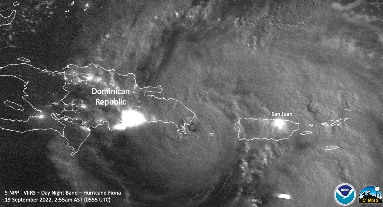
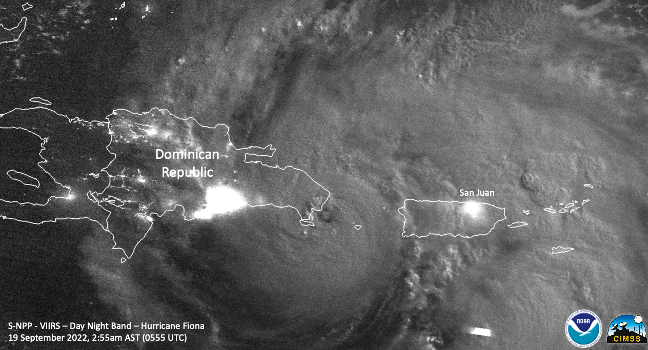
Hurricane Fiona approaching landfall in the Dominican Republic as seen in a nighttime image from the Suomi-NPP satellite’s VIIRS Day Night Band on September 19, 2022. Notice the blurred city lights in Puerto Rico and Hispaniola shining through the cloud shield of Fiona.
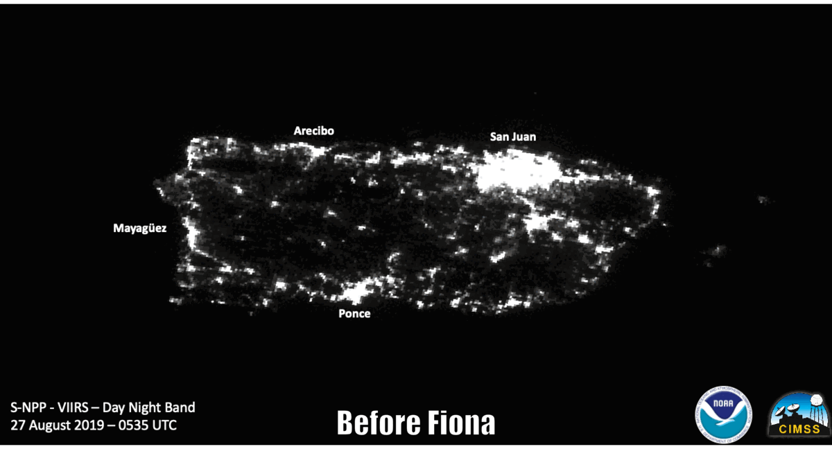
A before and after image of the nighttime lights prior to Hurricane Fiona (August 27, 2019) and after Hurricane Fiona (September 22, 2022), as seen from the VIIRS Day Night Band on the Suomi-NPP and NOAA-20 satellite.
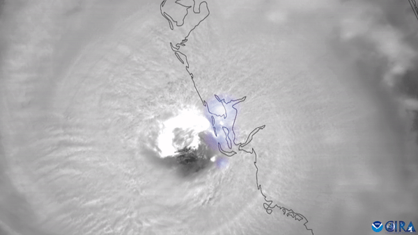
NOAA’s GOES-16 tracked Hurricane Ian as its swirling eye wrapped with intense lightning made landfall near Cayo Costa, Florida, around 3:05 p.m. ET on September 28, 2022. with maximum sustained winds of 150 mph.

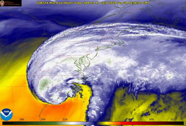
A water vapor animation of Post-Tropical Storm Ian from NOAA’s GOES-16 as it pushed northeastward along the southeast coast of the U.S. on September 30, 2022. Despite being downgraded, it continued to produce dangerous storm surges, flash flooding and high winds in parts of the Carolinas.
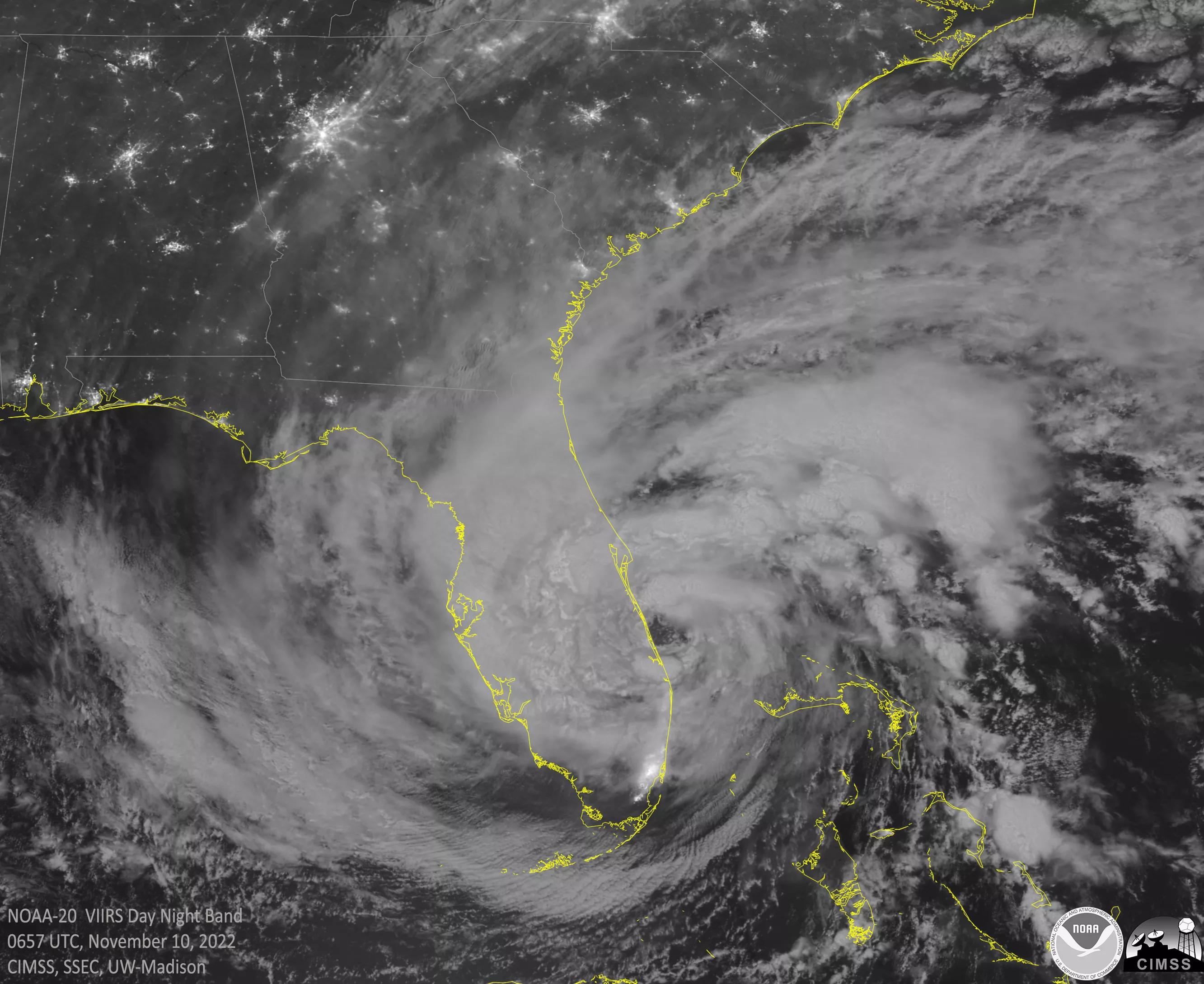
Hurricane Nicole approaching landfall just south of Vero Beach, Florida, on September 19, 2022, seen in a nighttime image from the NOAA-20 satellite’s VIIRS Day Night Band on November 10, 2022. Nicole was the third hurricane to form in November 2022, tying 2001 for the most November hurricanes on record in the Atlantic.
When winter weather threatens the U.S., NOAA satellites can assist forecasters in numerous ways. For example, JPSS satellites can help derive a winter storm’s snowfall rate and can assist in monitoring lake-effect snow squalls during times when ground-based radar is blocked by terrain, or only seeing a portion of a storm. GOES satellites can help monitor the development and movement of a storm—along with detecting the water vapor and temperature within several layers of the atmosphere—which helps weather forecast models better depict how much snow, sleet, or ice could fall.

An air mass/lightning composite animation from NOAA’s GOES-16 during a historic lake-effect snowstorm that buried parts of western and central New York in more than six feet of snow from November 17-20, 2022.

In this nighttime image from the NOAA-20 satellite on February 18, 2022, you can see a winter storm impacting the central and eastern U.S., along with a stripe of snow on the ground stretching from Kansas to Michigan. This thin area of snow is being picked up by the satellite due to light reflecting off of the snow from a waning full moon.
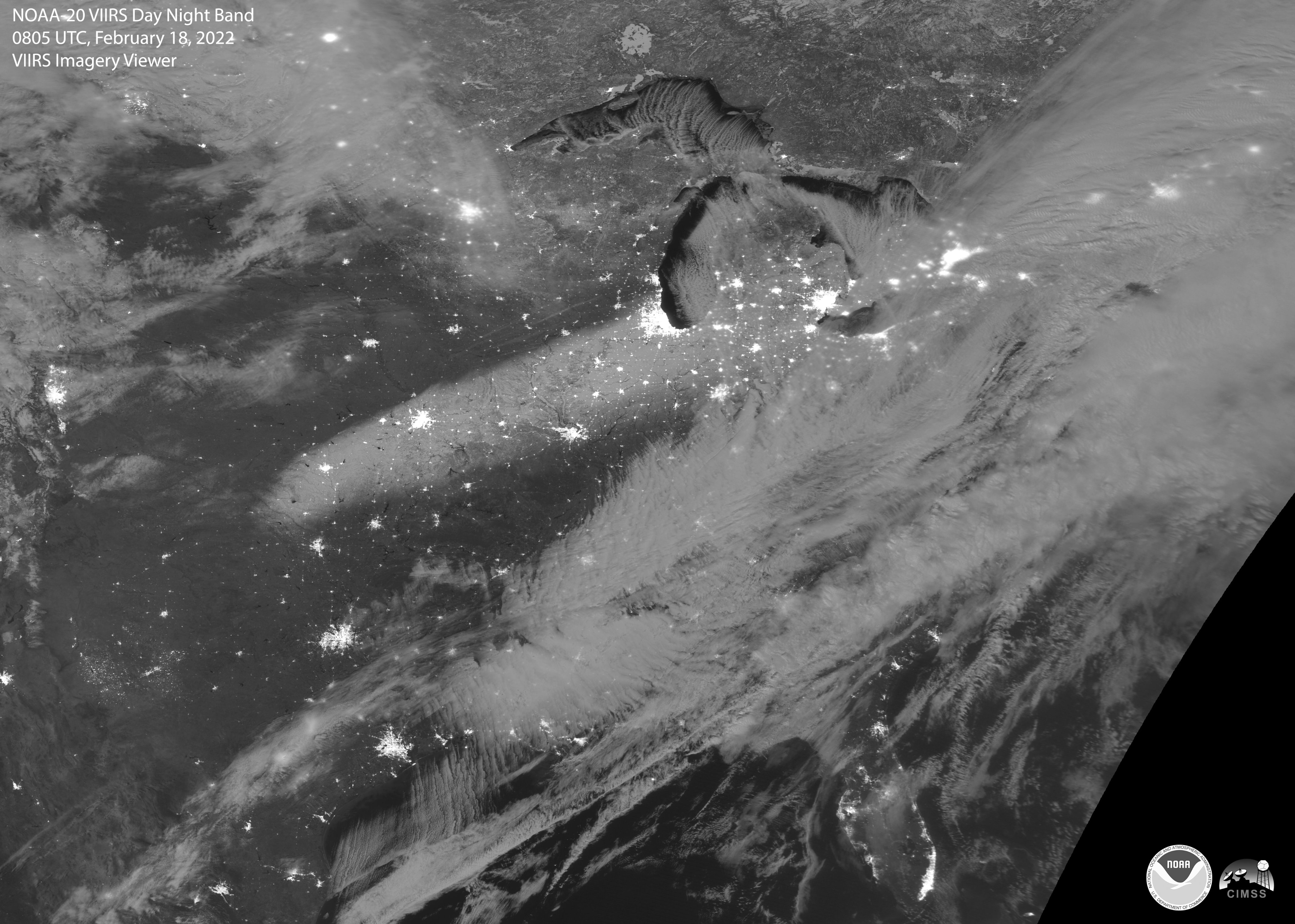
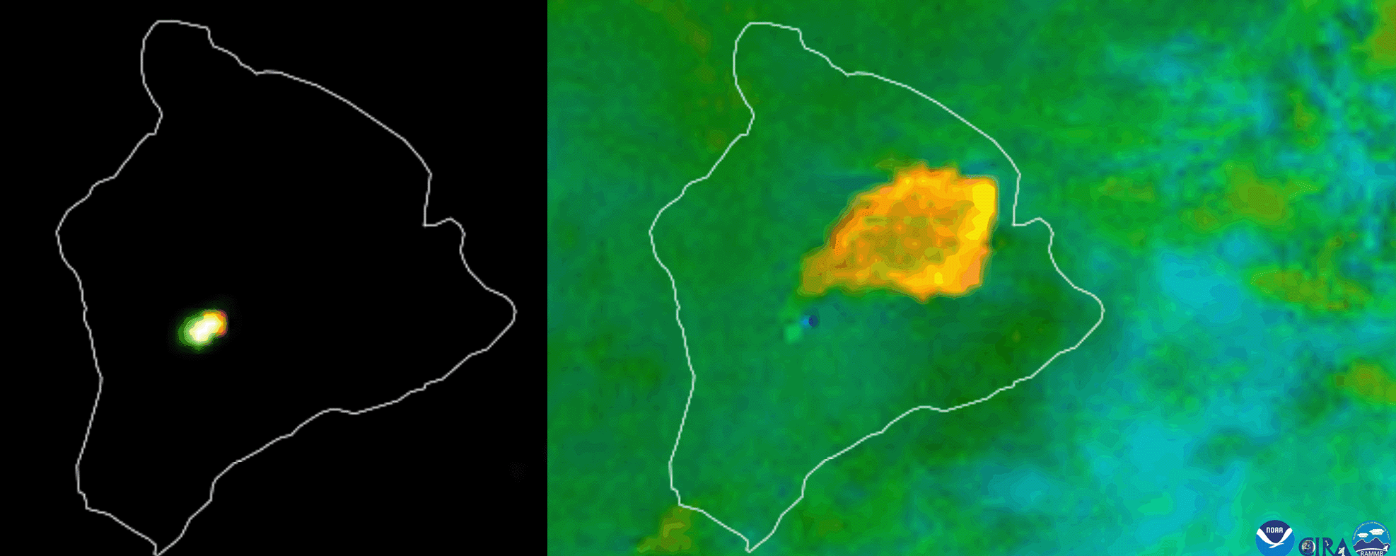
Similar to how we rang in the year, 2022 wound down with another bang—this time from Hawaii’s Mauna Loa volcano, located on Hawaii’s Big Island. The last time Mauna Loa erupted was in March 1984, which marked the beginning of the volcano’s longest period of quiet in recorded history until this year. NOAA satellites are able to detect both the heat and the emissions from volcanic eruptions, which helps forecasters and first responders make potentially life-saving decisions.

NOAA GOES-18 caught the heat signature from the lava (left) and the ash plume (right) from the eruption of the Mauna Loa volcano’s Moku‘āweoweo caldera on November 27-28, 2022.
NOAA satellites are another tool that meteorologists can use in their arsenal when forecasting severe weather. Satellites can track the development and intensification of thunderstorms, with multiple visible, infrared and multispectral channels helping measure many aspects of the storms. The National Weather Service’s Storm Prediction Center issued more than 400 severe thunderstorm watches and more than 170 tornado watches across the U.S. in 2022.
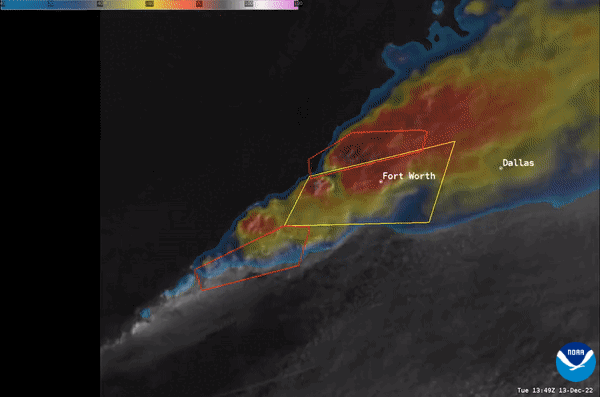
This visible/infrared “sandwich” animation from NOAA’s GOES-16 shows tornadic thunderstorms developing and moving across northern Texas during a tornado outbreak on December 13, 2022. The yellow polygons are severe thunderstorm warnings and the red polygons are tornado warnings.
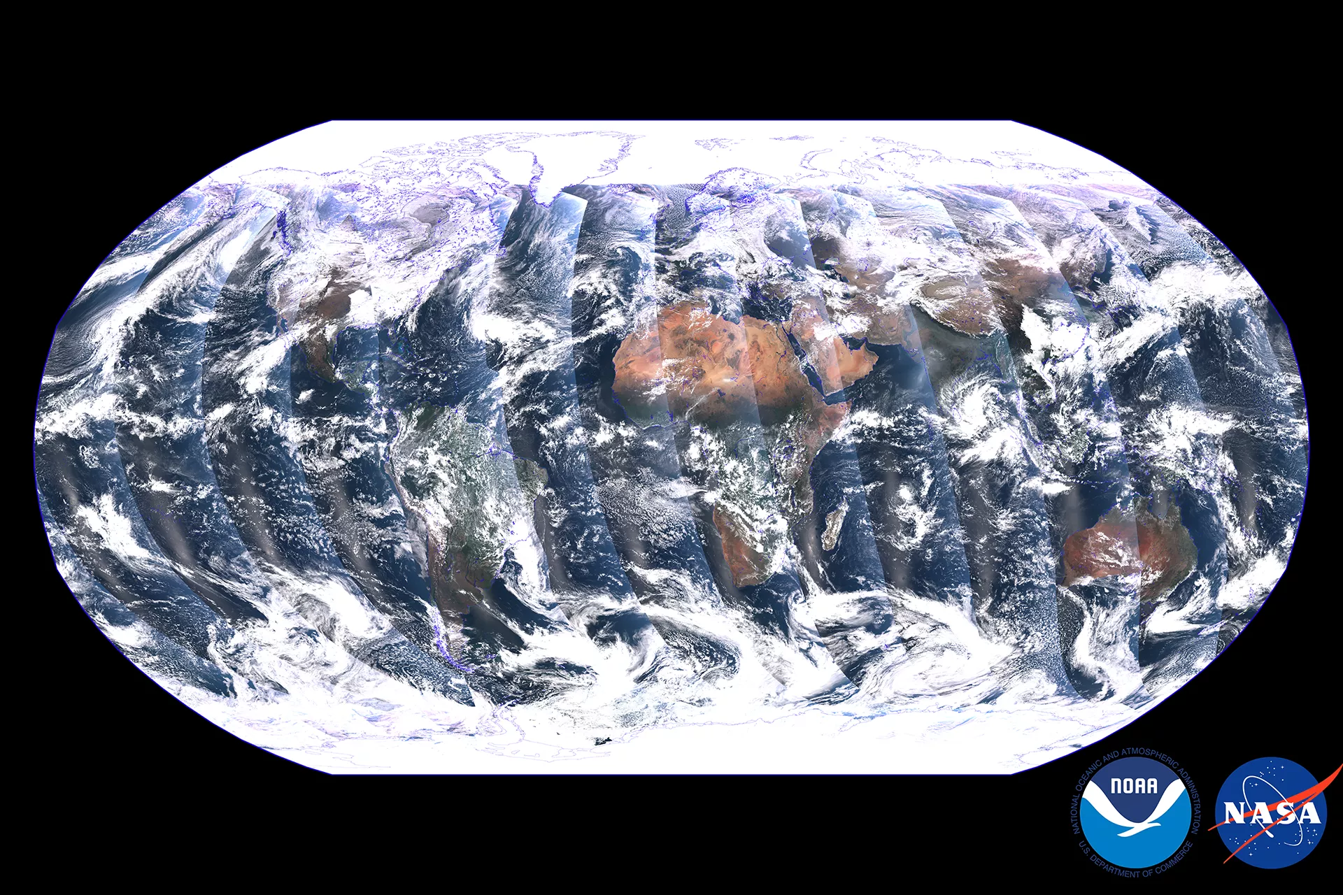
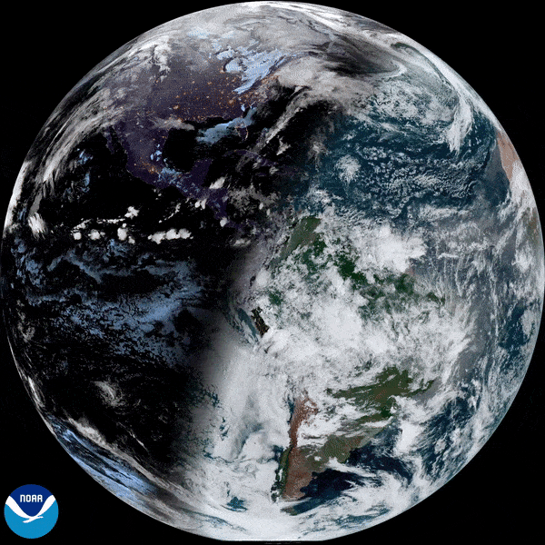
Lastly, we’ll leave you with this year-long time lapse imagery from NOAA’s GOES-16 satellite from December 2021 to December 2022. Notice how the Earth’s tilt creates the seasons as the planet revolves around the Sun, and look closely at the Atlantic basin to see if you can pick out the 2022 Hurricane Season from space!

Full disk GeoColor time-lapse imagery from NOAA’s GOES-16 satellite from December 2021 through December 2022.
As we head through 2023, NOAA’s Satellite and Information Service will continue to provide secure and timely access to global environmental data and information from satellites and other sources to promote and protect the nation's security, environment, economy, and quality of life… And our satellites will surely continue to provide another year of fascinating imagery of our beautiful, dynamic planet.