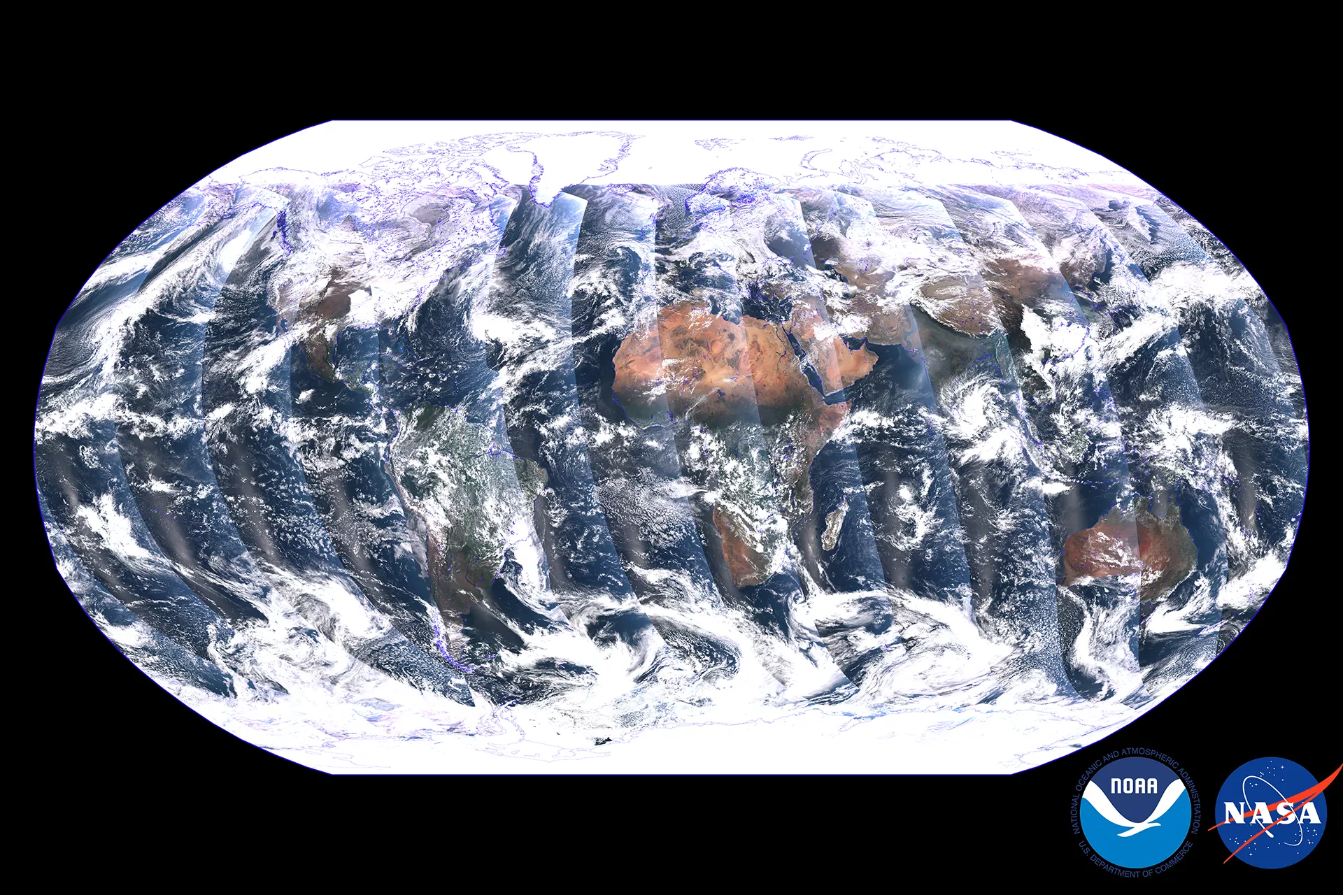
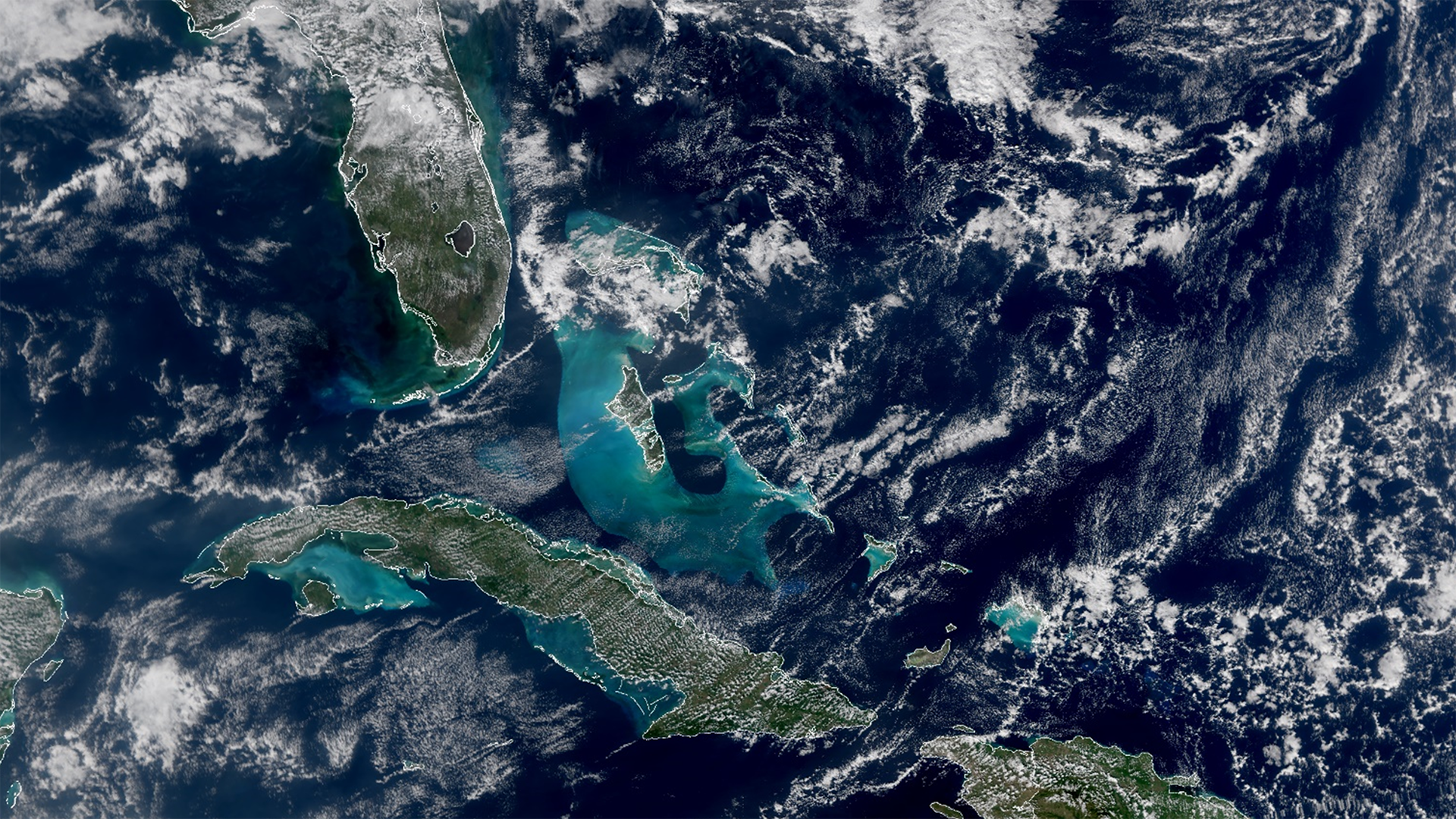
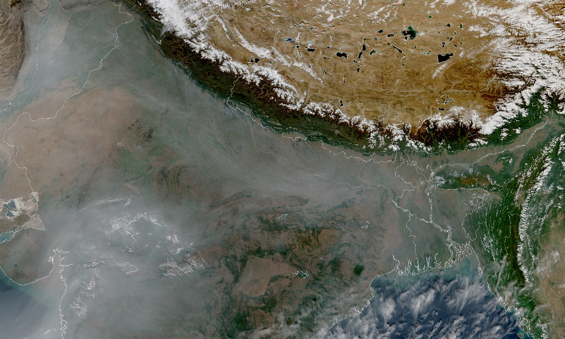
Bright blue water containing phytoplankton in the Caribbean Sea and smog from agricultural fires in Northern India can be seen in the first global image released by NOAA-21’s VIIRS instrument after it launched from the Vandenberg Space Force Base on Nov. 10.
The Visible Infrared Imaging Radiometer Suite (VIIRS) instrument on NOAA-21 began collecting Earth science data on December 5 over the East Coast of the United States. The data for the global image was collected on December 5 and 6.
VIIRS, which also flies on the Joint Polar Satellite System’s NOAA-20 and Suomi-NPP satellites, provides global measurements of the atmosphere, land and oceans. Over the oceans, it measures ocean color that helps detect harmful algal blooms and monitor phytoplankton activity, as well as sea surface temperature, a key ingredient for fueling hurricanes.

The turquoise color around Cuba and the Bahamas is due to sediment in the shallow waters around the continental shelf, said Dr. Satya Kalluri, Joint Polar Satellite System program scientist. Ocean color measured in different VIIRS bands provides important information about phytoplankton activity, a key indicator of ocean ecology and marine health. Ocean color is also important for detecting harmful algal blooms that adversely affect marine and human life.
Over land, VIIRS can detect and measure the intensity of wildfires, droughts and floods. The fire intensity is fed into a product that tracks the thickness and movement of wildfire smoke. This image below shows haze and smog over Northern India from agricultural burning. The snow capped Himalayas and the Tibetan plateau are also visible to the North.

VIIRS also generates critical environmental products on snow and ice cover, clouds, fog, aerosols and dust, and the health of the world’s crops.
“One of its most important uses is imagery over Alaska,” Dr. Kalluri said. “Up there, the satellites that provide the best imagery are polar-orbiting satellites.” This is because these satellites, which orbit the Earth from the North pole to the South pole, fly directly over the Arctic several times a day. One of the unique features of VIIRS is the Day-Night Band that captures images of lights at night, including city lights, lightning, auroras and lights from ships and fires.
These “first light” images, which were captured Dec. 6, come two weeks after the first image from the satellite’s Advanced Technology Microwave Sounder (ATMS) was released. The satellite, known as JPSS-2 during the build and launch, was officially renamed NOAA-21 after launch, following NOAA’s naming conventions for polar orbiting satellites.
“People can rest easy knowing their weather satellites are on the job,” said Dr. Jim Gleason, NASA Project Scientist for the JPSS Flight Project.
Together, NOAA and NASA oversee the development, launch, testing, and operation of all the satellites in the Joint Polar Satellite System program. NOAA funds and manages the program, operations, and data products. On behalf of NOAA, NASA and commercial partners develop and build the instruments, spacecraft, and ground system, and launch the satellites.