
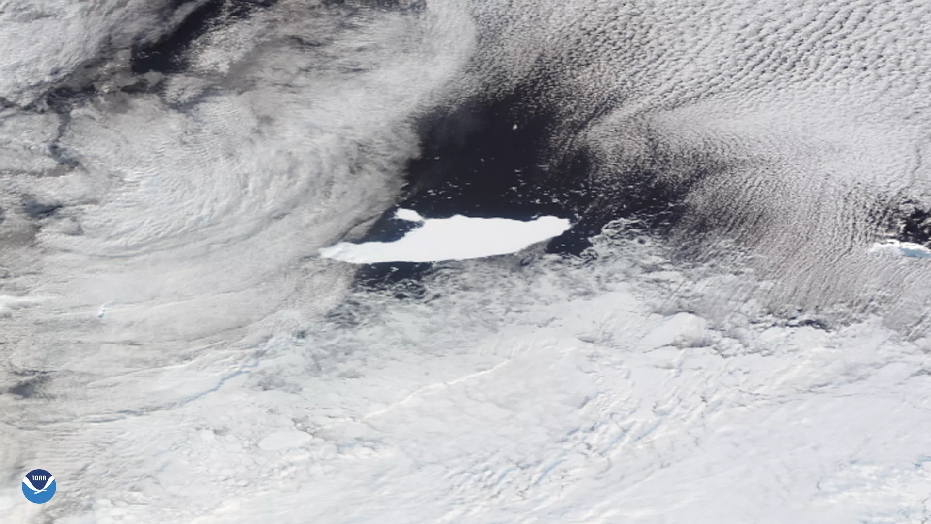
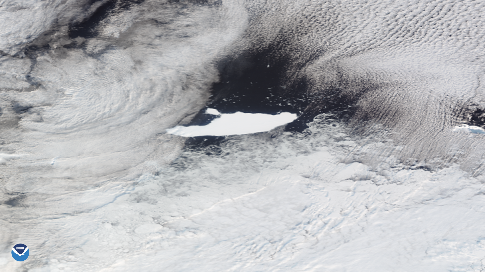
As the NOAA-20 satellite passed over the Antarctic Peninsula on May 5, 2020, it captured this cloudy image of the world’s largest iceberg, known as A-68A, drifting near the South Orkney Islands on the edge of the Weddell Sea and South Atlantic Ocean. According to the U.S. National Ice Center (USNIC), a large piece of A-68A broke off, (or “calved”), on April 22, 2020, and that piece has been named A-68C.
Despite having just lost this new significant chunk of ice, A-68A is still the largest iceberg currently floating on Earth. A-68C is roughly 11 x 7 nautical miles (~100 square miles in area) in size, equivalent to the size of Milwaukee, Wis. The largest iceberg ever recorded during the satellite era was B-15, which broke off the Ross Ice Shelf in late March of 2000. It was 160 x 20 nautical miles (184 x 23 miles), with an estimated area of 11,000 square kilometers (roughly 4,250 square miles). To put this in perspective, this was larger than the state of Delaware.
To learn more about tracking icebergs by satellite, read this article.
This image was captured by the NOAA-20 satellite's VIIRS instrument, which scans the entire Earth twice per day at a 750-meter resolution. Multiple visible and infrared channels allow it to detect atmospheric aerosols, such as dust, smoke and haze associated with industrial pollution and fires. The polar-orbiting satellite circles the globe 14 times daily and captures a complete daytime view of our planet once every 24 hours.