
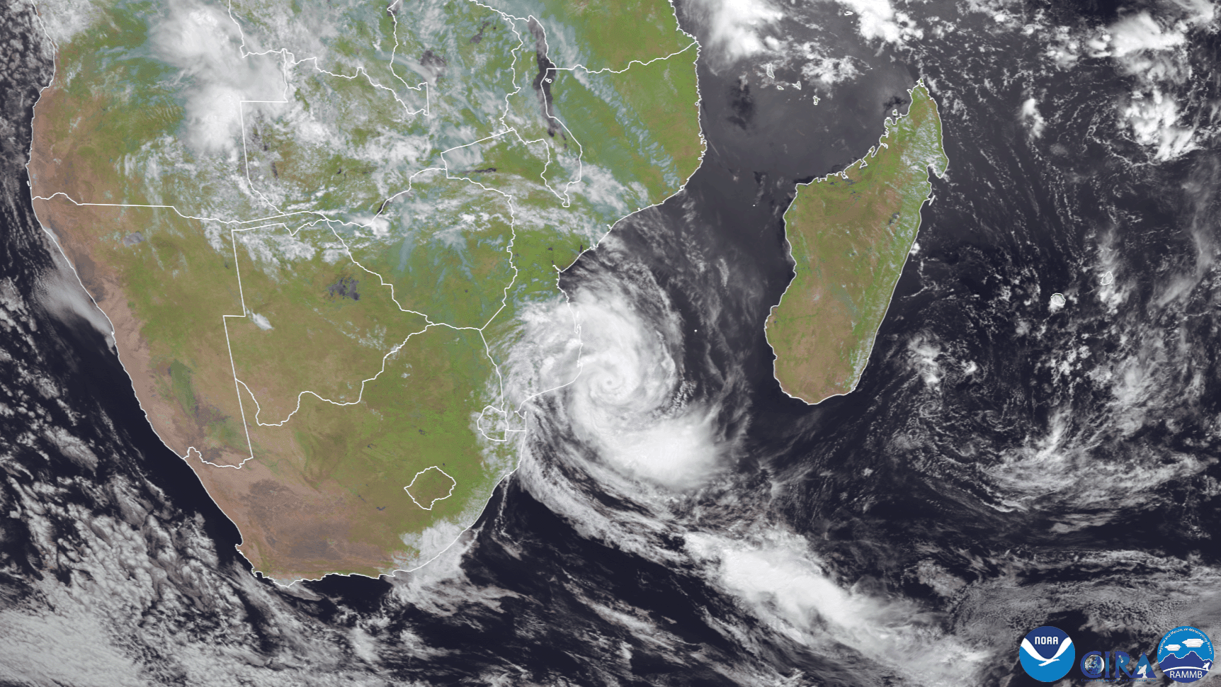
On Feb. 19, Europe’s Meteosat-8 satellite was keeping an eye on Tropical Cyclone Guambe, which developed off the southeastern coast of Africa this week from a system that was pushed off the continent into the Mozambique Channel. According to the United Kingdom’s Met Office , “[A]n area of low pressure has caused flooding rains over Mozambique and northeastern South Africa over the last week, and has now moved out over the ocean and strengthened to become Tropical Storm Guambe.”
In an update issued by the Joint Typhoon Warning Center (JTWC) on Feb. 19, Guambe had wind speeds around 80 mph, making it the equivalent to a Category 1 hurricane on the Saffir-Simpson Hurricane Wind Scale. Barely one month ago, another cyclone, Eloise , hit the same approximate area and produced heavy rain and flooding across Southern Africa when it made landfall in Mozambique. In contrast, Guambe is not expected to make landfall and will likely only brush Africa’s east coast before heading out into the open water.
In geostationary orbit at approximately 22,300 miles above the equator, the Meteosat-8 satellite operates over Europe, Africa, and the Indian Ocean. Meteosat-8 (launched from the Guiana Space Centre in Kourou in 2002) is positioned at 41.5 degrees and provides full disc imagery every 15 minutes. Meteosat-8 is one of the four geostationary satellites operated by Europe’s EUMETSAT.