

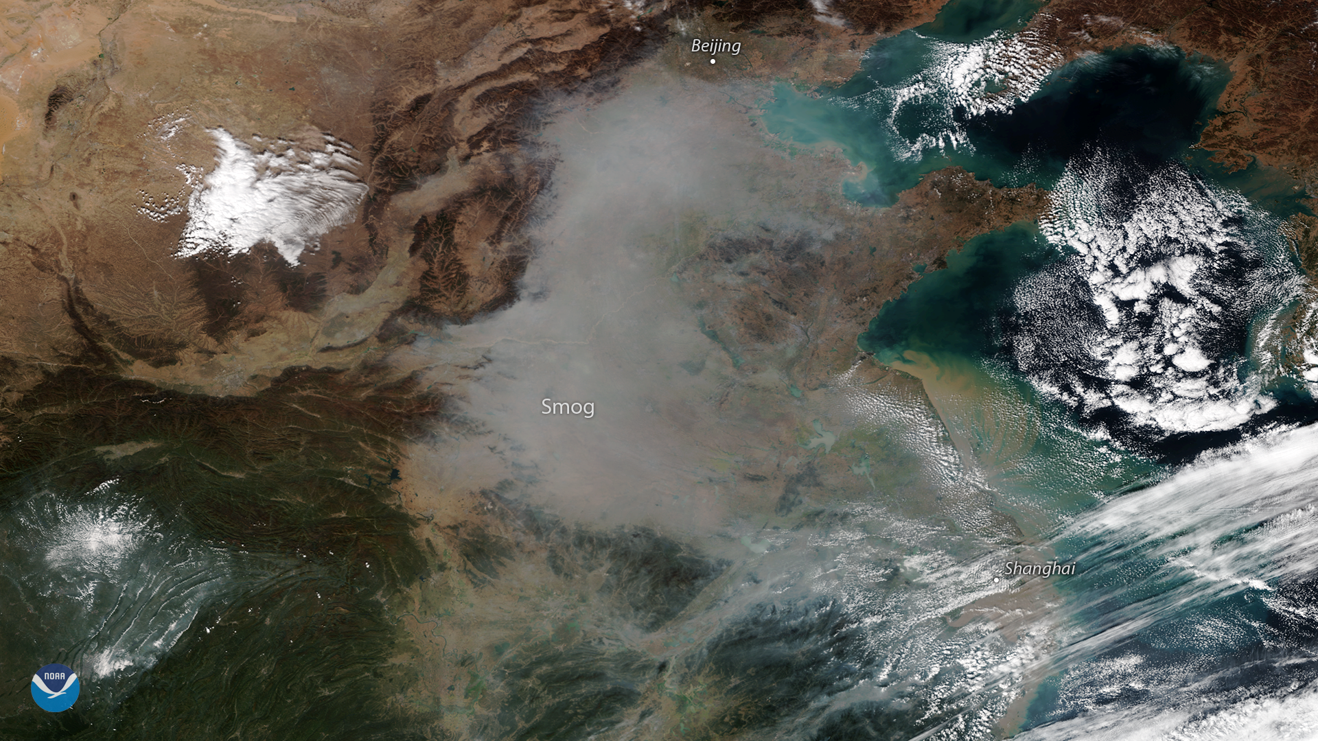
A plume of smog appears over northeastern China in this true-color image seen from the NOAA-20 satellite on October 31, 2018. While air quality in China has dramatically improved in recent years, thanks to ambitious government efforts to reduce coal consumption, pollution levels periodically still spike – especially during the fall and winter months, when more coal is burned for residential and commercial heating.
In recent days, air quality in Beijing has reached unhealthy levels. On November 2, air quality reports showed widespread fine particulate concentrations (PM2.5) above 200 micrograms per cubic meter in the Chinese capital,following several days of a high pressure weather pattern that trapped pollutants near the surface.
In addition to the smog, we can see several other interesting features in this satellite imagery. The outermost cloud bands of former Typhoon Yutu (now a tropical depression) appear in the lower right, while a dusting of snow is visible in the mountainous highlands along the border of China's Sichuan and Shaanxi provinces in the lower left.
The NOAA-20 satellite's VIIRS instrument provides global coverage twice per day with a 750-meter resolution across its entire span. Its multi-channel imaging capabilities allow us to detect atmospheric aerosols, such as dust, smoke, and haze associated with industrial pollution.