
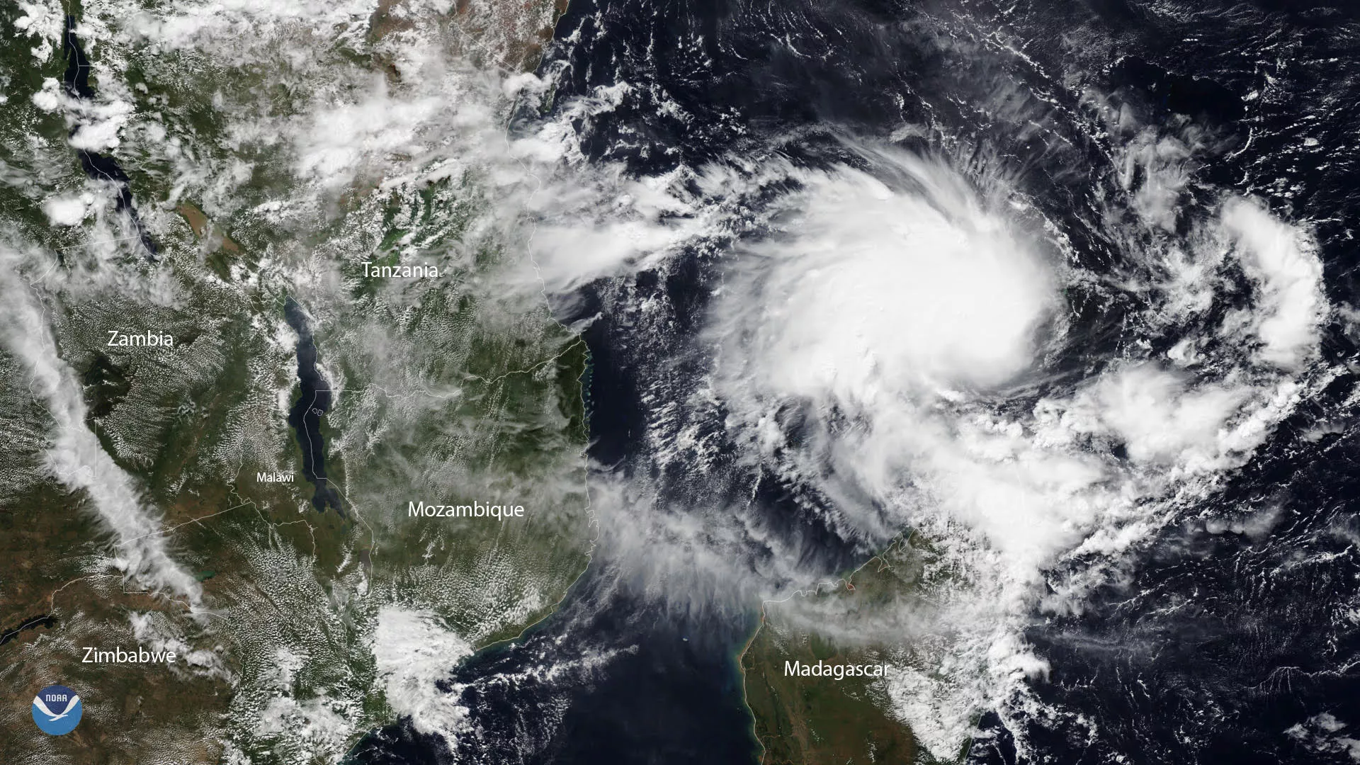
Tropical Cyclone Kenneth, seen here by NOAA-20 on April 23, 2019, is on track to pass near the Comoros Islands before making landfall near the Tanzania-Mozambique border later this week.
Low vertical wind shear and warm sea surface temperatures are creating favorable conditions for the storm to intensify over the next 12-18 hours as it passes close to the Comoros Islands tonight, according to the U.S. Department of Defense’s Joint Typhoon Warning Center. As of noon on April 24, Kenneth is forecast to potentially intensify to a Category 3 hurricane prior to landfall later this week.
While Kenneth is expected to weaken once it reaches land, the intense tropical cyclone is likely to unleash damaging winds and major flooding on areas along its path in the same region impacted by intense Tropical Cyclone Idai. Idai, which made landfall in early March, dealt a devastating blow to parts of Mozambique, Zimbabwe and Malawi, and killed more than 1,000 people. In Mozambique alone, there are nearly 69,000 internally displaced people still living in accommodation centers, according to the latest figures from the United Nations.