

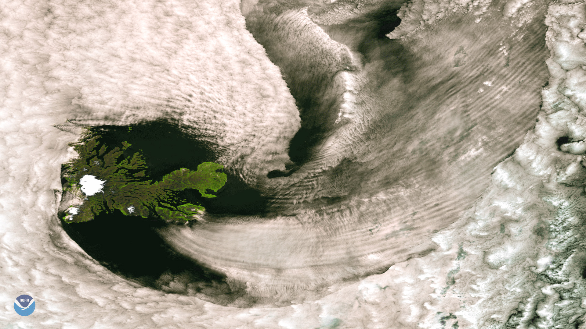
The Suomi NPP satellite spotted this break in the clouds over the remote Kerguelen Islands in the southern Indian Ocean on January 3, 2018. Located roughly 1,500 miles from Antarctica and 2,000 miles southeast of Madagascar, the volcanic archipelago, also known as the "Desolation Islands," is one of the most isolated places on Earth. First discovered in 1772, the French territory is located between the "Roaring Forties" and "Furious Fifties," where powerful westerlies in the Southern Ocean frequently batter the islands with gale-force winds, precipitation, and cloud cover. Due to their geographic isolation and cold, windswept climate, the islands have no permanent inhabitants.
This color-enhanced image was created using the VIIRS high resolution SVI1, SVI2, and SVI3 bands, each of which is sensitive to different colors of light. By combining these channels, features not apparent in normal visible imagery are more easily discerned. The Cook Ice Cap, which contains several dozen glaciers, is clearly visible in the western part of the island.