
Search
Showing 9 - 16 of 60 results
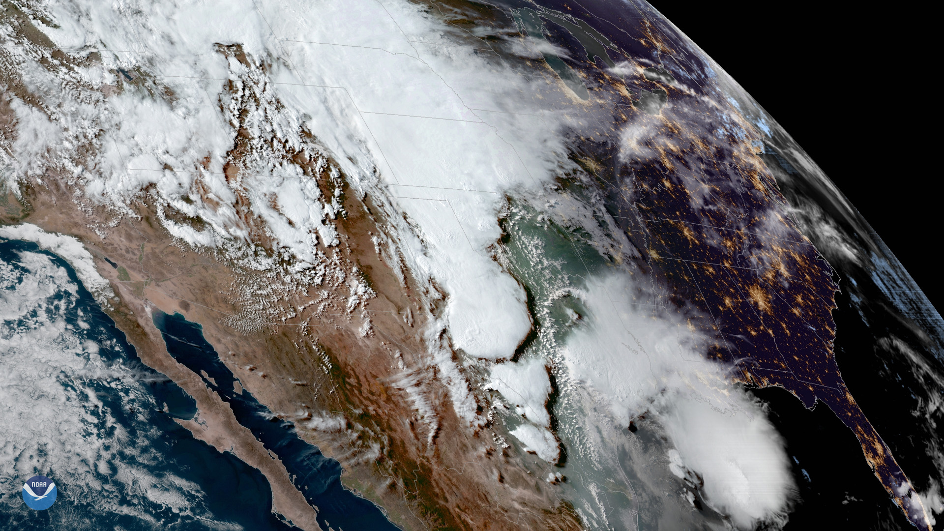
Severe storms and heavy rain continue to trigger flooding from Texas to Wisconsin. Flash flooding across Houston and parts…
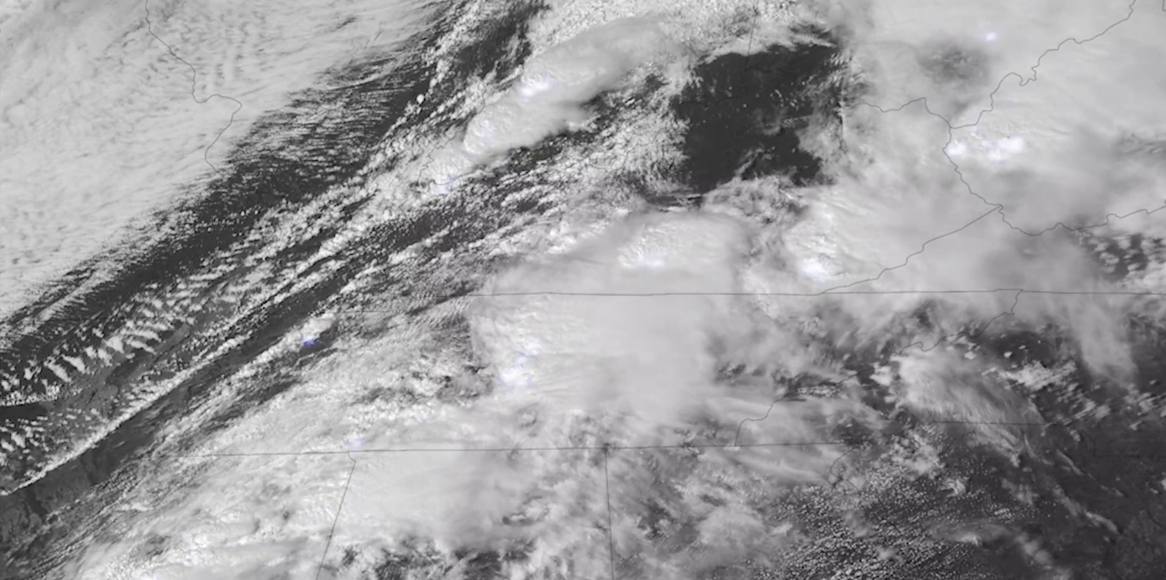
NOAA’s GOES East satellite watched as storms began firing up over the Upper Midwest on Friday, July 19, 2019. While there’s…

This Image of the Day features spectacular visible imagery of supercell thunderstorms developing over Texas, seen by the…
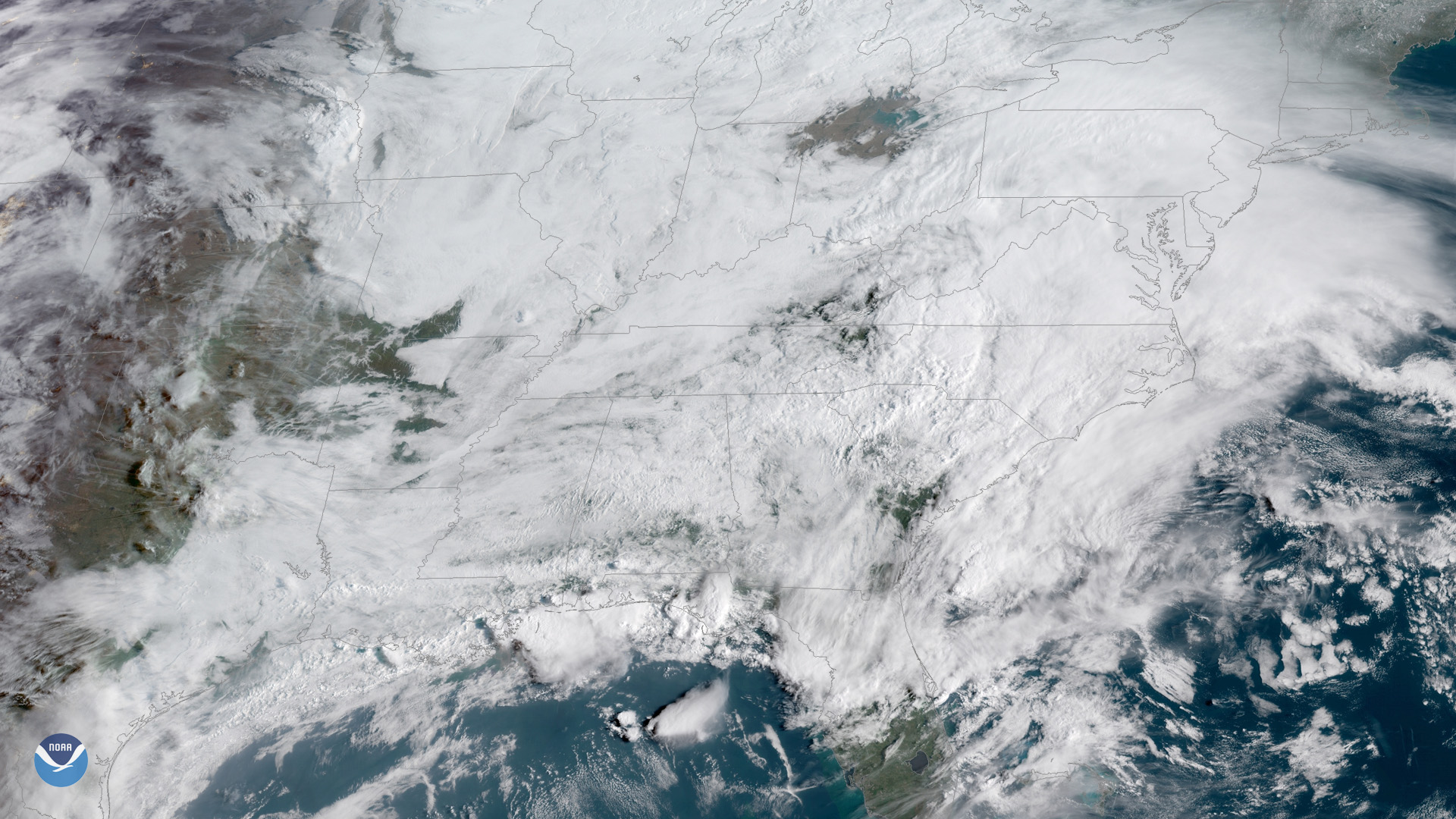
On April 2, 2025, NOAA’s GOES East (GOES-16) satellite captured imagery of numerous severe thunderstorms erupting across the…
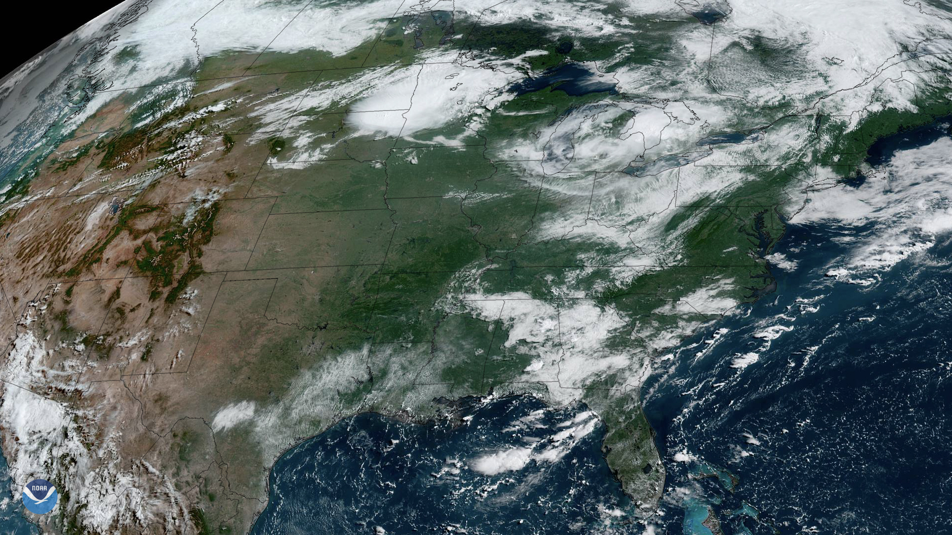
Strong to severe storms were captured moving across the Mississippi and Ohio River valleys via satellite imagery.
Citizen science includes the general public in meaningful tasks that contribute to the data collection, analysis of data,…
Gulf Coast thunderstorms bubble up above a blanket of clouds in this GOES East view from April 5, 2019.
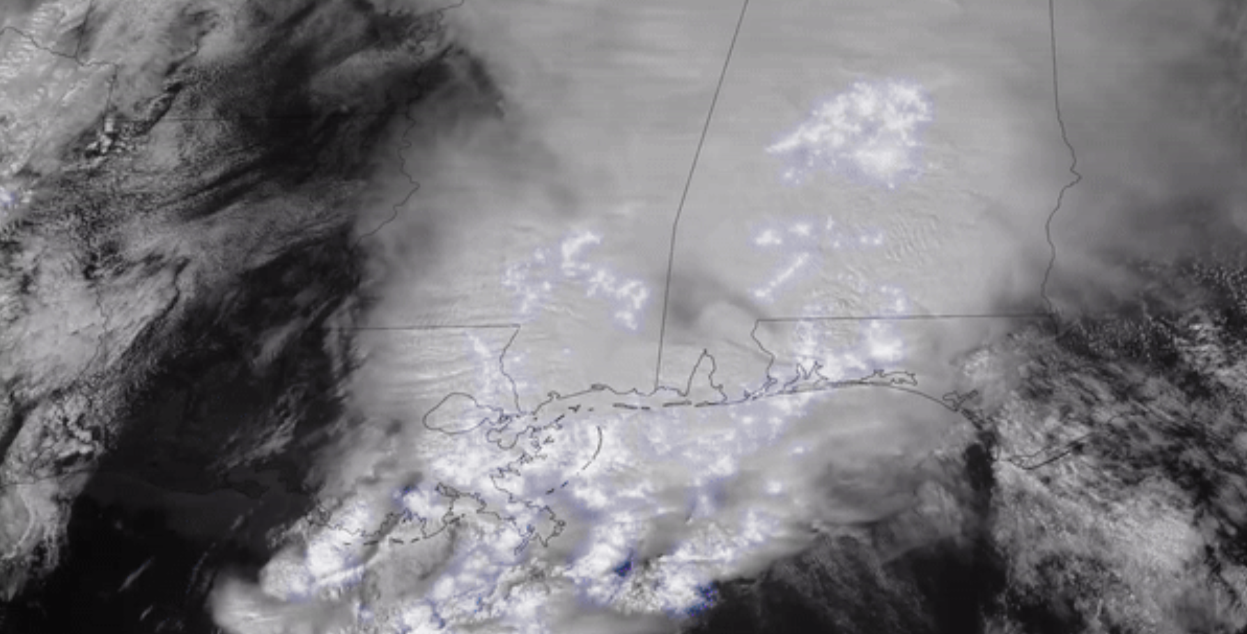
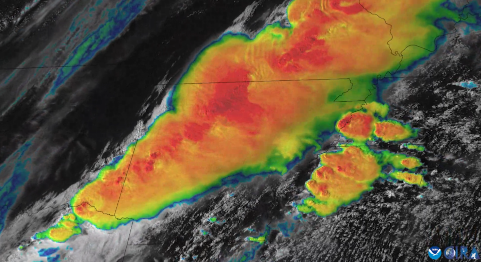
NOAA satellite imagery captured lightning illuminating the sky across the South as severe thunderstorms charged eastward.