

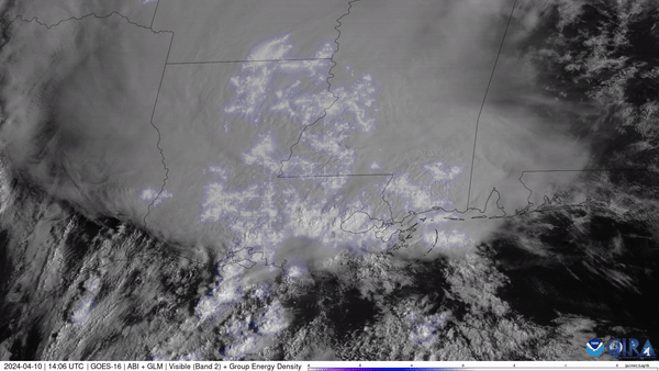
Phenomena: Lightning, Wind
Satellite: GOES-16 (GOES East)
Product: Visible (band 2), GLM Group Energy Density
Instrument: ABI GLM
Timespan: 2024/04/10 14:01 - 2024/04/10 19:11 UTC (10:01 a.m - 3:11 p.m. EDT)
NOAA satellite imagery captured lightning illuminating the sky across the South as severe thunderstorms charged eastward. The storms dropped large hail and produced damaging winds across the South, with one tornado reported in southern Alabama..
The GOES East geostationary satellite, also known as GOES-16, keeps watch over most of North America, including the contiguous United States and Mexico, as well as Central and South America, the Caribbean, and the Atlantic Ocean to the west coast of Africa. The satellite's high-resolution imagery provides optimal viewing of severe weather events, including thunderstorms, tropical storms, and hurricanes.