Last year, NOAA satellites assisted in the rescues of 307 people — the highest number since 2007.
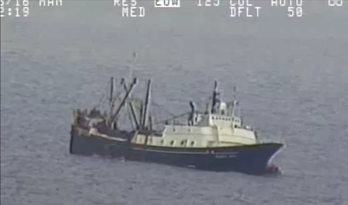
Coast Guard Air Station Kodiak aircrews, along with good Samaritans, rescue 46 crew members from life rafts after they abandoned ship approximately 690 miles west of Dutch Harbor, Alaska, July 26, 2016.
Last year, NOAA satellites assisted in the rescues of 307 people — the highest number since 2007, when 353 people were saved.
Of the 307 rescues in 2016, 205 were waterborne rescues, 23 were from aviation incidents and 79 were land-based rescues involving personal locator beacons. The largest single rescue in, or around, the United States credited to NOAA satellites and ground systems took place in the Bering Sea near Alaska last July, when 46 crew members were safely pulled from a sinking fishing vessel.
NOAA satellites are part of the international Search and Rescue Satellite Aided Tracking System, known as COSPAS-SARSAT. This system uses a network of spacecraft to detect and locate distress signals quickly from emergency beacons employed on aircraft, boats, and from handheld personal locator beacons, or PLBs.
Since the program’s inception in 1982, COSPAS-SARSAT has been credited with supporting more than 41,000 rescues worldwide, including more than 8,000 in the United States and its surrounding waters.
For more information about the SARSAT rescues that occurred in 2016, visit the NOAA website.
To see a map of where SARSAT rescues have taken place, visit the NOAA Satellite and Information Service Website.