
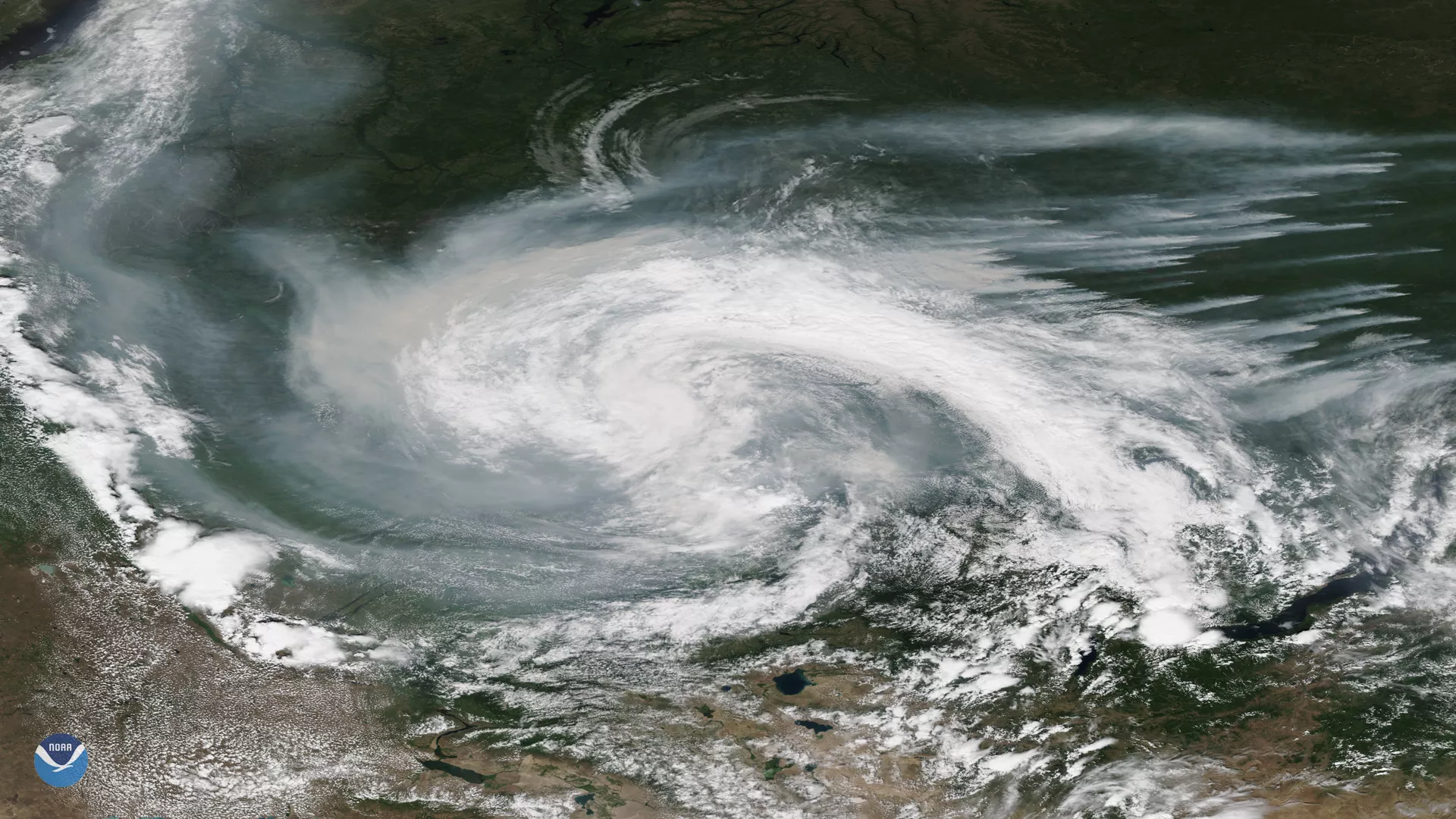
Smoke from active wildfires burning across northern Russia got caught in a low pressure system near the Verkhne-Tazovsky State Natural Reserve on July 21, 2019, as seen here by the NOAA-20 satellite. Residents of Krasnoyarsk and Novosibirsk, which are two of Siberia’s largest cities, have been advised to stay indoors due to poor air quality, according to local news outlets. In fact, June wildfires across the Arctic Circle produced the equivalent of Sweden’s total annual carbon dioxide emissions, according to a recent report from the Copernicus Atmosphere Monitoring Service ( CAMS ).
Much of the Arctic, including Alaska, Siberia and Greenland have faced unusually hot and dry conditions, which the World Meteorological Organization (WMO) said has only amplified the risk of wildfires. In parts of Russia where many of these fires are raging, June temperatures soared to nearly 10 degrees higher than the 1981-2010 long-term average, according to the WMO.
“Although wildfires are common in the northern hemisphere between May and October, the latitude and intensity of these fires, as well as the length of time that they have been burning for, has been particularly unusual,” Mark Parrington, who is a senior scientist and wildfire expert for CAMS, told the WMO in a press release.
The NOAA-20 satellite's VIIRS sensor provides global coverage twice a day with 750 m resolution across its entire scan. Its daily multi-band imaging capabilities support the acquisition of high-resolution atmospheric imagery, including visible and infrared imaging of hurricanes, atmospheric aerosols and, as shown here, detection of fires and smoke.