From June 30–July 1, 2020, the GOES-West satellite captured a cluster of actinoform clouds drifting toward the Hawaiian islands. These types of clouds generally form lower in the atmosphere (roughly 6,600 feet up) over water, in areas where stratocumulus clouds are common. Their puffy radial structure is reminiscent of wagon wheel spokes or leaves that stand out from the rest of the low-lying cloud field. Their name even describes their spoke-like shape, since the base "actino-" comes from the Greek word for "ray" and their arms/spoke-like structures that reach out in all directions are called "actiniae."
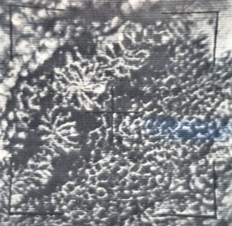
Actinoform clouds are usually so large that they are near impossible to recognize from the ground. They were first observed from images taken by the Television Infrared Observation Satellite (TIROS) V satellite, in August of 1963. One of these was impressive enough to become the very first feature of the Monthly Weather Review's "Picture of the Month" series that year.

First "Picture of the Month" image from Monthly Weather Review, 1963 (Vol. 91, p. 2)
As early as 1961, TIROS satellites observed shallow hexagonal convective systems of cloud cells that were organized into differing degrees of cloudiness; a phenomenon that became known as “mesoscale cellular convection” or MCC. Two basic types of MCC include open- and closed-cell cloud systems, depending on whether the center of the cell is clear or cloudy. Actinoform clouds are a third class of MCC, which don’t fit into either of those categories—and we are still continuing to learn about these mysterious types of clouds.
This GeoColor enhanced imagery was created by NOAA's partners at the Cooperative Institute for Research in the Atmosphere. The GOES-West satellite, also known as GOES-17, provides geostationary satellite coverage of the Western Hemisphere, including the United States, the Pacific Ocean, Alaska and Hawaii. First launched in March 2018, the satellite became fully operational in February 2019.
