
Meteorologists use observations from JPSS and other weather satellites to improve their situational awareness and forecasting of severe weather and life-threatening events like hurricanes, wildfires, and unhealthy air quality that cost thousands of lives and billions of dollars in damage. Researchers use satellite observations for analyzing the climate, tracking dust across continents, monitoring harmful algal blooms, and countless other purposes.
With an ever-increasing number of Earth observation satellites delivering an extraordinary amount of data (seven terabytes a day from JPSS satellites alone!), satellite data users need to stay up to date on the newest data products and applications so they have the best information to make informed decisions. Here’s where satellite data training comes in.

For operational forecasters, satellite data training is an ongoing part of their profession. New research, new datasets, new products, and new tools are always being evaluated for use in the operational setting. At the National Weather Service, training aims to “effectively and efficiently maximize a forecaster’s understanding of the current and future state of the atmosphere and allow them to issue the best possible warning and forecast in order to meet the mission of [NWS], Saving Lives and Property.”
Beyond weather forecasting, satellite data training offers many benefits like increasing accessibility to satellite data products and learning a new skill. Training also drives innovation. The training environment can stimulate new ideas through interactive discussion, learning exercises, and exposure to emerging concepts, all of which can be a source of inspiration. Likewise, training can act as a bridge between satellite data product developers and data users. Training turns satellite observations into knowledge and information that benefits society.
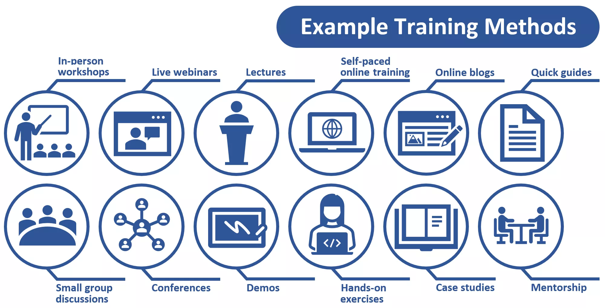
Satellite data training takes on different forms. The type of training used depends on many factors, such as available resources, trainee needs and background, and trainee location, culture, and virtual or in-person settings. Different training methods require different approaches to make the training valuable to the trainee.
The JPSS Program Office often looks to external organizations to develop satellite data training resources. One of JPSS’ most valuable resources is the trainers themselves—people like Jorel Torres, a JPSS Satellite Liaison at the Cooperative Institute for Research in the Atmosphere (CIRA) at Colorado State University, and Dr. Scott Lindstrom, a scientist at the Cooperative Institute for Meteorological Satellite Studies (CIMSS) at University of Wisconsin-Madison. An in-depth look into their experiences as trainers, including challenges, resources, and considerations for successful training, will be featured in the 2023 JPSS Annual Science Digest, published online each year in January. To learn more about the JPSS Annual Science Digest and read previous issues, visit www.nesdis.noaa.gov/jpss-digest.