
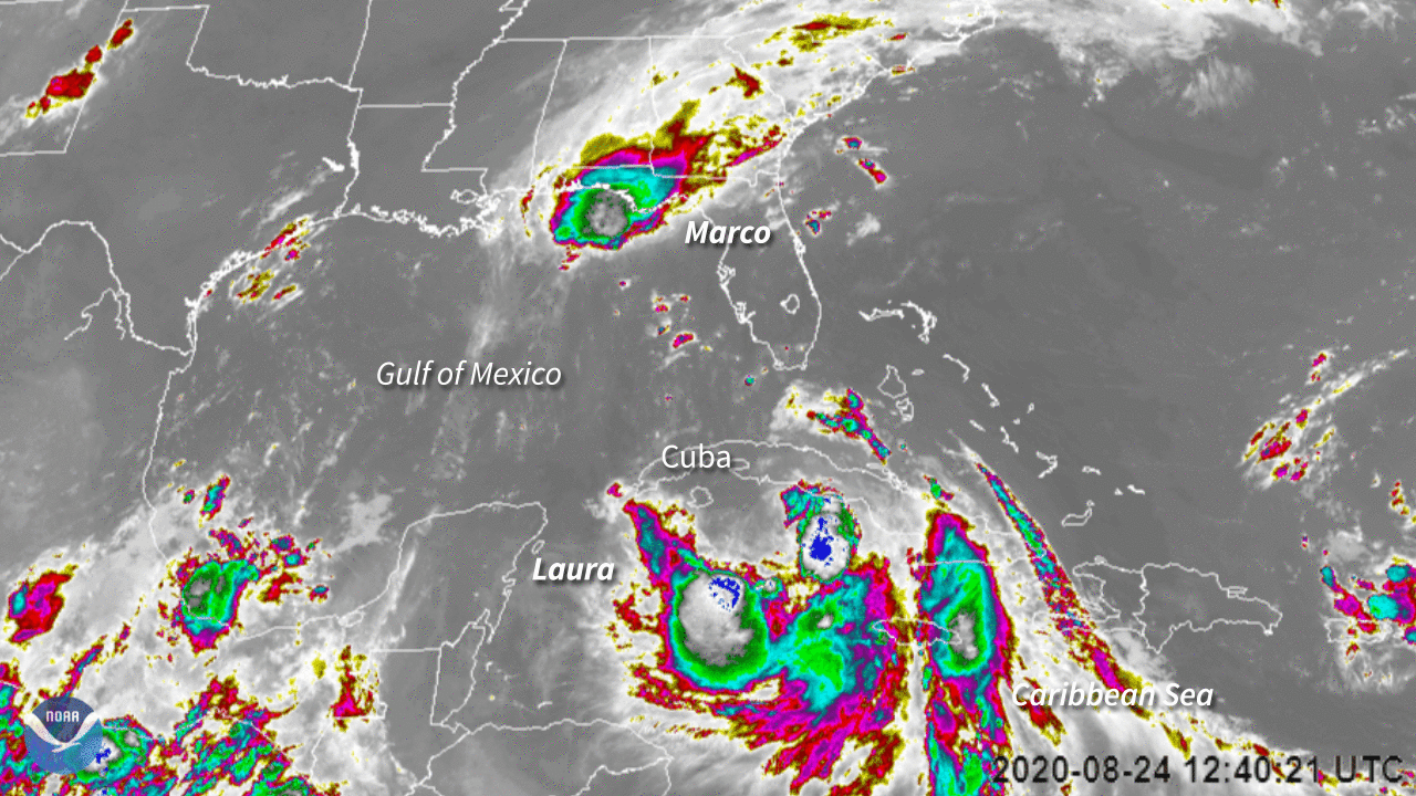
On August 24, 2020, NOAA’s GOES-East satellite was tracking two tropical systems, one in the Gulf of Mexico, the other in the Caribbean Sea: Tropical Storms Marco and Laura. Marco briefly became a hurricane on Sunday, just hitting Category-1 wind speeds of 75 miles per hour on the Saffir-Simpson Wind Scale before downgrading back to a tropical storm early Monday morning. While Marco is reportedly weakening as it spins near the Gulf Coast, Laura is intensifying and causing significant damage in the Greater Antilles at max sustained speeds of 65 miles per hour; it is currently near Cuba and the southern tip of Florida.
The Image of the Day is looking at both tropical storms using Band 15 on the satellite’s Advanced Baseline Imager. Also known as the Dirty Longwave Window, this highly sensitive band can better pick up differences in the atmosphere, such as estimates on low-level moisture, volcanic ash, airborne dust/sand, sea surface temperature, and cloud particle size—which is especially important for hurricane and tropical storm monitoring.
The GOES-East geostationary satellite, also known as GOES-16, keeps watch over most of North America, including the continental United States and Mexico, as well as Central and South America, the Caribbean, and the Atlantic Ocean to the west coast of Africa. The satellite's high-resolution imagery provides optimal viewing of severe weather events, including thunderstorms, tropical storms, and hurricanes.