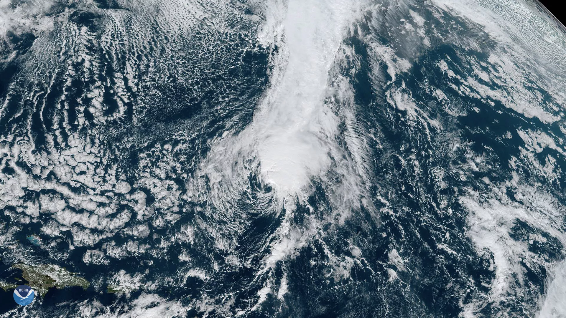
Although forecasts from earlier this week expected Tropical Storm Sebastien to strengthen into a hurricane, strong wind sheer is gradually causing the system, seen by GOES East, to weaken. Given Sebastien’s current shallow and disorganized structure, the storm is expected to dissipate within the next three days as it continues moving east-northeastward over the Atlantic Ocean.
Hurricanes in the Atlantic are rare this late in the season. In fact, only seven have formed after Nov. 20 since the use of satellites began keeping track in 1966, according to Dr. Philip Klotzbach, a meteorologist at Colorado State University who specializes in Atlantic hurricanes.
The last late-season hurricane to form was Otto on Nov. 23, 2016, which made landfall in southern Nicaragua after rapidly intensifying to a category 3 hurricane on the Saffir-Simpson Hurricane Wind Scale.
The GOES East geostationary satellite, also known as GOES-16, keeps watch over most of North America, including the continental United States and Mexico, as well as Central and South America, the Caribbean, and the Atlantic Ocean to the west coast of Africa. The satellite's high-resolution imagery provides optimal viewing of severe weather events, including thunderstorms, tropical storms, and hurricanes.