

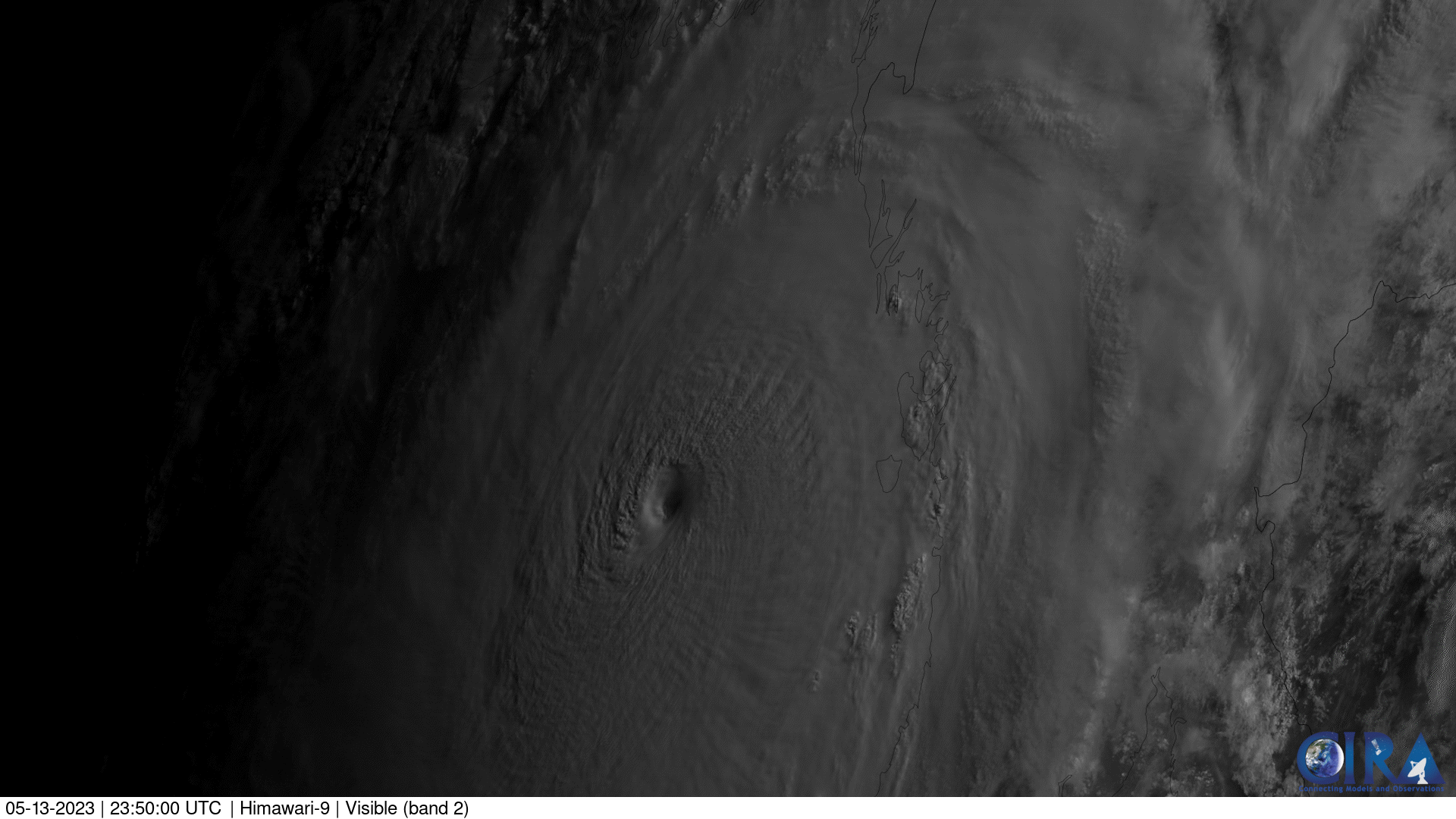
On May 14, 2023, Japan’s Himawari-9 satellite tracked Tropical Cyclone Mocha as the powerful storm moved over the Bay of Bengal in the Indian Ocean. This visible imagery shows the eye of Mocha prior to making landfall in Myanmar. The storm reached the equivalent of a Category 5 Atlantic hurricane, and then made landfall on Sunday, May 14 as a Category 4 storm, with sustained winds of 130 mph.
Hundreds of people are feared dead after the cyclone struck Myanmar over the weekend, residents and aid groups said on Tuesday, with rescue efforts hampered by damage to infrastructure. Myanmar's impoverished Rakhine State bore the brunt of Cyclone Mocha, during which winds ripped roofs off homes and brought a storm surge that inundated the state capital Sittwe.
This image was captured by the Advanced Himawari Imager (AHI) on Japan’s Himawari-9 satellite. This satellite, the second flight unit of the Japan Meteorological Agency's (JMA) third-generation of geostationary satellites, provides visible light and infrared images of the Asia-Pacific region. Himawari's data are vital for global geostationary coverage, which is why NOAA and JMA have agreed to mutual backup arrangements for their geostationary systems.