
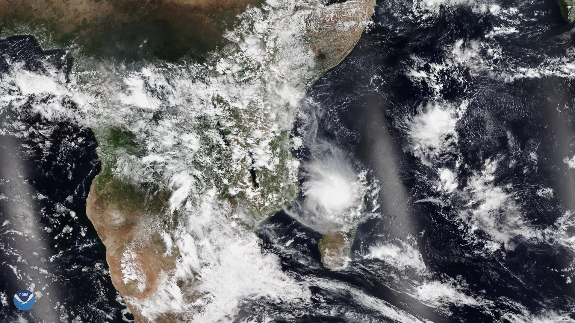
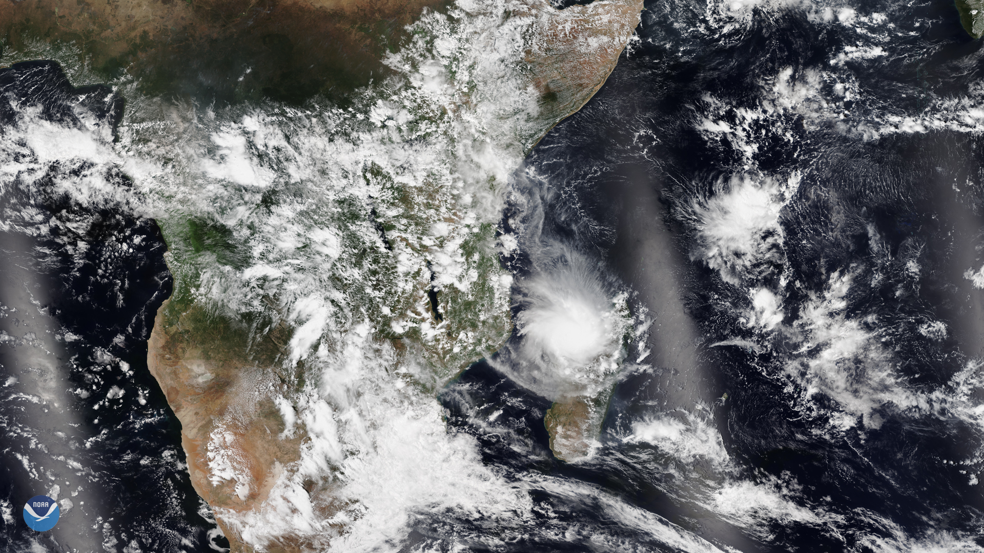
NOAA-20 captured Tropical Cyclone Belna as it made landfall at Boeny, a northwestern province on the island nation of Madagascar on Dec. 9, 2019. Meteo Madagascar warned the public that the tropical cyclone had sustained wind speeds of up to 93 miles per hour as it pushed southwest-ward toward central Madagascar. The Global Disaster Alert and Coordination System (GDACS), a joint project between the European Commission and the UN that provides disaster relief to various countries around the world, stated that the tropical cyclone would degrade into a depression within 24 hours after landfall.
The National Bureau of Risk Management and Disaster issued a bulletin on Dec. 10 at 1:21 p.m. local time that warned of heavy rainfall in Morafenobe, Mahabo and the other highlands in the Northwest until Dec. 12. After the tropical cyclone degrades into a tropical depression, it is anticipated to cause rain in southern territories on Wednesday, Dec. 11. While Madagascar is at elevated risk due to its location and logistical concerns, GDACS said that Tropical Cyclone Belna is not anticipated to trigger any sustained humanitarian aid for the population.
Madagascar is the fourth largest island in the world (after Greenland, New Guinea and Borneo) with elevation ranging from 9,436 ft in the northwest to sea-level on its coastline with the Indian Ocean. The brunt of the storm, at the northern end of the island, took place in higher elevation and largely spared lower-lying areas in the east that depend on maritime trade more heavily. However, the Ministry of Transport, Tourism and Meteorology advises seafarers between Besalmpy and Morondava to “stay safe [as] tragedy strikes,” and adds on a different page that they should “take boats ashore, and store any livestock safely.”
This image was captured by the NOAA-20 satellite's VIIRS instrument , which scans the entire Earth twice per day at a 750-meter resolution. Multiple visible and infrared channels allow it to detect atmospheric aerosols, such as dust, smoke and haze associated with industrial pollution and fires. The polar-orbiting satellite circles the globe 14 times daily and captures a complete daytime view of our planet once every 24 hours.