

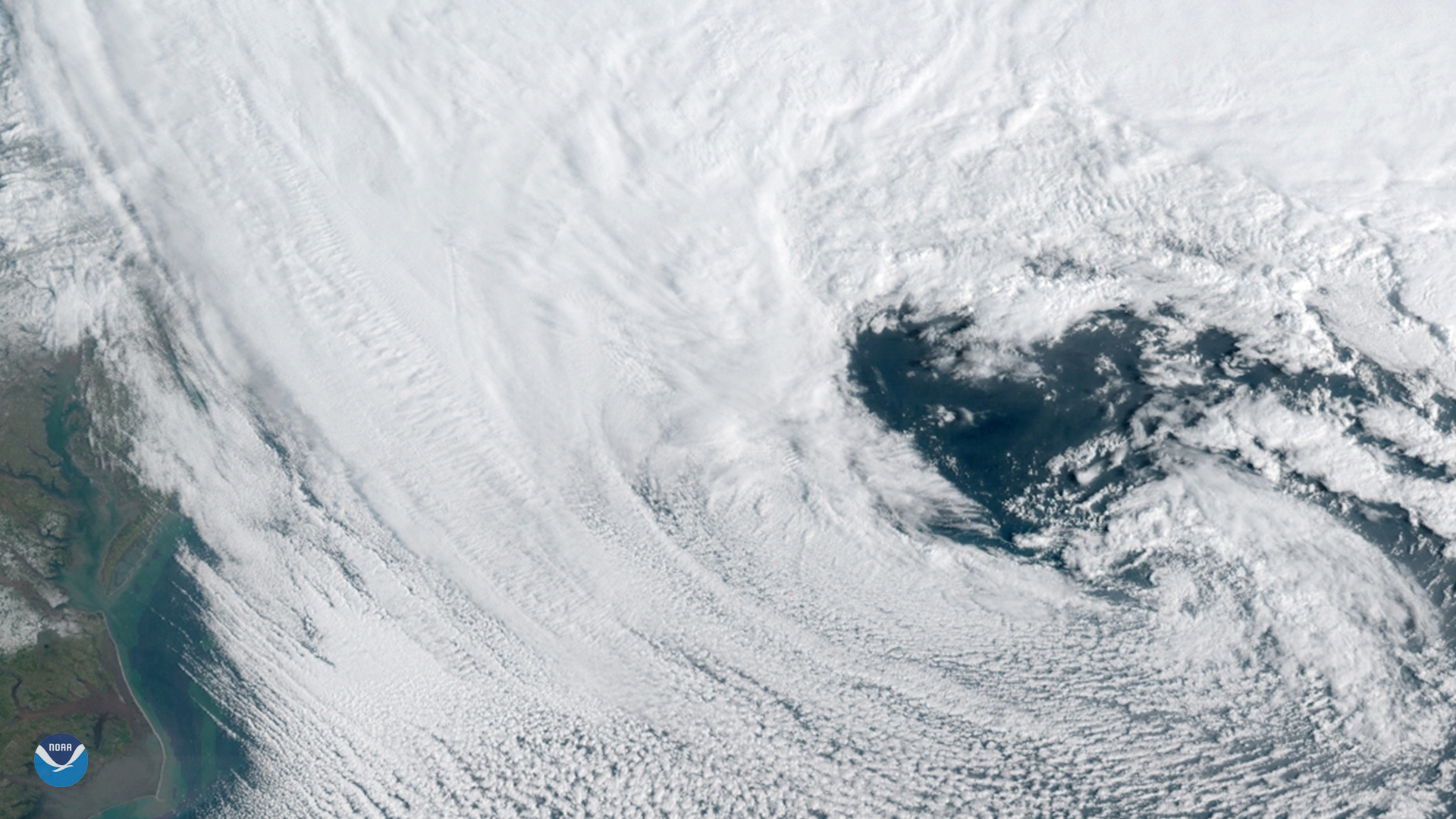
Clouds in the sky are constantly in motion, allowing them to take on all kinds of interesting shapes. In the spirit of Valentine's Day, we're sharing a heart-shaped cloud pattern seen from NOAA's GOES East satellite during a powerful nor'easter that barreled up the U.S. East Coast on March 13, 2018.
The heart shape is not actually a cloud, but rather the "heart of the storm," figuratively speaking. It's the low-pressure center of a sprawling mid-latitude cyclone , a weather system that can bring heavy rain, snow, sleet, or ice during the winter months. At the center of low pressure, bands of cold and warm air meet, and winds near Earth's surface flow in a counterclockwise direction (for storms in the Northern Hemisphere). Air rising near the center causes clouds and precipitation to develop.
The storm shown in this image brought blizzard conditions to Boston, Massachusetts and dumped 1 to 2 feet of snow across New England. It was one of four nor'easters to hit the East Coast in March 2018.
See a full view of the storm here.