
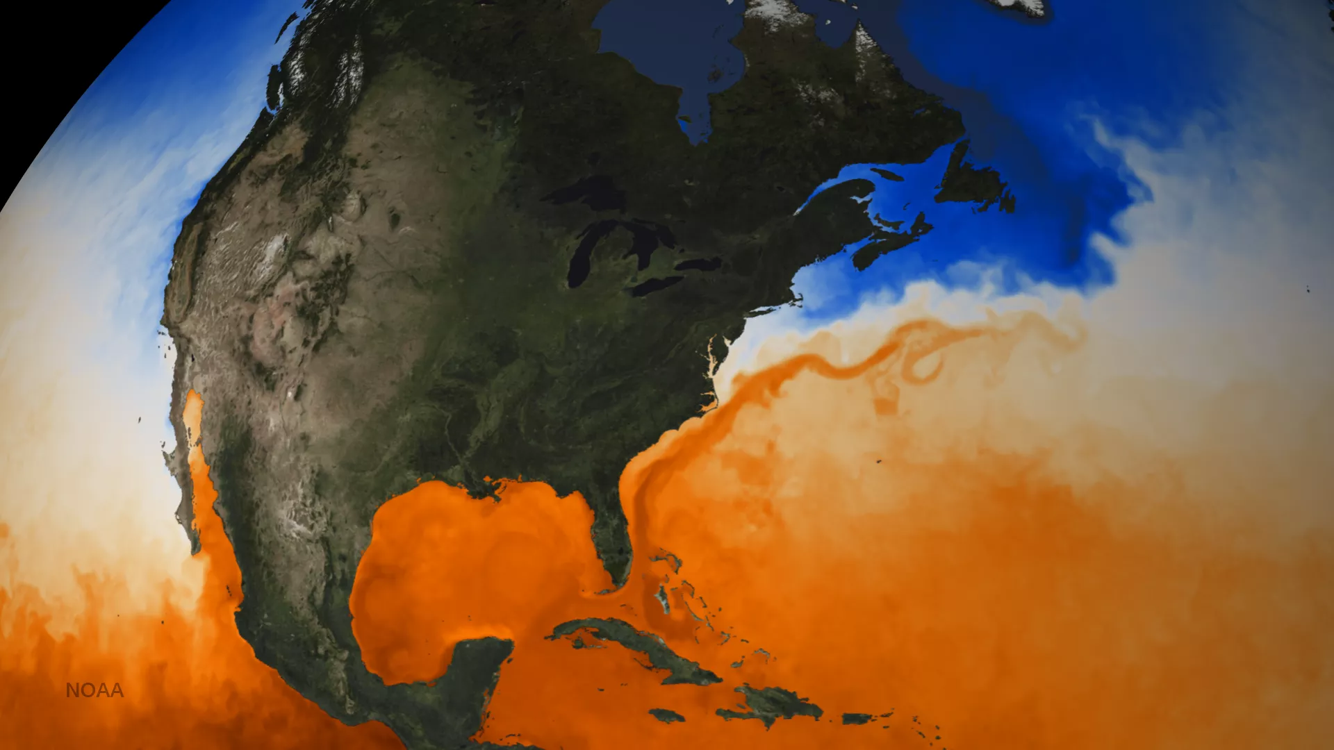
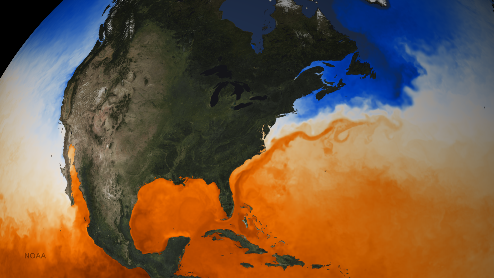
The Gulf Stream is a powerful current of warm water running through the Atlantic Ocean. Starting in the Gulf of Mexico, the current travels around the Florida panhandle and accelerates up the East Coast of the United States and Canada before stretching across the ocean toward Europe. The temperature contrast along the edge of the Gulf Stream can increase the intensity of cyclones moving up the coast. Deep pools of water around 78 degrees or warmer can cause a tropical storm or hurricane to intensify. During late June and July, conditions suitable for the development of tropical cyclones move from the Caribbean Sea and follow the Gulf Stream to the Gulf of Mexico or up the East Coast. This map of ocean Sea Surface Temperature, or SST, clearly shows the movement of warm water through the Gulf Stream. Instruments on satellites can measure the temperature of the surface water from hundreds and even thousands of miles away in space. These measurements can then be plotted on a grid, and then specialized software blends them together to produce a map. SST is a major factor for predicting weather and monitoring climate change. Where SST is relatively high, water evaporates easily, adding moisture and heat energy to the atmosphere. This data set is from June 2, 2016.