
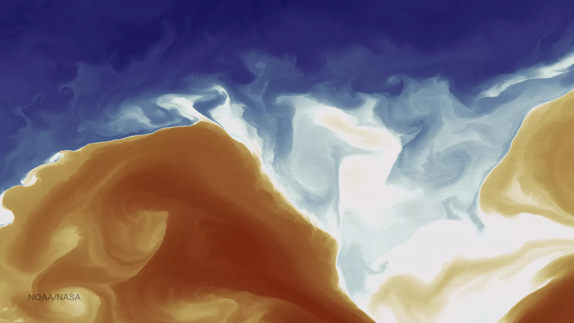
The swirling of sea surface waters is shown in this thermal infrared image from the Suomi NPP spacecraft on April 12, 2015 in an area just southeast of Cape Cod, Massachusetts. The VIIRS sensors can detect slight differences in temperature at a resolution of 375 meters per pixel, and here they are colored – blue for cold, and red for warm. The warm waters of the Gulf Stream meet and mix with the much cooler surface waters from the North Atlantic. An incredibly tight gradient between these two masses of water is especially evident on the left side of the image, where the area of white is very fine between cool and warm. These boundaries are often ecological hot spots, especially for fisheries.