

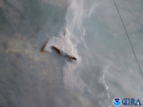
Over the course of twelve hours on June 14, the GOES West satellite captured this GeoColor imagery of brownish-gray smoke plumes rising from the Telegraph and Mescal fires in southeastern Arizona.
The fast-moving Telegraph Fire is generating the largest plume in the center of the frame above. As of the morning of June 15, the fire was estimated to have consumed nearly 105,000 acres, consisting mostly of timber, brush and grass, and prompted numerous evacuation alerts. The smaller Mescal Fire to the southeast covered roughly 72,000 acres and was mostly contained at the last report, but a recently ignited fire nearby—the Gravel Fire—was also reported.
Fire crews were working tirelessly to contain the blazes being exacerbated by a sweltering heat wave and ongoing exceptional drought in the area. Almost the entire state of Arizona was experiencing some sort of drought, according to the most recently updated U.S. Drought Monitor.
The GOES West satellite, also known as GOES-17, provides geostationary satellite coverage of the Western Hemisphere, including the United States, the Pacific Ocean, Alaska and Hawaii. First launched in March 2018, the satellite became fully operational in February 2019.