
September 14, 2020

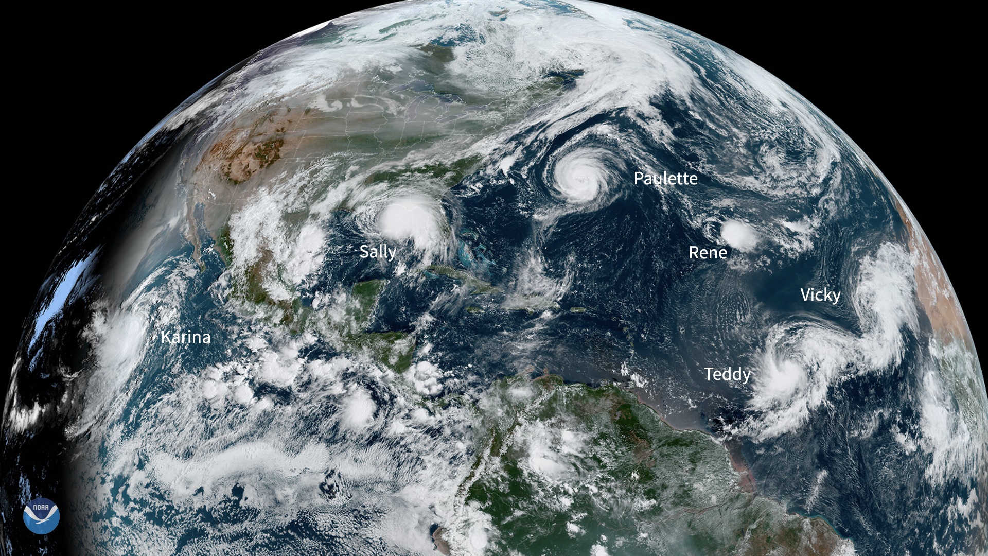
On the morning of September 14, 2020, NOAA’s GOES-East satellite spied six active tropical systems spanning the Atlantic and Pacific Oceans. According to the National Hurricane Center, there were 5 named storms—Paulette, Rene, Sally, Teddy, and Vicky—in the Atlantic. In the eastern Pacific, Karina is churning up the waters. This is the first time since 1971 that there have been five named storms, all at once, in the Atlantic Basin.
The major difference between tropical storms, tropical depressions, and hurricanes circle around sustained wind speed. According to the National Weather Service , a tropical depression’s winds max out at 38 mph; a tropical storm, however, has wind speeds ranging from 39-73 mph. A system becomes a hurricane, and therefore eligible for a rating on the Saffir-Simpson Hurricane Wind Scale , when it reaches 74 mph. The Atlantic Hurricane Season officially runs from Jun 1 through Nov. 30. However, tropical activity typically intensifies in August, peaks during the month of September, and winds down by early November.
GOES-East, which has a superior view from more than 22,000 miles above, can assist forecasters with visualizing and predicting storm trajectory, speed, and strength over time. The GeoColor product, according to this guide , “provides as close an approximation to daytime True Color imagery as is possible, [and] allows for intuitive interpretation of meteorological and surface-based features.” In other words, people from all over the world, with varying degrees of technological access, can review and interpret weather data much easier with this more naturalistic view of our planet from above.
The GOES-East geostationary satellite, also known as GOES-16, keeps watch over most of North America, including the continental United States and Mexico, as well as Central and South America, the Caribbean, and the Atlantic Ocean to the west coast of Africa. The satellite's high-resolution imagery provides optimal viewing of severe weather events, including thunderstorms, tropical storms, and hurricanes.