

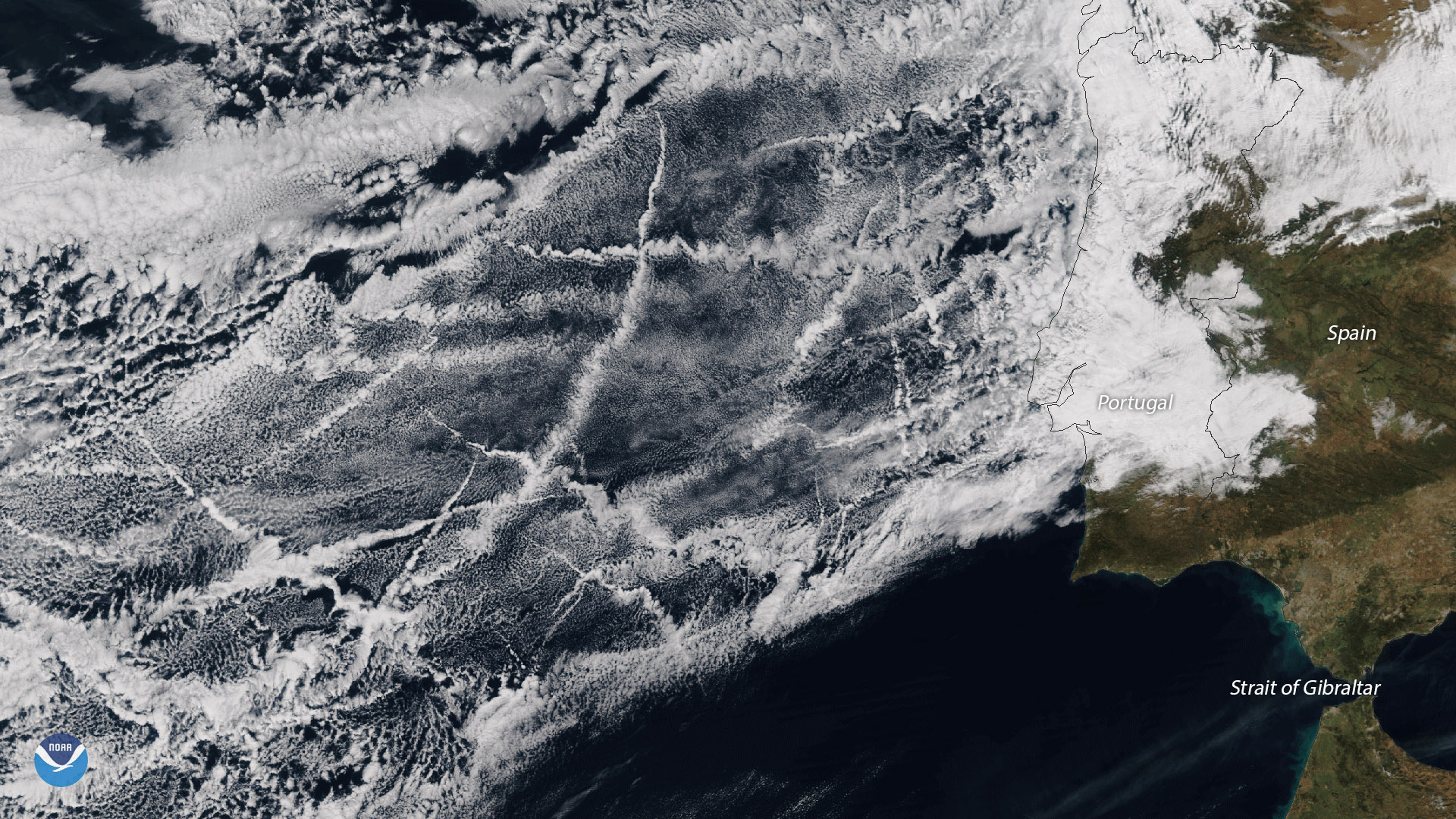
This image, captured January 15, 2018 by the Suomi NPP satellite's VIIRS instrument, shows multiple criss-crossing tracks of cargo ships just west of the Iberian Peninsula in the northeastern Atlantic Ocean. As cargo ships steam across the oceans, the tiny aerosol particles in their exhaust act as cloud nuclei, or seeds around which moisture in the atmosphere can condense. Occasionally this results in ship tracks becoming visible in cloud imagery. The ship tracks in this image stretch several hundred miles off the coast of Portugal, and occur in one of the most heavily trafficked areas for cargo ships in the world.
Although true-color images like this may appear to be photographs of Earth, they aren't. They are created by combining data from the three color channels on the VIIRS instrument sensitive to the red, green and blue (or RGB) wavelengths of light into one composite image. In addition, data from several other channels are often also included to cancel out or correct atmospheric interference that may blur parts of the image.