

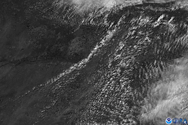
On May 24, 2021, the GOES East satellite’s visible channel watched the anvil-shaped cloud tops of severe thunderstorms bubble up over western Kansas. An approaching front helped lift the tops of these storms into the tropopause—the boundary where the troposphere and stratosphere meet—which can vary in height but was located around 40,000 feet up at the time. In general, the higher up in the atmosphere a thunderstorm’s anvil is, the stronger the thunderstorm is.
According to NOAA’s Storm Prediction Center, the storms brought damaging winds and large hail —some were the size of chicken eggs in Finney County, Kansas. There were also 17 preliminary reports of tornadoes around the state.
The GOES East geostationary satellite, also known as GOES-16, keeps watch over most of North America, including the continental United States and Mexico, as well as Central and South America, the Caribbean, and the Atlantic Ocean to the west coast of Africa. The satellite's high-resolution imagery provides optimal viewing of severe weather events, including thunderstorms, tropical storms, and hurricanes.