
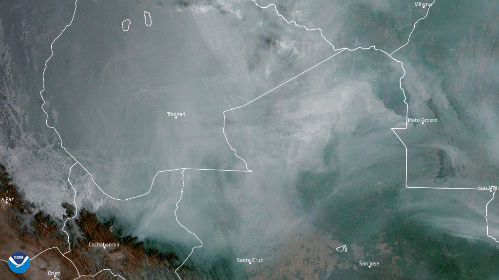
On Nov. 5, 2020, NOAA’s GOES-East satellite focused its sensors on a thick blanket of grayish-brown smoke billowing across large swaths of forest and wetlands in central South America. The smoke is emanating from devastating wildfires, which experts say “ have become critical in 2020,” and are ravaging Argentina, Brazil, Bolivia, and Paraguay.
The fires are likely due to several reasons. The Pantanal, which is the world’s largest wetland that spans throughout Brazil, Bolivia, and Paraguay, is experiencing its worst drought in 47 years. This is also the dry season, in which farmers use agricultural slash-and-burn techniques to try to regenerate the soil. Additionally, strong winds and hot, dry temperatures are helping the fires to grow and spread.
“The fires [in Paraguay]… at the end of September and first week of October broke all records,” according to a top official at the National Weather Center. Throughout the country, authorities said the number of fires increased by 46 percent this year compared to last.
The GOES East geostationary satellite, also known as GOES-16, keeps watch over most of North America, including the continental United States and Mexico, as well as Central and South America, the Caribbean, and the Atlantic Ocean to the west coast of Africa. The satellite's high-resolution imagery provides optimal viewing of severe weather events, including thunderstorms, tropical storms, and hurricanes.