
Perhaps you have noticed the price of avocados rising the last time you were at the store. Around 90 percent of the nation’s avocado crop is produced in California, where drought conditions are expected to impact California’s avocado yield. In order to assess weather conditions and help farmer’s decision making, the California Avocado Commission relies on United States Drought Monitor for monthly weather outlooks that will allow farmers to maximize production of the fruit (that’s right, avocados are fruits!).
It’s not just about making your guacamole; droughts affect all agricultural areas and are among the nation’s most costly weather related events. In 2016, drought has already cost an estimated 4.5 billion, hitting the western states the hardest. That’s why farmers and livestock producers across the nation look to the U.S. Department of Agriculture (USDA), and in turn NOAA, to assist them in preparing for and responding to changing weather and climate conditions.
Key to the success of this effort are products derived from satellites like those in the Joint Polar Satellite System (JPSS) constellation, which can be of particular use to the agricultural community. Among these are blended or derived products that appear in the form of maps illustrating climactic conditions such as drought, precipitation totals, soil moisture, snow depth, and temperature.
While not fully replacing in-situ data, the information is critical in providing information in data-sparse areas.
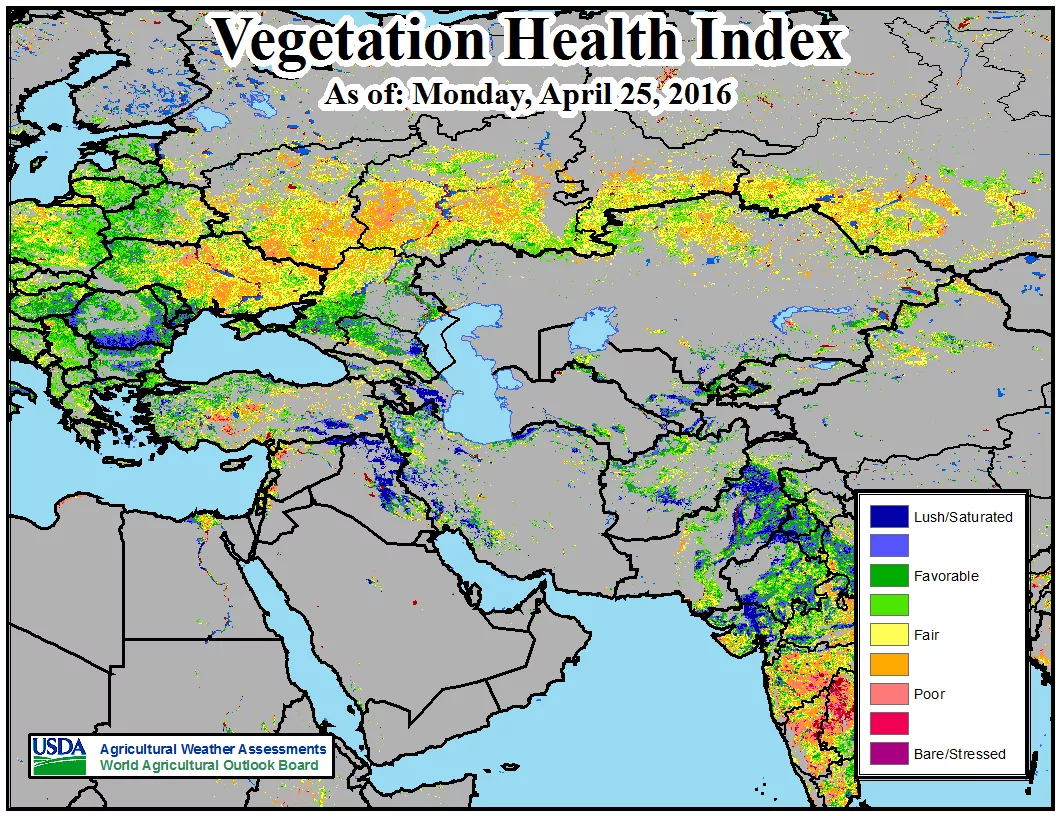
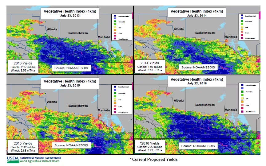
Satellites like JPSS have unique advantages over conventional observations of drought, due to their ability to acquire information over large geographical areas, measure and analyze key features of droughts routinely with increased spatial detail of vegetation conditions improving early drought detection. The Visible Infrared Imaging Radiometer Suite (VIIRS) instrument on JPSS is able to provide vegetation health data, with eight times more detail, and at a much higher and more consistent quality than earlier satellite radiometer instruments. Using this data, NOAA’s Center for Satellite Applications and Research (STAR) has created the Vegetation Health Indices (VHI) product.
“The VHI has quickly become an important component in USDA’s effort to monitor world agricultural production, particularly in areas where in-situ data is sparse or non-existent,” said Mark Brusberg, Deputy Chief Meteorologist at USDA.
VHI is used often to estimate crop condition and anticipated yield. A low index indicates different levels of vegetation stress such that losses of crop and pasture production might be expected; whereas high indices indicate a favorable condition where plentiful production might be expected. VHI is very useful for an advanced prediction of crop losses.
Since the creation of the Joint Agricultural Weather Facility in 1978, NOAA and USDA have partnered to collect and disseminate weather information from station- and satellite-derived meteorological data to the public. One avenue is the Weekly Weather and Crop Bulletin, a joint publication dating back to 1872. Another is the World Agricultural Supply and Demand Estimates (WASDE) report, a major economic publication detailing global production of major commodities. Meteorologists from USDA have increasingly become reliant on products like the VHI to aid in their assessments of crop yield in key international farming areas. The Foreign Agriculture Service (FAS) is another USDA component that incorporates satellite data (along with reporting from FAS’s worldwide offices, official statistics of foreign governments, and analysis of economic data) in their contributions to the monthly release of the WASDE report.
The success of these programs underscore the importance of satellite monitoring to farmers, as well as policy makers, who need to quickly respond to a variety of challenges posed by weather and climate phenomena that cannot be monitored by station data alone.