
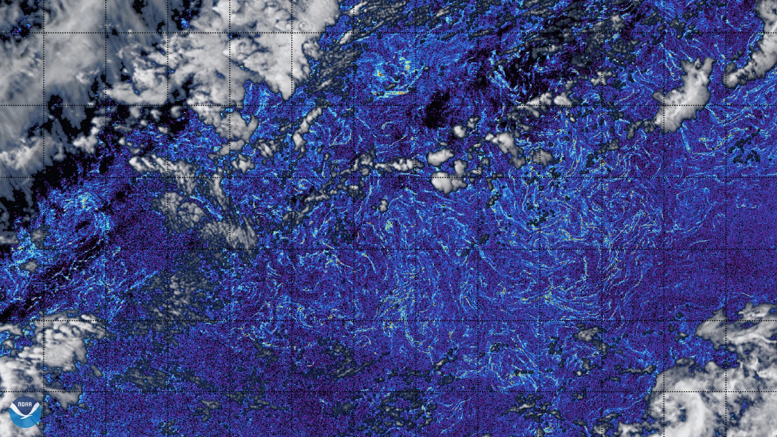
NOAA CoastWatch Atlantic OceanViewer, on March 3, 2021, captured imagery of massive amounts of Sargassum algae on the normally crystal blue waters of its namesake, the Sargasso Sea. On the water’s surface, indications of high chlorophyll content were calculated from the European Space Agency’s Sentinel-3 Ocean and Land Color Instrument (OLCI) data.
In the imagery, white and gray patches are clouds, and the dark blue is clear open ocean water. The cyan and green colored wisps and swirls indicate floating Sargassum patches. This particular point in the ocean is around 300 sq. mi. and over 1,300 miles from the nearest coastline in Western Sahara. Any particular swath of Sargassum that is within 200 miles of the U.S. coastline is considered an Essential Fish Habitat (EFH) and is protected by an act of Congress.
The only sea without a land boundary, the Sargasso Sea is formed by The North Atlantic Subtropical Gyre located in the middle latitudes of the Atlantic Ocean. Sargassum, a brown macroalgae that forms floating rafts when concentrated by winds and waves, is especially prevalent in the North Atlantic at some times of the year. Colloquially known as the Great Atlantic Sargassum Belt, the region shown above is home to many migratory fish species, turtles, and crabs.
While Sargassum is beneficial in the middle of the sea, it does habitually wash up ashore as it gets close to landmasses. When it does, it can be a nuisance as well as a health hazard. According to CoastWatch, currents and waves strand massive amounts of the algae onshore annually, especially in Florida and the Caribbean.
NOAA CoastWatch promotes satellite data products from NOAA and partner satellites for understanding and managing our oceans and coasts. Sentinel-3 is an Earth observation satellite constellation developed by our partners at the European Space Agency, as part of the Copernicus Programme. A multi-instrument platform, the constellation focuses on ocean color, ocean surface topography as well as land and sea surface temperature.
Imagery courtesy of NOAA’s CoastWatch Atlantic Ocean Node.