
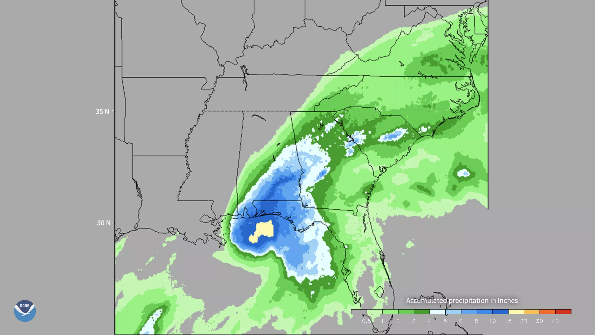
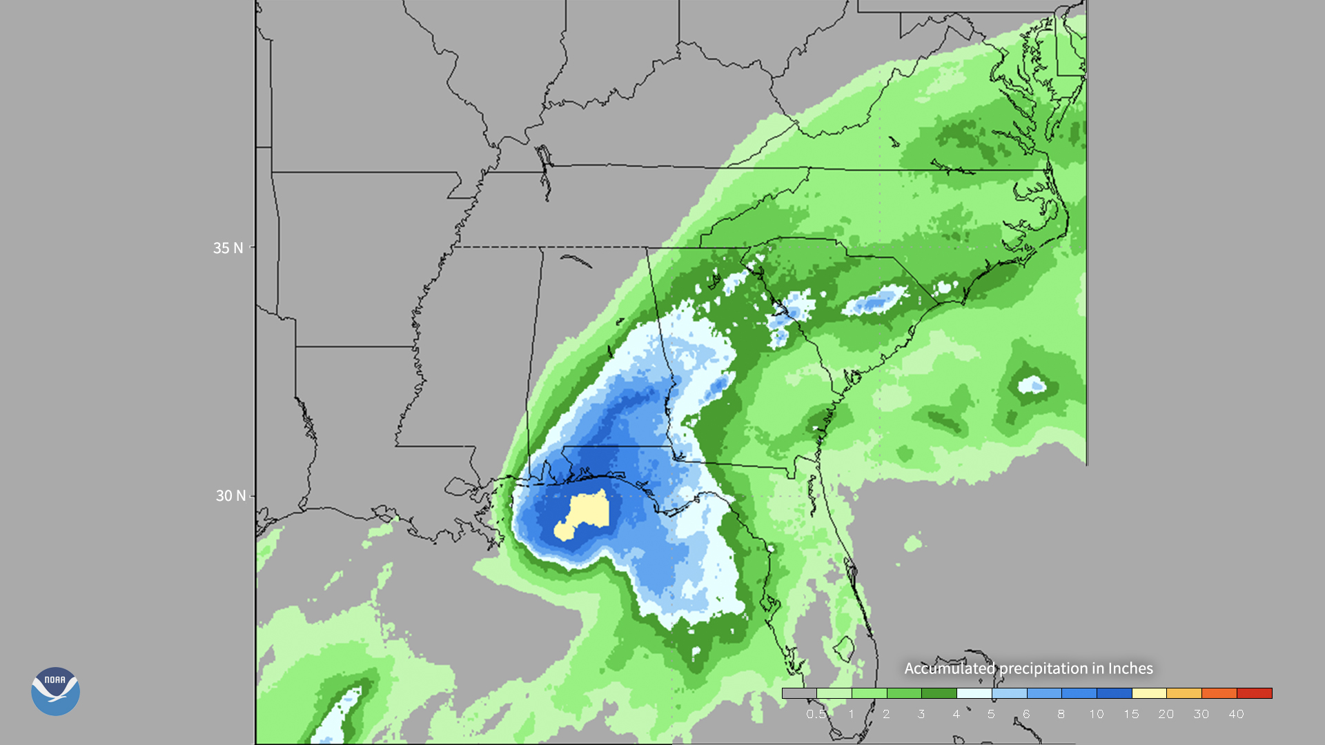
CMORPH (NOAA Climate Prediction Center MORPHing technique) produces global precipitation analyses at very high spatial and temporal resolution. This second generation CMORPH covers the entire globe from pole to pole on a fine resolution 0.05 degree latitude/longitude grid at 30-minute intervals and is updated in real time. This image shows total rainfall produced by Hurricane Sally from September 15 to 18, 2020. NOAA generates this global satellite derived rainfall product from a combination of 17 geostationary and polar orbiting satellites, including NOAA operational JPSS and GOES-R satellites. CMORPH is produced and maintained by the NOAA National Weather Service Climate Prediction Center's Pingping Xie.