
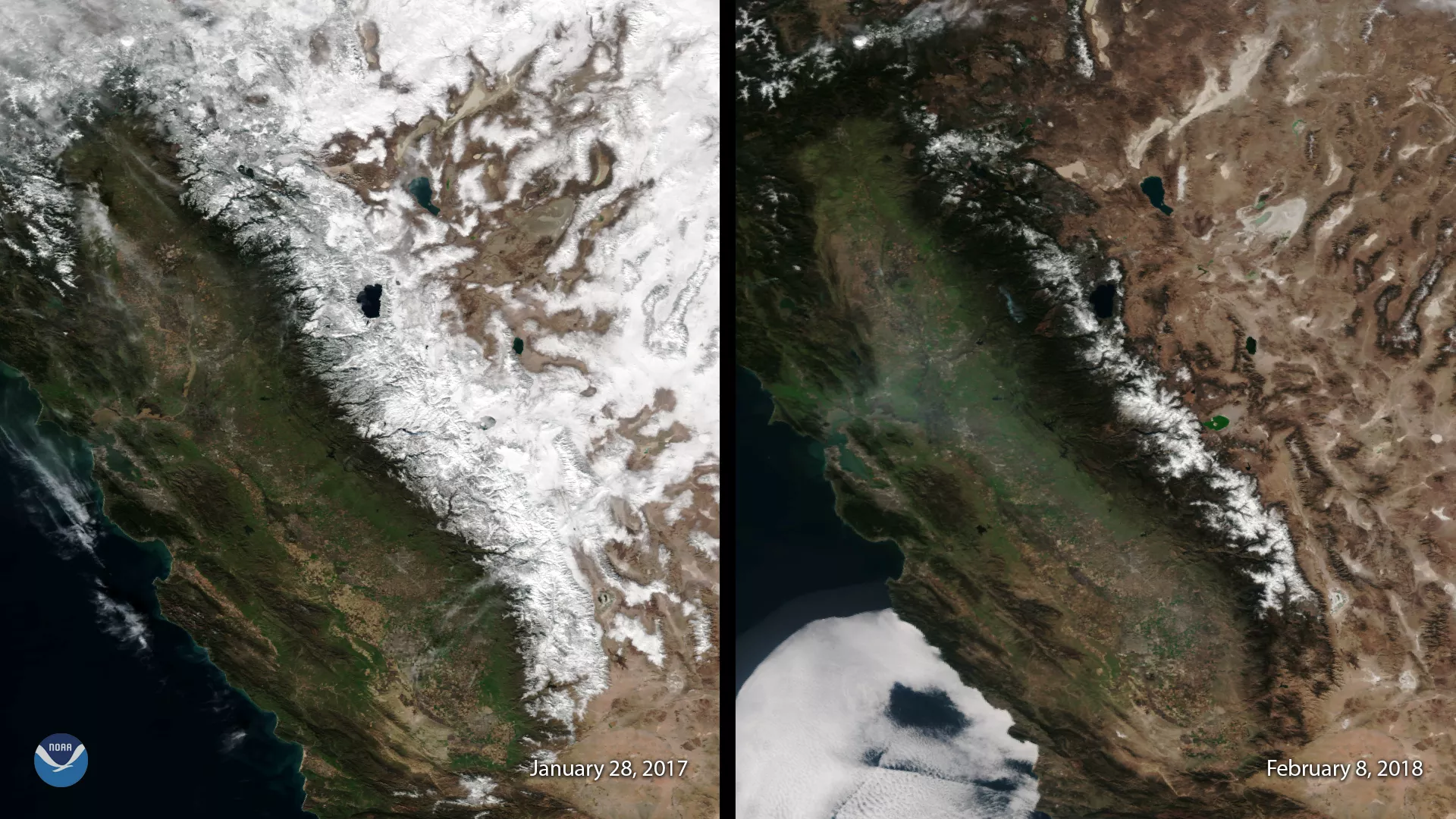
This image, captured by the Suomi NPP satellite's VIIRS instrument compares current snow cover in the Sierra Nevada mountains with conditions last year, when well above-average snowfall helped end California's historic five-year drought. The left image, seen January 28, 2017, shows abundant snow cover over the high elevations of California and neighboring Nevada. The right image, seen February 8, 2018, depicts this winter's return to drier conditions and relative lack of snow. The average snow depth across the Sierra Nevada is currently only 3.4 inches, compared with 46.0 inches at the same time in 2017, according to data from NOAA's National Operational Hydrologic Remote Sensing Center.
While water levels in California's reservoirs are still high after 2017's near record-wet year across the state, this winter's snow dearth is raising concerns about drought conditions returning during the summer dry season. Winter snowpack in the Sierra is a vital source of California's water supply. Dry winters, or frequent warm conditions that bring rain instead of snow to high elevations, mean there is less spring and summer snowmelt available to replenish the state's water reservoirs during the summer months.
Although true-color images like this may appear to be photographs of Earth, they aren't. They are created by combining data from the three color channels on the VIIRS instrument sensitive to the red, green and blue (or RGB) wavelengths of light into one composite image. In addition, data from several other channels are often also included to cancel out or correct atmospheric interference that may blur parts of the image.