
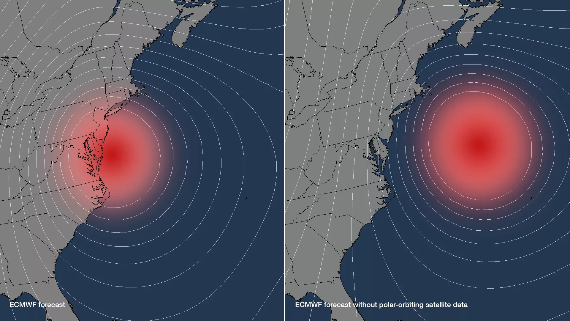
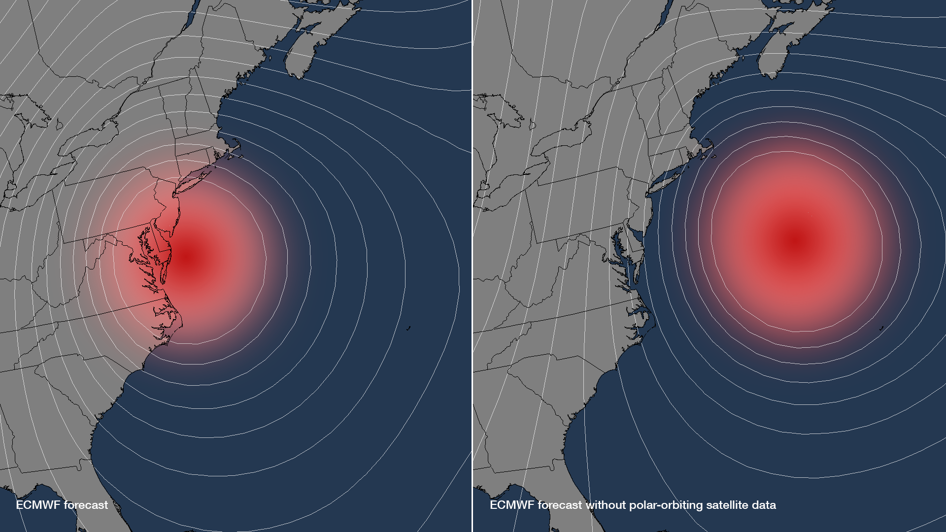
The incredibly accurate 5-day forecasts for Hurricanes Irene and Sandy have illustrated the improvements in both observations and numerical weather models. But what would happen to these forecasts if some observations were lost? The European Centre for Medium-Range Weather Forecasts (ECMWF) recently ran an experiment that removed all of the polar-orbiting satellite data from their numerical weather models and re-ran their forecasts for Hurricane Sandy. The result: without the data from polar-orbiting satellites, Sandy’s forecast track would not have made the turn inland, and instead would have remained out to sea.
This image uses the model output from the ECMWF experiment, showing where Sandy was predicted to be located 4 days out with the normal satellite data inputs into the model (left) and without any polar-orbiting satellite data (right). Both position and intensity forecasts were affected – Sandy stays out to sea without the polar-orbiting satellite data, and the closer isobar lines encircling the storm also imply a more organized and stronger system.
More information on the results of the ECMWF’s data denial study can be found at NOAA.gov.