
A view from a satellite over Earth’s ocean and an aerial view of a blue whale.
NOAA’s expertise in using satellite data to predict the weather is well established. But did you know we’re also using satellites to monitor how the ocean is changing—and how those changes affect fisheries and marine life? By tracking the ocean’s temperature, salinity, currents, and even microscopic organisms, satellites provide a clearer picture of our marine environment.
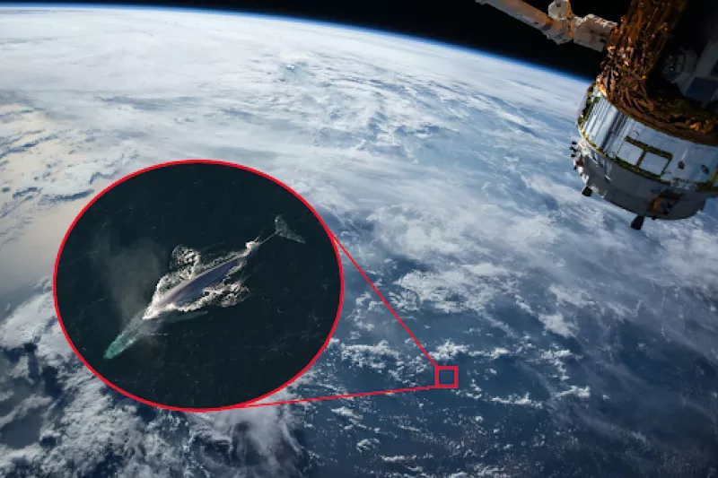
Unlike traditional methods like ship surveys, satellites deliver insights into oceanographic processes much faster and on a much larger scale. They also help us create models to predict where and when marine animals will appear. Incredibly, satellite images are now so detailed that we can identify and count individual whales from space. These breakthroughs are transforming our ability to manage and protect marine species.
In this podcast, Ryan Vandermeulen, NOAA Fisheries’ satellite remote sensing coordinator, shares his passion for satellite technology and his mission to make satellite data more accessible to everyone. Tune in to learn about the exciting future of satellite advancements—and to hear the music Ryan composed, inspired by satellite images of phytoplankton blooms.