
On June 25, 2024, GOES-U, the final satellite in NOAA’s GOES-R Series, launched from NASA’s Kennedy Space Center in Florida. Once GOES-U reached geostationary orbit on July 7, the satellite was renamed GOES-19. As NOAA marks the first anniversary of sending GOES-U into space, we check in with the newest satellite in NOAA’s fleet.
What’s happened since GOES-U launched?
Launching a satellite is an enormous feat, but there’s still a lot to do to prepare it for operational service. After maneuvering it into geostationary orbit 22,236 miles above Earth’s equator over 12 days, satellite operators deployed GOES-19’s solar array, a set of panels that use solar energy to power the satellite. Next, the operators began deploying the satellite’s antennas and activating its seven observational instruments to calibrate them. Engineers vigorously tested all systems to ensure everything worked properly. Scientists precisely validated GOES-19’s observational data for use in forecasts and warnings.
In September 2024, NOAA released the first imagery of the Western Hemisphere from GOES-19 as post-launch testing continued. In late January 2025, the GOES-R program handed GOES-19 over to NOAA’s Office of Satellite and Product Operations (OSPO). OSPO commenced additional validation of the satellite’s data products and moved the satellite from its checkout location between GOES East and GOES West to the operational GOES East Position.
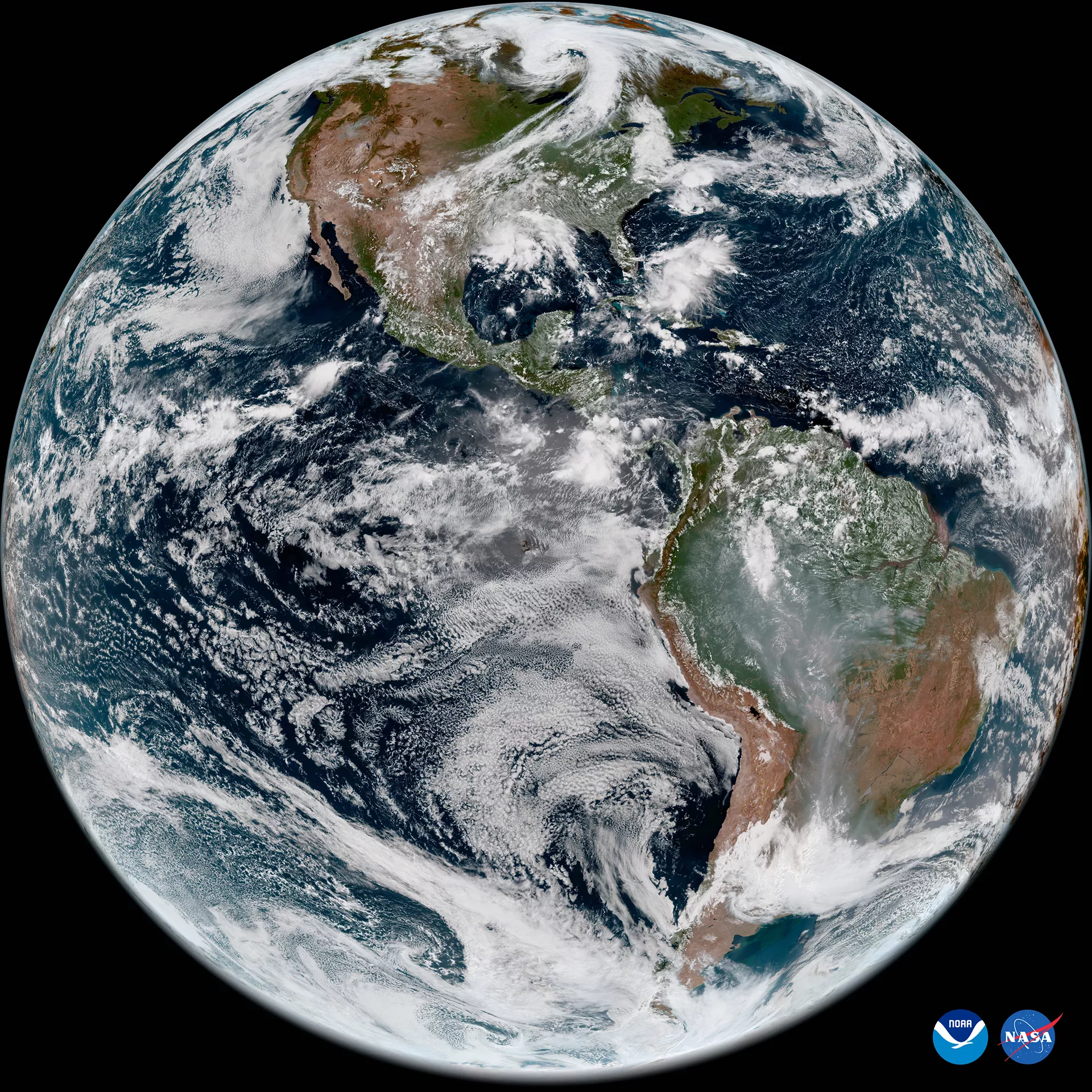
First full disk image from GOES-19. Credit: NOAA/NASA
On April 7, 2025, GOES-19 replaced GOES-16 as NOAA’s operational GOES East satellite. In its new role, GOES-19 serves as NOAA's primary geostationary satellite for monitoring much of the Western Hemisphere. The satellite tracks hurricanes and tropical storms in the Atlantic Ocean basin and monitors severe weather, atmospheric rivers, wildfires, volcanic eruptions and other environmental events affecting the contiguous U.S. GOES-16 is now the primary backup for NOAA’s geostationary satellite constellation, maintaining its operational readiness for future use, if needed.
How is GOES-19 supporting forecasts of severe weather and hazards?
Although GOES-19 has only been in service for a short time, the satellite has already proved vital for short-term forecasts and warnings of severe weather as well as detecting and monitoring hazards such as wildfires and smoke.
As destructive severe weather, including two significant tornado outbreaks, swept across the nation in May, GOES-19 provided critical data to NOAA’s National Weather Service (NWS), which helped them deliver early warnings, real-time updates, and on-site support for emergency managers. GOES-19 imagery revealed where the storms were most intense and allowed forecasters to monitor rapidly changing conditions. The satellite’s lightning mapper detected rapid increases in lightning activity, indicating intensifying storms. During severe weather, NWS forecasters also incorporate GOES-19 data into new artificial intelligence (AI) models that predict the likelihood a developing thunderstorm produces severe weather or hazardous lightning — an hour or more in advance.
When a large fire erupted in Ocean County, New Jersey, in April,GOES-19 monitored the blaze and smoke in near real-time. NOAA also used GOES-19 data in its new experimental wildfire tool, the Next Generation Fire System (NGFS). NGFS uses artificial intelligence to scan GOES satellite imagery and quickly detect fires down to the neighborhood level. NGFS also tracks wildfire growth and monitors fire intensity in near real-time. The NGFS dashboard satellite imagery, fire weather outlooks, red flag warnings, wildfire incident perimeters, and fuels data to aid decision-making during a fire. This new tool shows promise for assisting first responders in prioritizing fires that need immediate attention and helping to keep firefighters safe.
How is the GOES-19’s new CCOR instrument helping NOAA’s Space Weather Prediction Center?
GOES-19 doesn’t just watch for weather and hazards on Earth — it also keeps an eye on the sun and space weather. The satellite carries five sophisticated instruments to warn of hazardous space weather that can disrupt communications and navigation systems as well as damage key infrastructure such as electrical power grids. Included in this suite of instruments is NOAA’s CCOR-1 (Compact Coronagraph-1), the first coronagraph designed for use in operational space weather forecasts.
CCOR-1, which images the outer layer of the sun’s atmosphere, is part of NOAA’s Space Weather Follow On mission. CCOR-1 detects and characterizes coronal mass ejections (CMEs), which are the main cause of geomagnetic storms.
“With CCOR-1 now delivering high-resolution imagery of coronal mass ejections in as little as 15 minutes, we can sharpen our forecasts and provide earlier warnings, buying critical time for the operators of power grids, satellites, aviation systems, and communication networks," said Clinton Wallace, director of NOAA's Space Weather Prediction Center. "This is a major leap forward in our mission to protect the Nation’s infrastructure from space weather threats.”
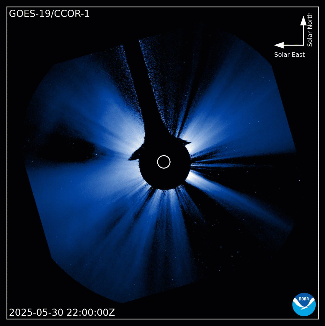
CCOR-1 imagery of a CME that triggered a severe geomagnetic storm warning for Earth on May 31, 2025. CCOR-1 observed the CME 21 minutes before other coronagraph imagery was available. Credit: NOAA
What other milestone is GOES celebrating in 2025?
As NOAA marks the first anniversary of the launch of the final satellite in the GOES-R Series, the agency is also commemorating 50 years of the GOES satellite program. Since 1975, GOES data has been the backbone of short-term forecasts and warnings of severe weather and environmental hazards in the Western Hemisphere as well as space weather forecasts and warnings. Each generation of GOES has brought improvements and new capabilities to monitor both Earth and space. GOES-19 continues that legacy, poised to deliver crucial information and help to keep the one billion people who live in and work in the Americas safe into the 2030s.
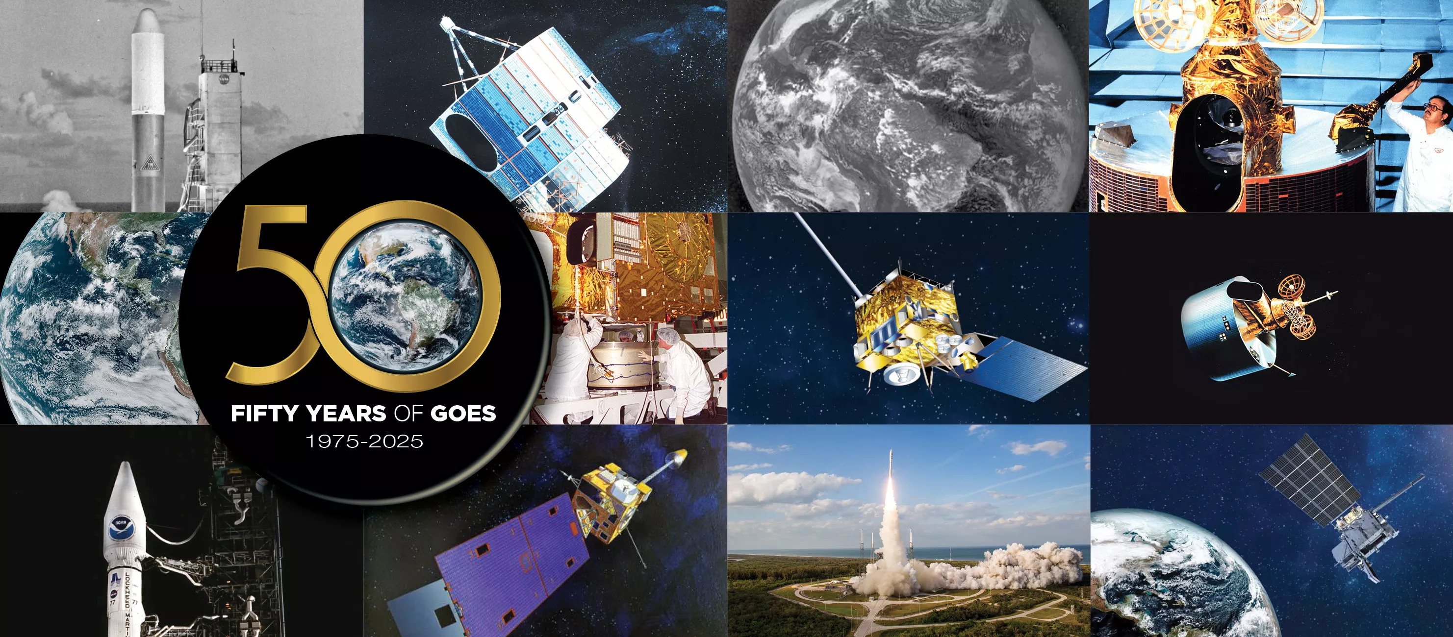
50 years of GOES graphic. Credit: NOAA