
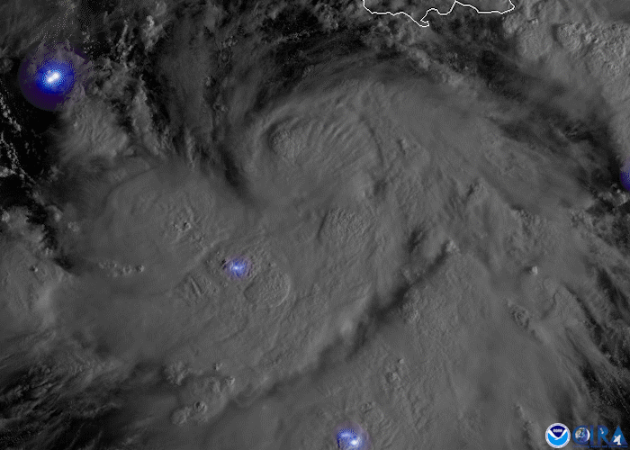
On Oct. 5, 2020, the GOES-East satellite watched Tropical Storm Delta form in the Caribbean Sea. As of 11:00 a.m. ET, the National Hurricane Center reported that the storm was located roughly 130 miles south of Jamaica with maximum sustained winds of 45 mph. It was forecast to strengthen into a hurricane on Tuesday and reach the northern Gulf Coast by Friday. Here, Tropical Storm Delta is seen via the satellite’s visible band 2, with lightning overlaid from the satellite’s Geostationary Lightning Mapper.
This is not only the earliest 25th named Atlantic storm on record; it is also the second time that the Greek letter Delta has been used to name a storm. The previous Delta storm formed on November 15, 2005. Additionally, if Delta makes landfall, it will be the first time on record that 10 named storms have done so in the U.S. in one season, breaking the 1916 record of nine landfalling storms.
The imagery above was captured by the GOES-East geostationary satellite, also known as GOES-16, which keeps watch over most of North America, including the continental United States and Mexico, as well as Central and South America, the Caribbean, and the Atlantic Ocean to the west coast of Africa. The satellite's high-resolution imagery provides optimal viewing of severe weather events, including thunderstorms, tropical storms, and hurricanes.